Bancroft, Michigan
| Bancroft, Michigan | |
|---|---|
| Village | |
 Location of Bancroft in Shiawassee County, Michigan | |
| Coordinates: 42°52′36″N 84°3′58″W / 42.87667°N 84.06611°WCoordinates: 42°52′36″N 84°3′58″W / 42.87667°N 84.06611°W | |
| Country | United States |
| State | Michigan |
| County | Shiawassee |
| Area[1] | |
| • Total | 0.59 sq mi (1.53 km2) |
| • Land | 0.58 sq mi (1.50 km2) |
| • Water | 0.01 sq mi (0.03 km2) |
| Elevation | 856 ft (261 m) |
| Population (2010)[2] | |
| • Total | 545 |
| • Estimate (2012[3]) | 531 |
| • Density | 939.7/sq mi (362.8/km2) |
| Time zone | Eastern (EST) (UTC-5) |
| • Summer (DST) | EDT (UTC-4) |
| ZIP code | 48414 |
| Area code(s) | 989 |
| FIPS code | 26-05080[4] |
| GNIS feature ID | 2398026[5] |
Bancroft is a village in Shiawassee County in the U.S. state of Michigan. The population was 545 at the 2010 census. The village is located in the southeast part of Shiawassee Township.
History
Bancroft was platted in 1877 when the railroad was extended to that point.[6] The settlement took its name from the Bancroft Mining Company.[7] A post office has been in operation in Bancroft since 1877.[8] The village of Bancroft was incorporated in 1883.[9]
Geography
According to the United States Census Bureau, the village has a total area of 0.59 square miles (1.53 km2), of which 0.58 square miles (1.50 km2) is land and 0.01 square miles (0.03 km2) is water.[1]
Demographics
| Historical population | |||
|---|---|---|---|
| Census | Pop. | %± | |
| 1880 | 387 | — | |
| 1890 | 642 | 65.9% | |
| 1900 | 528 | −17.8% | |
| 1910 | 543 | 2.8% | |
| 1920 | 529 | −2.6% | |
| 1930 | 439 | −17.0% | |
| 1940 | 581 | 32.3% | |
| 1950 | 615 | 5.9% | |
| 1960 | 636 | 3.4% | |
| 1970 | 724 | 13.8% | |
| 1980 | 618 | −14.6% | |
| 1990 | 599 | −3.1% | |
| 2000 | 616 | 2.8% | |
| 2010 | 545 | −11.5% | |
| Est. 2015 | 522 | [10] | −4.2% |
2010 census
As of the census[2] of 2010, there were 545 people, 191 households, and 142 families residing in the village. The population density was 939.7 inhabitants per square mile (362.8/km2). There were 214 housing units at an average density of 369.0 per square mile (142.5/km2). The racial makeup of the village was 97.4% White, 0.6% African American, 0.7% Native American, 0.2% from other races, and 1.1% from two or more races. Hispanic or Latino of any race were 1.1% of the population.
There were 191 households of which 41.9% had children under the age of 18 living with them, 57.6% were married couples living together, 10.5% had a female householder with no husband present, 6.3% had a male householder with no wife present, and 25.7% were non-families. 19.9% of all households were made up of individuals and 4.7% had someone living alone who was 65 years of age or older. The average household size was 2.85 and the average family size was 3.29.
The median age in the village was 35.9 years. 27.2% of residents were under the age of 18; 9.1% were between the ages of 18 and 24; 25.6% were from 25 to 44; 28.9% were from 45 to 64; and 9.2% were 65 years of age or older. The gender makeup of the village was 51.6% male and 48.4% female.
2000 census
As of the census[4] of 2000, there were 616 people, 203 households, and 158 families residing in the village. The population density was 1,049.4 per square mile (403.1/km²). There were 218 housing units at an average density of 371.4 per square mile (142.7/km²). The racial makeup of the village was 96.43% White, 0.32% Native American, 0.16% from other races, and 3.08% from two or more races. Hispanic or Latino of any race were 1.14% of the population.
There were 203 households out of which 40.9% had children under the age of 18 living with them, 62.6% were married couples living together, 11.8% had a female householder with no husband present, and 21.7% were non-families. 17.7% of all households were made up of individuals and 9.4% had someone living alone who was 65 years of age or older. The average household size was 3.03 and the average family size was 3.39.
In the village the population was spread out with 31.0% under the age of 18, 9.1% from 18 to 24, 28.9% from 25 to 44, 20.8% from 45 to 64, and 10.2% who were 65 years of age or older. The median age was 32 years. For every 100 females there were 89.5 males. For every 100 females age 18 and over, there were 90.6 males.
The median income for a household in the village was $41,538, and the median income for a family was $42,500. Males had a median income of $35,972 versus $22,500 for females. The per capita income for the village was $15,451. About 8.5% of families and 10.3% of the population were below the poverty line, including 9.4% of those under age 18 and 8.5% of those age 65 or over.
References
- 1 2 "US Gazetteer files 2010". United States Census Bureau. Archived from the original on January 24, 2012. Retrieved 2012-11-25.
- 1 2 "American FactFinder". United States Census Bureau. Retrieved 2012-11-25.
- ↑ "Population Estimates". United States Census Bureau. Archived from the original on June 17, 2013. Retrieved 2013-06-03.
- 1 2 "American FactFinder". United States Census Bureau. Archived from the original on September 11, 2013. Retrieved 2008-01-31.
- ↑ U.S. Geological Survey Geographic Names Information System: Bancroft, Michigan
- ↑ "Ghost towns and post offices of Shiawassee County". The Argus-Press. September 15, 2000. p. 3. Retrieved 30 April 2015.
- ↑ Daly, Matthew L.; Herman, Jennifer L.; Hannan, Caryn (1 December 2008). Michigan Encyclopedia. North American Book Dist LLC. p. 160. ISBN 978-1-878592-94-1.
- ↑ "Shiawassee County". Jim Forte Postal History. Retrieved 30 April 2015.
- ↑ "Ghost towns and post offices of Shiawassee County". The Argus-Press. Sep 15, 2000. p. 3. Retrieved 28 October 2015.
- ↑ "Annual Estimates of the Resident Population for Incorporated Places: April 1, 2010 to July 1, 2015". Retrieved July 2, 2016.
- ↑ "Census of Population and Housing". Census.gov. Archived from the original on May 11, 2015. Retrieved June 4, 2015.
Municipalities and communities of Shiawassee County, Michigan, United States | ||
|---|---|---|
| Cities | 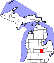 | |
| Villages | ||
| Charter townships | ||
| General law townships | ||
| Unincorporated communities | ||
| Footnotes | ‡This populated place also has portions in an adjacent county | |