Minamibōsō
| Minamibōsō 南房総市 | |||
|---|---|---|---|
| City | |||
|
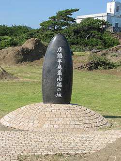
Monument marking southernmost point on the Bōsō Peninsula | |||
| |||
 Location of Minamibōsō in Chiba Prefecture | |||
 Minamibōsō
| |||
| Coordinates: 35°02′35.4″N 139°50′24″E / 35.043167°N 139.84000°ECoordinates: 35°02′35.4″N 139°50′24″E / 35.043167°N 139.84000°E | |||
| Country | Japan | ||
| Region | Kantō | ||
| Prefecture | Chiba Prefecture | ||
| Government | |||
| • Mayor | Yutaka Ishii | ||
| Area | |||
| • Total | 230.14 km2 (88.86 sq mi) | ||
| Population (December 1, 2015) | |||
| • Total | 38,945 | ||
| • Density | 169/km2 (440/sq mi) | ||
| Time zone | Japan Standard Time (UTC+9) | ||
| Address | 28 Aoki Tomiura-chō, Minamibōsō-shi, Chiba-ken 299-2492 | ||
| Website |
www | ||


Minamibōsō (南房総市 Minamibōsō-shi) is a city located in southern Chiba Prefecture, Japan. As of December 1, 2015, the city had an estimated population of 38,945 and a population density of 169 persons per km². The total area was 230.22 square kilometres (88.89 sq mi), making it the fifth largest city in Chiba Prefecture in terms of area.
Minamibōsō is an area of historical relics and shrines.[1] The city's slogan is 「ひと・ゆめ・みらい 地域で創る魅力の郷 南房総」 Which translates to "People, Dreams, Future. A Village With Locally Grown Appeal, Minamibōsō." Minamibōsō is known for flowers, uchiwa fans (房州うちわ), loquat fruit, whaling (捕鯨), and surfing. It is currently tied in first place for the city with the most roadside stations selling locally produced goods in Japan.[2]
Geography
Minamibōsō is in the southern portion of Chiba Prefecture, near the southern tip of the Bōsō Peninsula. It is surrounded by water on three sides facing the Pacific Ocean to the east and south, and the entrance to Tokyo Bay on the west. Minamibōsō city has several mountain ranges over 300 meters high such as Mount Atago and Mount Tomi. Minamibōsō City surrounds Tateyama on the north, east, and south. The land in Minamibōsō is broken up as follows: 30.43% mountains/forest land, 13.23% rice paddies, 8.81% crop land, 6.25% open fields, 4.61% residential land.[3]
Neighboring municipalities
Chiba Prefecture
Climate
The Minamibōsō area has a warm, maritime climate with hot summers and mild winters due to the Kuroshio Current.[1] The average temperature is 16.22 degrees Celsius, with the average high and low temperatures at 34.34 degrees Celsius and -4.16 degrees Celsius respectively. The hottest months are from June to September, and the coldest months are from January to March. Minamibōsō City receives an average of 1767.15 mm of rainfall annually.[3]
History
The area of present-day Minamibōsō was part of ancient Awa Province, dominated by the Satomi clan during the Sengoku period, and mostly tenryō territory controlled directly by the Tokugawa shogunate, with portions under the control of various minor feudal domains. The area was divided into numerous towns and villages in the Meiji period, all within Awa District of Chiba Prefecture.
The modern city of Minamibōsō was formed from the merger on March 20, 2006 of the towns of Chikura, Maruyama, Shirahama, Tomiura, Tomiyama and Wada, and the village of Miyoshi (all from Awa District).
Population
As of October 2012, Minamibōsō's population is 42,425 people.[4] The most populous area is Chikura which has about double the population of the other areas of Minamibōsō. As of 2007, 10.3% of the population was 0–14 years old, 56.1% of the population was between 15–64 years old, and 33.6% of the population was 65 and older.[3]
Economy
Minamibōsō serves as a commercial center for the surrounding region of southern Chiba Prefecture. The primary industry is commercial fishing and agriculture (horticulture and flowers). The tourist industry is a growing component of the local economy, with attractions being the areas beaches and hot spring resorts. In 2008, about 4.5 million tourists visited Minamibōsō City. Due to its close proximity to Tokyo and Chiba City, many people visit Minamibōsō on day trips. Of those 4.5 million tourists in 2008, almost 3.9 million of them were visiting on a day trip. Of the working population, about 60% own various private businesses such as small shops restaurants or medical practices, 25% work in Farming Fishing and Forestry, and 17% work in Manufacturing and Construction.[3]
Famous Foods
The area of Wadaura in Wada is famous for whaling, and is one of two areas in Japan where whaling is permitted. As of November 7, 2012, a roadside station opened up in Wadaura in order to promote whale and other local cuisine such as namero and sanga (なめろう), and Boshu Lobster, and there are 21 restaurants in Wada that serve whale. Tomiura is famous for loquat fruits and also has a roadside station promoting the sales of products containing loquat. The area of Iwai in Tomiura is famous for abalone. Being surrounded by water on three sides, the entirety of Minamibōsō is famous for the aforementioned seafood as well as sushi and sashimi. Another famous thing in the area being flowers, edible flower dishes are well known in Minamibōsō city.[5]
Roadside Stations
As of November 7, 2012, Minamibōsō City has eight roadside stations promoting local produce and goods. It is currently tied with Takayama, Gifu for having the most roadside stations in the country.[6] The roadside stations include:
- Tomiura Biwa Club: Located in Tomiura, it promotes products containing loquat, and has a local art gallery.
- Ootsu no Sato Flower Club: Located in Tomiura, it promotes seasonal flowers.
- Tomiraku Sato Tomiyama: Located in Tomiyama, it promotes fresh mountain and ocean produce.
- Hina no Sato: Located in Miyoshi, it promotes fresh vegetables and fruits.
- Rosemary Park: Located in Maruyama, it features a garden and buildings styled after Shakespeare's country home, and promotes seasonal flowers and herbs.[7]
- Shirahama Nojimazaki: The southernmost roadside station, it is located in Shirahama, and it is a tourist break spot that offers information about the various localities in Minamibōsō.
- Chikura Shiokaze Oukoku: Located in Chikura, it promotes local seafood sales, and contains a small art gallery.[8]
- Wadaura Wa・O!: Located in Wadaura, it is the newest roadside station in Japan, having opened on November 7, 2012. It promotes whale and other local marine cuisine, and has the Mini Whale Museum inside.[2][9]
Other Attractions
- Boshu Uchiwa fans (房州うちわ) are a traditional style of uchiwa that came to Minamibōsō and Tateyama in the 1870s.
- Being a peninsula, fishing is very popular.
- Flowers are grown all over Minamibōsō, and there are flower parks where the flowers are in bloom year-round.
- There are many hiking paths available in the mountains around Minamibōsō.
- The Knife Ceremony held three times a year at Takabe Shrine is a historic event that has taken place since the Heian period.
- Minamibōsō has a golf course called Cosmo Classic Golf Club.
- Campers can pitch a tent on the beach at Nemoto Marine Campground.
- There are many hot spring resorts in Minamibōsō in addition to several public foot baths which are located at the Tomiura Genki Club, Shirahama Flower Park, and Miyoshi's Hina no Sato.[5]
- The beaches in Chikura are famous for having good waves for surfing.[2]
Transportation
Railway
Highway
Bus
There are city buses that travel through three areas:
Bicycle
Bicycles can be rented by the day from various locations in Minamibōsō and Tateyama.[5]
Access
Car
From Tokyo:
Minamibōsō City is located within 100 km of Tokyo, and can be reached in 95 minutes by car through use of the Tokyo Bay Aqua-Line.
From Chiba:
It takes about 70 minutes from Chiba City to Minamibōsō by the Tateyama Expressway.[3]
From Haneda Airport:
Minamibōsō City is about 80 minutes by car or highway bus from Haneda Airport[11]
Highway Bus
Highway Buses run by Keisei(京成), Nitto Transportation (日東交通), and Tateyama Nitto Bus (館山日東バス) companies are available to and from Chiba Station.
JR Buses (ジェイアールバス関東) are available to and from Tokyo Station.
From Chiba Station:
- Chiba Station - Highway Oasis Furari
- Chiba Station - Tomiura Biwa Club - Nagotaketo Building - Tateyama Station - Nanso Cultural Hall - Kokonoe Station
- Chiba Station - Chikura Station - Asai Commercial and Industrial Association - Shiokaze Oukoku (道の駅ちくら・潮風王国) - Shirahama Post Office - Shirahama Nojimazaki Station[12]
From Tokyo Station: There are bus stops at:
- Tomiura Biwa Club in Tomiura
- Highway Oasis Furari in Tomiyama
- Chikura Station
- Asai Commercial and Industrial Center and Shiokaze Oukoku in Chikura
- Shirahama Post Office
- Awa Shirahama (安房白浜駅)[13]
Ferry
The Tokyo-Wan Ferry is available to cross the Tokyo Bay from the Port of Kanaya in Futtsu, Chiba to the Port of Yokosuka.[14]
Sightseeing
Museums
- Shirahama Kaiyo Museum has exhibitions of maiwai fishing jackets and maritime artifacts.
- The Chikura Kaigan Museum has photography and glassware exhibitions by Shinpei Asai.[5]
Shrines and Temples
- Jorakuzan Mantoku-ji Temple: famous for its "Reclining Buddha" statue.
- Joju-in Temple: the family temple of the Satomi clan, the basis for the book, Nansō Satomi Hakkenden.
- Takabe Shrine: the only temple in Japan that worships the god of cooking. The Knife Ceremony, which dates back to the Heian period is held here three times a year.
- Komatsu-ji Temple: a famous place to visit to see the leaves change color in autumn. There are legends surrounding it involving the Satomi clan.
- Ishido-ji Temple: originated 1300 years ago, and houses the Eleven Faced Goddess of Mercy Statue.[5]
Other Famous Areas
- The Cave of Princess Fuse: Princess Fuse lived here with her dog Yatsufusa in the novel Nansō Satomi Hakkenden.
- Takida Castle: ancient residence of the Isshiki clan, it is also the setting for the beginning of Nansō Satomi Hakkenden.
- Yatsufusa Park: located below Kasuga shrine, it has a statue of Yatsufusa.[5]
- Cape Taibusa is located on Tokyo Bay, and is one of "Chiba's Top 100 Sceneries." It also has a nature park with hiking trails.
- Cape Nojimazaki is famous for Nojimazaki Lighthouse, the second western-style lighthouse to be built in Japan.
- Megane Bridge is one of "Japan's Famous Bridges." It is lit up every year in December and January.
- Mount Karasuba is another of "Chiba's Top 100 Sceneries". You can see Mt. Fuji from its observation decks.
- Mount Atago is home to a JASDF radar station
- Mount Tomi is another of "Chiba's Top 100 Sceneries" and Mt. Fuji can be seen from the observation deck. It is surrounded by Mount Tomi Prefectural Park.
- Mount Takazuka
- Mount Iyogatake
Festivals and Ceremonies
- Chikura BON Festa (August)
- Iwai Beach Nouryou Fireworks Festival (August)
- Knife Ceremony (May, October, November)
- Omatoshinji (March)
- Sangyo Matsuri (August)
- Shirahama Ama Festival (July)
Education
Junior High Schools
- Chikura Junior High School
- Maruyama Junior High School
- Miyoshi Junior High School
- Shirahama Junior High School
- Tomiura Junior High School
- Tomiyama Junior High School
- Wada Junior High School[2]
Elementary Schools
- Asai Elementary School
- Kotto Elementary School
- Maru Elementary School
- Minami Elementary School
- Minamihara Elementary School
- Nanaura Elementary School
- Takeda Elementary School
- Wada Elementary School[2]
Notable people from Minamibōsō
- Ai Aoki – politician, former singer
- Sessue Hayakawa - actor
- Sora Tokui - voice actress
Sister Cities
 Whale rifle at Minamibōsō City Hall
 Wadaura Harbor
 Mount Karasuba, Wadaura District
 Surfer at Minamibōsō coast
 View of Mount Atago from Mount Iyogatake
 Flower farm at Shiramazu
References
- 1 2 http://www.city.minamiboso.chiba.jp/cmsfiles/contents/0000003/3455/ippanhaikibutushorikihonkeikaku.pdf
- 1 2 3 4 5 http://www.city.minamiboso.chiba.jp/
- 1 2 3 4 5 http://www.city.minamiboso.chiba.jp/cmsfiles/contents/0000001/1523/487eab75004.pdf
- ↑ http://www.city.minamiboso.chiba.jp/cmsfiles/contents/0000003/3149/2012-10.pdf
- 1 2 3 4 5 6 http://www.mboso-etoko.jp/top_shoku.asp |Official Website: Tourist Information
- ↑ http://www.city.minamiboso.chiba.jp/0000003679.html
- ↑ http://rosemary-park.jp/
- ↑ http://www.shiokaze-oukoku.jp/index.html
- ↑ http://www.ktr.mlit.go.jp/honkyoku/road/eki/station/chiba_wadaura/index.html
- ↑ http://www.city.minamiboso.chiba.jp/qa/contents/qadoc.cgi?no=142&cate=cl&cid=44&so=new
- ↑ http://www.keikyu-bus.co.jp/keikyu-bus/airport/08_05.html#
- ↑ http://www.keiseibus.co.jp/kousoku/day/ttym.html
- ↑ http://www.jrbuskanto.co.jp/timebook/#page=78
- ↑ http://www.tokyowanferry.com/
- ↑ "US-Japan Sister Cities by State". Asia Matters for America. Honolulu, HI: East-West Center. Retrieved 20 November 2015.
External links
| Wikimedia Commons has media related to Minamiboso, Chiba. |
| Wards of Chiba | ||
|---|---|---|
| Core cities | ||
| Cities | ||
| Inba District | ||
| Katori District | ||
| Sanbu District | ||
| Chōsei District | ||
| Isumi District | ||
| Awa District | ||