Kamogawa, Chiba
| Kamogawa 鴨川市 | ||
|---|---|---|
| City | ||
|
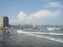
Kamogawa Beach | ||
| ||
 Location of Kamogawa in Chiba Prefecture | ||
 Kamogawa
| ||
| Coordinates: 35°06′50.5″N 140°05′56″E / 35.114028°N 140.09889°ECoordinates: 35°06′50.5″N 140°05′56″E / 35.114028°N 140.09889°E | ||
| Country | Japan | |
| Region | Kantō | |
| Prefecture | Chiba Prefecture | |
| Area | ||
| • Total | 191.30 km2 (73.86 sq mi) | |
| Population (April 2012) | ||
| • Total | 35,103 | |
| • Density | 183/km2 (470/sq mi) | |
| Time zone | Japan Standard Time (UTC+9) | |
| - Tree | Pine | |
| - Flower | Rapeseed | |
| - Fish | Sparidae | |
| Phone number | 04-7092-1111 | |
| Address | 1450 Yokosuka, Kamogawa-shi, Chiba-ken 296-8601 | |
| Website | City of Kamogawa | |


Kamogawa (鴨川市 Kamogawa-shi) is a city in southern Chiba Prefecture, Japan.[1]
In April 2012, the city had an estimated population of 35,103 and a population density of 183 persons per km². The total area is 191.30 km².
The name of the city consists of two characters: the first, kamo (鴨), meaning "duck", and the second, kawa (川), meaning "river".[2]
Geography
Kamogawa is near the southern tip of the Bōsō Peninsula, facing the Pacific Ocean. The area has a warm maritime climate with hot summers and mild winters. Kamogawa is home to Mount Atago, which at 408.2 m (1,339 ft) is the highest point in Chiba Prefecture.[3] Mount Kiyosumi (337 m (1,106 ft)) is home to Seichō-ji. The Kamo River (22.25 kilometres (13.83 mi)) empties into the Pacific Ocean at Kamogawa.[4]
Neighboring municipalities
History
Early history
The area of present-day Kamogawa was part of ancient Awa Province. Nichiren (1222 – 1282) was born in the Kominato district of Kamogawa, and his birthplace is commemorated at Tanjō-ji.[5] During the Edo period, it was mostly tenryō territory controlled directly by the Tokugawa shogunate, with portions under the control of the feudal domains of Funagata Domain, Tateyama Domain, Iwasuki Domain and Tsurumaki Domain.[2] The short-lived (1638-1690) Tōjō Domain and the Bakumatsu period Hanabusa Domain were also located within the borders of modern Kamogawa.
Modern history
In 1877, ten years after the beginning of the Meiji era, Kamogawa suffered a notable cholera outbreak. In 1927 Awa-Kamogawa Station became the terminus of both the Sotobō Line and the Uchibō Line.[2] The city sustained injuries and fatalities during World War II via aerial bombing by the United States. The city was occupied by American forces after the war. Soon after, land reform and economic reform were carried out in Kamogawa. In 1958 the coastal areas of Kamogawa became a part of Minami Bōsō Quasi-National Park, and the town became a tourist destination as a result of the establishment of the park.
Economy
Kamogawa serves as a commercial center for the surrounding region of south-central Chiba Prefecture. Commercial fishing remains the primary industry in Kamogawa, which has five active fishing ports. The city is noted for its sardine and mackerel production. Rice farming and floriculture are practiced.[2] The tourist industry is a growing component of the local economy, with visitors attracted to the area's beaches, hot spring resorts, Kamogawa Seaworld, and the Futomi Flower Center.
Administrative history
At the start of the Meiji period, Kamogawa consisted of all of Nagasa District with two towns and nine villages, and two villages from neighboring Asai District. All of these villages and towns (including Kamogawa Town) became part of Awa District in 1890. Kamogawa was elevated to city status on March 31, 1971.
On February 11, 2005, the town of Amatsukominato (from Awa District) was merged into Kamogawa.
Transportation
Railway
Highway
Education
- Josai International University – Kamogawa Campus
- Waseda University – Kamogawa Campus
- Toyo University – Kamogawa Campus
Sister city relations
 - Minobu, Yamanashi, Japan, from 1991
 - Manitowoc, Wisconsin, USA from 1993
Local attractions
- Kamogawa Sea World, noted especially for its captive orcas and numerous other sea creatures
- Tanjō-ji – Buddhist temple associated with Nichiren
- Seichō-ji – Buddhist temple associated with Nichiren
Noted people from Kamogawa
- Nichiren – noted Buddhist prelate
- Tokiko Kato - singer, composer, lyricist, and actress
- Yuka Murayama - writer
Cultural references
The anime series Lagrange: The Flower of Rin-ne is set in Kamogawa.
References
- ↑ "Kamogawa". Encyclopedia of Japan. Tokyo: Shogakukan. 2012. OCLC 56431036. Retrieved 2012-06-19.
- 1 2 3 4 "鴨川(市)" [Kamogawa]. Nihon Daihyakka Zensho (Nipponika) (in Japanese). Tokyo: Shogakukan. 2012. OCLC 153301537. Retrieved 2012-06-02.
- ↑ "Atago-yama". Nihon Daihyakka Zensho (Nipponika) (in Japanese). Tokyo: Shogakukan. 2012. Retrieved 2012-05-19.
- ↑ 河川現況
- ↑ "Nichiren". Encyclopedia of Japan. Tokyo: Shogakukan. 2012. OCLC 56431036. Retrieved 2012-06-24.
External links
| Wikimedia Commons has media related to Kamogawa, Chiba. |
- Kamogawa City official website (Japanese)
- Kamogawa City official website (English)
- Manitowoc, WI International Sister City
- Kamogawa visitors' information center official website (Japanese)
- Kamogawa visitors' information local info website (Japanese)
| Wards of Chiba | ||
|---|---|---|
| Core cities | ||
| Cities | ||
| Inba District | ||
| Katori District | ||
| Sanbu District | ||
| Chōsei District | ||
| Isumi District | ||
| Awa District | ||