Mill en Sint Hubert
| Mill en Sint Hubert | |||
|---|---|---|---|
| Municipality | |||
|
Church in Mill | |||
| |||
.svg.png) Location in North Brabant | |||
| Coordinates: 51°41′N 5°47′E / 51.683°N 5.783°ECoordinates: 51°41′N 5°47′E / 51.683°N 5.783°E | |||
| Country | Netherlands | ||
| Province | North Brabant | ||
| Government[1] | |||
| • Body | Municipal council | ||
| • Mayor | Antoine Walraven (VVD) | ||
| Area[2] | |||
| • Total | 53.17 km2 (20.53 sq mi) | ||
| • Land | 52.28 km2 (20.19 sq mi) | ||
| • Water | 0.89 km2 (0.34 sq mi) | ||
| Elevation[3] | 17 m (56 ft) | ||
| Population (May 2014)[4] | |||
| • Total | 10,847 | ||
| • Density | 207/km2 (540/sq mi) | ||
| Time zone | CET (UTC+1) | ||
| • Summer (DST) | CEST (UTC+2) | ||
| Postcode | 5450–5455 | ||
| Area code | 0485, 0486 | ||
| Website |
www | ||


Mill en Sint Hubert (Dutch pronunciation: [mɪl ɛn sɪnt ˈɦybɛrt]) is a municipality in southern Netherlands.
Population centres
- Langenboom
- Mill
- Sint Hubert
- Wilbertoord
Topography

Dutch topographic map of the municipality of Mill en Sint Hubert, June 2015
Image gallery
.JPG) Aldendriel Castle
Aldendriel Castle Church of Mill
 Heilmolen (mill)
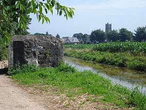 Defence canal and bunker
References
- ↑ "College van B&W" [Board of mayor and aldermen] (in Dutch). Gemeente Mill en Sint Hubert. Retrieved 21 April 2014.
- ↑ "Kerncijfers wijken en buurten" [Key figures for neighbourhoods]. CBS Statline (in Dutch). CBS. 2 July 2013. Retrieved 12 March 2014.
- ↑ "Postcodetool for 5451BM". Actueel Hoogtebestand Nederland (in Dutch). Het Waterschapshuis. Retrieved 21 April 2014.
- ↑ "Bevolkingsontwikkeling; regio per maand" [Population growth; regions per month]. CBS Statline (in Dutch). CBS. 26 June 2014. Retrieved 24 July 2014.
External links
 Media related to Mill en Sint Hubert at Wikimedia Commons
- Official website
 |
Grave | | ||
| Landerd | |
Cuijk | ||
| ||||
| | ||||
| Uden | Sint Anthonis |

This article is issued from Wikipedia - version of the 7/18/2016. The text is available under the Creative Commons Attribution/Share Alike but additional terms may apply for the media files.