Bladel
| Bladel | |||
|---|---|---|---|
| Municipality | |||
|
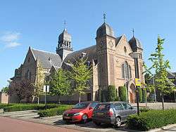
Church in Bladel | |||
| |||
.svg.png) Location in North Brabant | |||
| Coordinates: 51°22′N 5°13′E / 51.367°N 5.217°ECoordinates: 51°22′N 5°13′E / 51.367°N 5.217°E | |||
| Country | Netherlands | ||
| Province | North Brabant | ||
| Government[1] | |||
| • Body | Municipal council | ||
| • Mayor | Boy Swachten (VVD) | ||
| Area[2] | |||
| • Total | 75.62 km2 (29.20 sq mi) | ||
| • Land | 75.35 km2 (29.09 sq mi) | ||
| • Water | 0.27 km2 (0.10 sq mi) | ||
| Elevation[3] | 32 m (105 ft) | ||
| Population (May 2014)[4] | |||
| • Total | 19,817 | ||
| • Density | 263/km2 (680/sq mi) | ||
| Time zone | CET (UTC+1) | ||
| • Summer (DST) | CEST (UTC+2) | ||
| Postcode | 5527–5534 | ||
| Area code | 0497 | ||
| Website |
www | ||

Bladel (![]() pronunciation ) is a municipality and a town in the southern Netherlands.
pronunciation ) is a municipality and a town in the southern Netherlands.
Population centres
- Bladel
- Casteren
- Hapert
- Hoogeloon
- Netersel
Topography
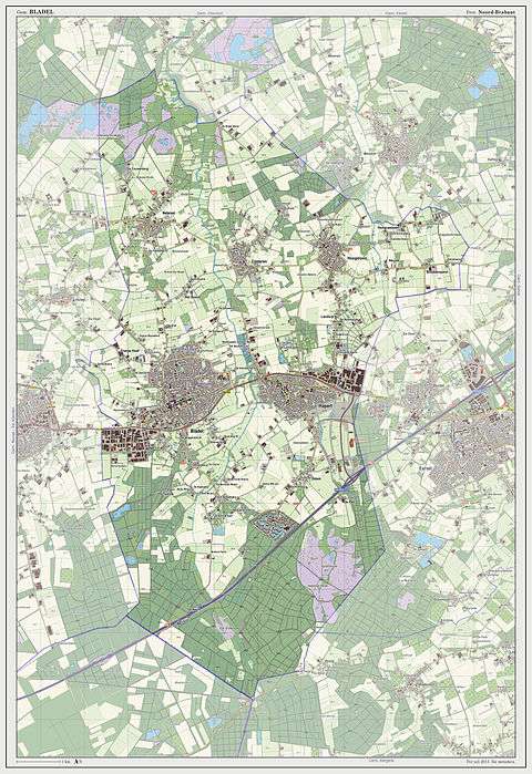
Dutch Topographic map of the municipality of Bladel, 2013.
Notable residents
- Roy Beerens (born 1987), Dutch footballer
- Corky de Graauw (born 1951), Dutch ice hockey player
- Jan Renier Snieders (1812-1888), Flemish writer
- August Snieders (1825-1904), Flemish writer and journalist
References
- ↑ "Namen en portefeuilles" [Names and tasks] (in Dutch). Gemeente Bladel. Retrieved 1 May 2014.
- ↑ "Kerncijfers wijken en buurten" [Key figures for neighbourhoods]. CBS Statline (in Dutch). CBS. 2 July 2013. Retrieved 12 March 2014.
- ↑ "Postcodetool for 5531BC". Actueel Hoogtebestand Nederland (in Dutch). Het Waterschapshuis. Retrieved 1 May 2014.
- ↑ "Bevolkingsontwikkeling; regio per maand" [Population growth; regions per month]. CBS Statline (in Dutch). CBS. 26 June 2014. Retrieved 24 July 2014.
External links
 Media related to Bladel at Wikimedia Commons
- Official website
 |
Hilvarenbeek | Oirschot | | |
| Reusel-De Mierden | |
Eersel | ||
| ||||
| | ||||
| Mol (BE-VAN) | Bergeijk |

This article is issued from Wikipedia - version of the 10/1/2015. The text is available under the Creative Commons Attribution/Share Alike but additional terms may apply for the media files.