Merrimac, Massachusetts
| Merrimac, Massachusetts | ||
|---|---|---|
| Town | ||
|
Merrimac Town Hall near Merrimac Square | ||
| ||
 Location in Essex County in Massachusetts | ||
| Coordinates: 42°49′50″N 71°00′10″W / 42.83056°N 71.00278°WCoordinates: 42°49′50″N 71°00′10″W / 42.83056°N 71.00278°W | ||
| Country | United States | |
| State | Massachusetts | |
| County | Essex | |
| Settled | 1638 | |
| Incorporated | 1876 | |
| Government | ||
| • Type | Open town meeting | |
| • Board of Selectmen |
Hal Lloyd Andrew Connor Earl Baumgardner | |
| Area | ||
| • Total | 8.8 sq mi (22.9 km2) | |
| • Land | 8.5 sq mi (21.9 km2) | |
| • Water | 0.4 sq mi (1.0 km2) | |
| Elevation | 107 ft (33 m) | |
| Population (2010) | ||
| • Total | 6,338 | |
| • Density | 720/sq mi (280/km2) | |
| Time zone | Eastern (UTC-5) | |
| • Summer (DST) | Eastern (UTC-4) | |
| ZIP code | 01860 | |
| Area code(s) | 351 / 978 | |
| FIPS code | 25-40430 | |
| GNIS feature ID | 0618301 | |
| Website |
www | |


Merrimac is a town in Essex County, Massachusetts, United States, and on the southeastern border of New Hampshire, approximately 34 miles (55 km) northeast of Boston and 10 miles (16 km) west of the Atlantic Ocean. It was incorporated on April 11, 1876. It is situated along the north bank of the Merrimack River in the Merrimack Valley. The population was 6,338 at the 2010 census.[1] Historically a manufacturing center, it has long since become a largely residential community. It is part of the Greater Boston metropolitan area.
History

Settled by the English in 1638 as a part of Salisbury and later as a part of Amesbury around the village of Merrimacport, it was known throughout the seventeenth and eighteenth centuries as an agricultural and fishing community, with a small amount of shipbuilding. When Amesbury separated from Salisbury in 1666, Merrimac was referred to as the West Parish of Amesbury, or simply West Amesbury, although it was unincorporated. When a border dispute between the Massachusetts and New Hampshire colonies was settled in 1741, the new border sliced off the parts of Amesbury that were further from the Merrimack River, with the area then associated with West Amesbury becoming the "new town" of Newton, New Hampshire.
In the nineteenth century, benefiting from a manufacturing boom following the establishment of some of the first planned industrial cities in the United States, nearby Lawrence and Lowell, Merrimac came to be known worldwide for its horse-drawn carriage industry. During this period, the town proper of Merrimac, centered around Merrimac Square, expanded separately from the village of Merrimacport. In 1876, Merrimac, including Merrimacport, separated from Amesbury and officially incorporated itself as a town. It is believed that the town, as well as the river that runs along its southern border, are both named for the American Indian tribe that occupied the region. "Merrimac" (or Merrimack) means "swift water place" in the language of this tribe. This town center consists of the typical brick buildings and Victorian architecture of the late nineteenth century, and it is surrounded by much of the town's population. Interstate 495 now divides Merrimacport from Merrimac. At the beginning of the twentieth century, as with the rest of the New England, it went through a period of deindustrialization as the region's industry relocated to the Midwest. The communities of the Merrimack Valley, including Merrimac, were particularly affected by this long period of economic decline and have never fully recovered.
Today, Merrimac is a typical small New England community. It went through numerous growth spurts throughout the 1990s and the beginning of the twenty-first century as it was absorbed into the Greater Lawrence metropolitan area.

Geography
According to the United States Census Bureau, the town has a total area of 8.8 square miles (22.9 km2), of which 8.5 square miles (21.9 km2) is land and 0.39 square miles (1.0 km2), or 4.48%, is water.[2] Merrimac is drained by the Merrimack River, whose north bank the town lies on. Located in the Merrimack River Valley and on the coastal plain of Massachusetts, Merrimac's land consists mainly of small, forested hills (before the twentieth century, it was mostly pasture). The town also has several ponds, streams and Lake Attitash.
Merrimac is roughly diamond-shaped, and is bordered by Amesbury and Lake Attitash to the northeast, West Newbury to the southeast, Haverhill to the southwest, Newton, New Hampshire, to the north and northwest, South Hampton, New Hampshire, to the far northeast, and Plaistow, New Hampshire, on the western corner. The town is 14 miles (23 km) northeast of Lawrence, 30 miles (48 km) southeast of Manchester, New Hampshire, and 34 miles (55 km) north of Boston. Merrimac lies along Interstate 495, with Exit 53 giving access to the town. Massachusetts Route 110 also passes through the town, just north of I-495. There are no bridges crossing the Merrimack directly into the town; the Rocks Village Bridge lies just to the south of town in Haverhill, and the nearest downstream crossing is the Whittier Memorial Bridge in Amesbury.
Demographics

| Historical population | ||
|---|---|---|
| Year | Pop. | ±% |
| 1880 | 2,237 | — |
| 1890 | 2,633 | +17.7% |
| 1900 | 2,131 | −19.1% |
| 1910 | 2,202 | +3.3% |
| 1920 | 2,173 | −1.3% |
| 1930 | 2,392 | +10.1% |
| 1940 | 2,320 | −3.0% |
| 1950 | 2,804 | +20.9% |
| 1960 | 3,261 | +16.3% |
| 1970 | 4,245 | +30.2% |
| 1980 | 4,451 | +4.9% |
| 1990 | 5,166 | +16.1% |
| 2000 | 6,138 | +18.8% |
| 2010 | 6,338 | +3.3% |
| * = population estimate.[3][4][5][6][7][8] | ||
As of the census[9] of 2000, there were 6,138 people, 2,233 households, and 1,699 families residing in the town. The population density was 719.6 people per square mile (277.8/km²). There were 2,295 housing units at an average density of 269.1 per square mile (103.9/km²). The racial makeup of the town was 98.27% White, 0.39% African American, 0.11% Native American, 0.28% Asian, 0.29% from other races, and 0.65% from two or more races. Hispanic or Latino of any race were 0.90% of the population.
There were 2,233 households out of which 40.6% had children under the age of 18 living with them, 62.8% were married couples living together, 10.3% had a female householder with no husband present, and 23.9% were non-families. 19.8% of all households were made up of individuals and 9.2% had someone living alone who was 65 years of age or older. The average household size was 2.73 and the average family size was 3.16.
In the town the population was spread out with 29.0% under the age of 18, 5.0% from 18 to 24, 31.4% from 25 to 44, 23.6% from 45 to 64, and 11.0% who were 65 years of age or older. The median age was 37 years. For every 100 females there were 94.9 males. For every 100 females age 18 and over, there were 90.5 males.
The median income for a household in the town was $58,692, versus $65,401 statewide, and the median income for a family was $69,118. Males had a median income of $48,718 versus $35,325 for females. The per capita income for the town was $24,869. About 1.9% of families and 2.7% of the population were below the poverty line, including 0.7% of those under age 18 and 7.7% of those age 65 or over.
Government
Merrimac, like all New England towns, is governed by the New England town meeting form of government, a kind of participatory direct democracy. Three selectmen are elected to administer the government, but all major decisions, as well as many minor decisions, are handled during the town's annual town meeting, as well as special town meetings, if required. Per the constitution of the Commonwealth of Massachusetts, any resident of Merrimac may introduce legislation with the support of 10 registered voters.
Education
The following schools serve the town of Merrimac. All regional schools, however, are located in neighboring West Newbury. Merrimac High School operated until 1958, but closed when Pentucket Regional High School opened.
- Frederick N. Sweetsir School – named for a doctor who practiced in Merrimac
- Helen R. Donaghue School – named for a former principal of the school
- Pentucket Regional Middle School
- Pentucket Regional High School
- Pentucket Regional School District
Notable people

- Dennis Berran, outfielder for the Chicago White Sox
- Richard P. Gabriel, computer scientist known for his contributions to the Lisp programming language community
- Ephraim Morse, early settler of San Diego, California and one of the founders of Balboa Park
- Henry Boynton Smith, Presbyterian theologian
- Kevin J. Sullivan, Massachusetts politician and former mayor of Lawrence
- George W. Weymouth, Massachusetts politician and former U.S. Representative
Sites of interest
- Lake Attitash (and Indian Head Park)
- The Merrimac Public Library is the town library. It belongs to the Merrimack Valley Library Consortium.
- Merrimac Square
- Merrimac Town Forest
- Merrimac Training Field
- Merrimacport
- Stevens Field
- Skip's, a popular local diner that originated as a drive-in restaurant.
Annual events
Merrimac is home to several regional events:
- The Merrimac Santa Parade
- Merrimac Old Home Days
- Santa in his sleigh with his Reindeers riding on a flat bed truck visits every street in Merrimac on Christmas Eve.
 Town Hall on the Square
 Pilgrim Congregational Church
 Aerial view of Merrimac and neighboring West Newbury
References
- ↑ "Profile of General Population and Housing Characteristics: 2010 Demographic Profile Data (DP-1): Merrimac town, Essex County, Massachusetts". U.S. Census Bureau, American Factfinder. Retrieved September 4, 2012.
- ↑ "Geographic Identifiers: 2010 Demographic Profile Data (G001): Merrimac town, Essex County, Massachusetts". U.S. Census Bureau, American Factfinder. Retrieved September 4, 2012.
- ↑ "TOTAL POPULATION (P1), 2010 Census Summary File 1, All County Subdivisions within Massachusetts". United States Census Bureau. Retrieved September 13, 2011.
- ↑ "1990 Census of Population, General Population Characteristics: Massachusetts" (PDF). US Census Bureau. December 1990. Table 76: General Characteristics of Persons, Households, and Families: 1990. 1990 CP-1-23. Retrieved July 12, 2011.
- ↑ "1980 Census of the Population, Number of Inhabitants: Massachusetts" (PDF). US Census Bureau. December 1981. Table 4. Populations of County Subdivisions: 1960 to 1980. PC80-1-A23. Retrieved July 12, 2011.
- ↑ "1950 Census of Population" (PDF). 1: Number of Inhabitants. Bureau of the Census. 1952. Section 6, Pages 21–10 and 21-11, Massachusetts Table 6. Population of Counties by Minor Civil Divisions: 1930 to 1950. Retrieved July 12, 2011.
- ↑ "1920 Census of Population" (PDF). Bureau of the Census. Number of Inhabitants, by Counties and Minor Civil Divisions. Pages 21–5 through 21-7. Massachusetts Table 2. Population of Counties by Minor Civil Divisions: 1920, 1910, and 1920. Retrieved July 12, 2011.
- ↑ "1890 Census of the Population" (PDF). Department of the Interior, Census Office. Pages 179 through 182. Massachusetts Table 5. Population of States and Territories by Minor Civil Divisions: 1880 and 1890. Retrieved July 12, 2011.
- ↑ "American FactFinder". United States Census Bureau. Retrieved 2008-01-31.
External links
| Wikimedia Commons has media related to Merrimac, Massachusetts. |
- Town of Merrimac official website
- Merrimac Public Library
- 1872 Map of Amesbury (Merrimac was then known as West Amesbury) from plate 9 of the 1872 Atlas of Essex County.
- 1884 Map of Merrimac from plate 172 of the 1884 Atlas of Essex County.
- 1884 Map of Merrimacport from plate 154 of the 1884 Atlas of Essex County.
- 1884 Map of Merrimac Village from plate 151 of the 1884 Atlas of Essex county.
- 1888 Merrimac article by William T. Davis on pages 1535–1556 in Volume II of the History of Essex County Massachusetts with Biographical Sketches, published by D. Hamilton Hurd in 1888.
- 1922 Merrimac article Chapter 30 on pages 313–318 of Volume I of the Municipal History of Essex County, edited by Benjamin F. Arrington, published 1922 by Lewis Historical Publishing.
Municipalities and communities of Essex County, Massachusetts, United States | ||
|---|---|---|
| Cities | 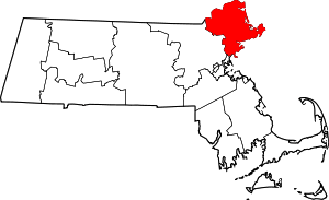 | |
| Towns | ||
| CDPs | ||
| Other villages | ||