Mellen, Wisconsin
| Mellen, Wisconsin | |
|---|---|
| City | |
|
Looking north in downtown Mellen | |
 Location of Mellen, Wisconsin | |
| Coordinates: 46°19′27″N 90°39′33″W / 46.32417°N 90.65917°WCoordinates: 46°19′27″N 90°39′33″W / 46.32417°N 90.65917°W | |
| Country | United States |
| State | Wisconsin |
| County | Ashland |
| Area[1] | |
| • Total | 1.87 sq mi (4.84 km2) |
| • Land | 1.87 sq mi (4.84 km2) |
| • Water | 0 sq mi (0 km2) |
| Elevation[2] | 1,250 ft (381 m) |
| Population (2010)[3] | |
| • Total | 731 |
| • Estimate (2012[4]) | 716 |
| • Density | 390.9/sq mi (150.9/km2) |
| Time zone | Central (CST) (UTC-6) |
| • Summer (DST) | CDT (UTC-5) |
| ZIP code | 54546 |
| Area code(s) | 715 & 534 |
| FIPS code | 55-50700[5] |
| GNIS feature ID | 1579857[2] |
| Website |
www |

Mellen is a city in Ashland County in the U.S. state of Wisconsin. The population was 731 at the 2010 census.
Attractions
- Camp Eagle Ridge, a coeducational leadership summer camp, is located in Mellen.
- Copper Falls State Park is located just north of Mellen.
Geography
Mellen is located at 46°19′27″N 90°39′33″W / 46.32417°N 90.65917°W (46.324288, -90.659295),[6] along the Bad River.[7]
According to the United States Census Bureau, the city has a total area of 1.87 square miles (4.84 km2), all of it land.[1]
Demographics
| Historical population | |||
|---|---|---|---|
| Census | Pop. | %± | |
| 1910 | 1,833 | — | |
| 1920 | 1,981 | 8.1% | |
| 1930 | 1,629 | −17.8% | |
| 1940 | 1,598 | −1.9% | |
| 1950 | 1,306 | −18.3% | |
| 1960 | 1,182 | −9.5% | |
| 1970 | 1,168 | −1.2% | |
| 1980 | 1,046 | −10.4% | |
| 1990 | 935 | −10.6% | |
| 2000 | 845 | −9.6% | |
| 2010 | 731 | −13.5% | |
| Est. 2015 | 700 | [8] | −4.2% |
2010 census
As of the census[3] of 2010, there were 731 people, 337 households, and 182 families residing in the city. The population density was 390.9 inhabitants per square mile (150.9/km2). There were 428 housing units at an average density of 228.9 per square mile (88.4/km2). The racial makeup of the city was 97.1% White, 0.3% African American, 1.2% Native American, 0.1% Asian, 0.3% from other races, and 1.0% from two or more races. Hispanic or Latino of any race were 1.6% of the population.
There were 337 households of which 24.9% had children under the age of 18 living with them, 38.6% were married couples living together, 11.0% had a female householder with no husband present, 4.5% had a male householder with no wife present, and 46.0% were non-families. 40.4% of all households were made up of individuals and 15.7% had someone living alone who was 65 years of age or older. The average household size was 2.08 and the average family size was 2.77.
The median age in the city was 46.5 years. 20.7% of residents were under the age of 18; 6.4% were between the ages of 18 and 24; 20.6% were from 25 to 44; 30.1% were from 45 to 64; and 22.2% were 65 years of age or older. The gender makeup of the city was 49.4% male and 50.6% female.
2000 census
As of the census[5] of 2000, there were 845 people, 378 households, and 215 families residing in the city. The population density was 456.5 people per square mile (176.4/km²). There were 436 housing units at an average density of 235.5 per square mile (91.0/km²). The racial makeup of the city was 96.57% White, 0.24% African American, 1.66% Native American, 0.12% Asian, 0.12% Pacific Islander, 0.36% from other races, and 0.95% from two or more races. Hispanic or Latino of any race were 0.95% of the population.
There were 378 households out of which 23.8% had children under the age of 18 living with them, 46.3% were married couples living together, 7.7% had a female householder with no husband present, and 43.1% were non-families. 39.7% of all households were made up of individuals and 22.0% had someone living alone who was 65 years of age or older. The average household size was 2.15 and the average family size was 2.89.
In the city the population was spread out with 20.6% under the age of 18, 7.1% from 18 to 24, 26.2% from 25 to 44, 21.8% from 45 to 64, and 24.4% who were 65 years of age or older. The median age was 43 years. For every 100 females there were 98.4 males. For every 100 females age 18 and over, there were 91.7 males.
The median income for a household in the city was $31,917, and the median income for a family was $41,111. Males had a median income of $30,804 versus $21,042 for females. The per capita income for the city was $16,297. About 1.4% of families and 5.9% of the population were below the poverty line, including 5.6% of those under age 18 and 10.2% of those age 65 or over.
Notable people
- Robert F. Barabe, politician, Wisconsin State Assembly
- D. E. Bowe, politician, Wisconsin State Assembly
- Bernard E. Gehrmann, politician, Wisconsin State Assembly
- Bernard J. Gehrmann, politician, United States House of Representatives and Wisconsin Legislature
Images
 Looking south at downtown Mellen
 Mellen Weekly Record newspaper building
 Mellen Fire and Rescue
 Post office
 Sign on WIS13
 Welcome sign
 Joan of Arc Willow
References
- 1 2 "US Gazetteer files 2010". United States Census Bureau. Retrieved 2012-11-18.
- 1 2 "US Board on Geographic Names". United States Geological Survey. 2007-10-25. Retrieved 2008-01-31.
- 1 2 "American FactFinder". United States Census Bureau. Retrieved 2012-11-18.
- ↑ "Population Estimates". United States Census Bureau. Retrieved 2013-06-24.
- 1 2 "American FactFinder". United States Census Bureau. Retrieved 2008-01-31.
- ↑ "US Gazetteer files: 2010, 2000, and 1990". United States Census Bureau. 2011-02-12. Retrieved 2011-04-23.
- ↑ DeLorme (1992), Wisconsin Atlas & Gazetteer, Freeport, Maine: DeLorme, p. 95, ISBN 0-89933-247-1
- ↑ "Annual Estimates of the Resident Population for Incorporated Places: April 1, 2010 to July 1, 2015". Retrieved July 2, 2016.
- ↑ "Census of Population and Housing". Census.gov. Retrieved June 4, 2015.
External links
| Wikimedia Commons has media related to Mellen, Wisconsin. |
- Mellen, Wisconsin Chamber of Commerce
- Sanborn fire insurance maps: 1909 1917
Municipalities and communities of Ashland County, Wisconsin, United States | ||
|---|---|---|
| Cities | 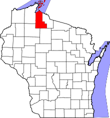 | |
| Village | ||
| Towns | ||
| CDPs | ||
| Unincorporated communities | ||
| Indian reservation | ||
| Footnotes | ‡This populated place also has portions in an adjacent county or counties | |