Copper Falls State Park
| Copper Falls State Park | |
| Wisconsin State Park | |
 Copper Falls | |
| Country | United States |
|---|---|
| State | Wisconsin |
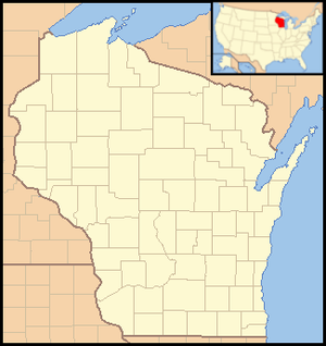
| County | Ashland |
| Location | Mellen |
| - coordinates | 46°22′35″N 90°38′36″W / 46.37639°N 90.64333°WCoordinates: 46°22′35″N 90°38′36″W / 46.37639°N 90.64333°W |
| Area | 3,068 acres (1,242 ha) |
| Founded | 1929 |
| Management | Wisconsin Department of Natural Resources |
 | |
| Website: Copper Falls State Park | |
|
Copper Falls State Park | |
| Location | WI 169, 1.8 mi. NE of Mellen |
| Nearest city | Morse, Wisconsin |
| Built | 1929–1953 |
| Architect | Bernard Herber Knobla, J.C. Steiro |
| NRHP Reference # | 05001425[1] |
| Added to NRHP | December 16, 2005 |
Copper Falls State Park is a 3,068-acre (1,242 ha) state park in Wisconsin. The park contains a section of the Bad River and its tributary the Tylers Forks, which flow through a gorge and drop over several waterfalls. Old Copper Culture Indians and later European settlers mined copper in the area. The state park was created in 1929 and amenities were developed by the Civilian Conservation Corps and the Works Progress Administration. In 2005 the park was listed on the National Register of Historic Places as a site with 10 contributing properties.[2]
Activities and amenities
- Loon Lake: The lake offers swimming, fishing, kayaking, canoeing, and boating with electric motors only. Trout fishing can be found on the Bad River and Tylers Forks.[3]
- Trails: The park has 17 miles (27 km) of trails including a portion of the North Country National Scenic Trail. Trails are used for hiking, biking, cross-country skiing, and snowshoeing.[3]
- Camping: The campground has 24 sites with electric hookups. A camper cabin is accessible to persons with disabilities.[4]
References
- ↑ National Park Service (2007-01-23). "National Register Information System". National Register of Historic Places. National Park Service.
- ↑ "State Highway 169, 1.8 miles northeast of Mellen". Wisconsin Historical Society. Retrieved 2013-12-29.
- 1 2 "Copper Falls State Park: Activities and recreation". Wisconsin Department of Natural Resources. January 18, 2013. Retrieved September 2, 2013.
- ↑ "Copper Falls State Park: Camping". Wisconsin Department of Natural Resources. July 19, 2013. Retrieved September 2, 2013.
Images
 Cabin
Cabin Sign
Sign Entrance sign
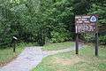
 The Bad River in Copper Falls State Park
External links
| Wikimedia Commons has media related to Copper Falls State Park. |
- Copper Falls State Park Wisconsin Department of Natural Resources
- Historic American Landscapes Survey (HALS) No. WI-7, "Copper Falls State Park, State Highway 169, 1.8 miles northeast of Mellon, Mellen, Ashland County, WI", 4 data pages
This article is issued from Wikipedia - version of the 5/27/2016. The text is available under the Creative Commons Attribution/Share Alike but additional terms may apply for the media files.