Mau district
| Mau district मऊ ماؤ | |
|---|---|
| District of Uttar Pradesh | |
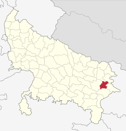 Location of Mau district in Uttar Pradesh | |
| Country | India |
| State | Uttar Pradesh |
| Administrative division | Azamgarh |
| Tehsils | Mau Ghosi |
| Government | |
| • Lok Sabha constituencies | Ghosi |
| • Assembly seats | Ghosi Madhuban Rasara Mau Sadar Mohammadaba Gohana |
| Area | |
| • Total | 1,713 km2 (661 sq mi) |
| Population (2011) | |
| • Total | 2,205,170 |
| • Density | 1,300/km2 (3,300/sq mi) |
| Demographics | |
| • Literacy | 75.16 per cent |
| • Sex ratio | 978 |
| Major highways | NH-29 |
| Website | Official website |
Mau is one of the districts of Uttar Pradesh state of India, and Mau town is the district headquarters. Mau district is a part of Azamgarh Division. It is situated in the south-eastern part of the state with headquarters in Maunath Bhanjan. The district is surrounded by Ghazipur district on the south, Ballia district in the east, Azamgarh district in the west, and by Gorakhpur and Deoria districts on the north.
Demographics
According to the 2011 census Mau Nath Bhanjan district has a population of 2,205,170, in which male and female were 1,114,888 and 1,090,282 respectively. In 2001 census, Mau had a population of 1,853,997, in which males were 933,523 and remaining 920,474 were females.[1] roughly equal to the nation of Latvia[2] or the US state of New Mexico.[3] This gives it a ranking of 206th in India (out of a total of 640).[1] The district has a population density of 1,287 inhabitants per square kilometre (3,330/sq mi) .[1] Its population growth rate over the decade 2001-2011 was 18.94%.[1] Mau has a sex ratio of 978 females for every 1000 males,[1] and a literacy rate of 75.16%.[1]
Sports
In sports Mau has a tremendous history:
- Bhim Narayan Rai of village Revaridih -Sahroj: National Champion and Record Holder in javelin Throw in National Games 1961, where he broke the Asian Games record. He has also broken a record in the Indian School Games -1960. He was awarded Outstanding performer in 1964 U.P. Athletic meet, and he won the UP state Track & Field championship 1961 to 1965 of UP
- Long racer Bahadur Prasad participated in several Asian Games
- Eminent Wrestler Kisore Pahlwan of Village Basiharam
- Sprinter Ram das Sahani of Village Amila
- TezBahadur Singh (UP Kesari) of village Sarwan Ranbirpur
- Tridip Rai International Basket Ball player of village Kasara
- Kamran Khan IPL Cricket player of village Nadwa Sarai.
Politics
Jharkande Rai and Kalpanath Rai were well-known faces of politics in Mau. Mau sadar is the Legislative seat of politician Mukhtar Ansari. Politicians Sunil Singh Chauhan, Harinarayan Rajbhar are also from Mau.
Literature
In literature, Mau has produced many great writers and poets, such as:
- Laxmi Narayan Mishra (1903–1987), born in the village Basti, district Mau. He was a popular play writer of HINDI. He was a theatre personality of Uttar Pradesh. His works became very popular between 1930 and 1950. They were frequently staged by schools, colleges, and amateur groups. Laxmi Narayan Mishra is considered the founder of the problem play in Hindi theatre.
- Fiza Ibn-e-Faizi (1923–2009) was a modern Urdu and Persian poet. He was a native of Mau district of Uttar Pradesh and was considered a 'qadir-ul-kalaam' poet and had received numerous awards within the Urdu world. At least, six poetry collections of Faizi had been published and acclaimed. In 2009, a memorial named as Faizi Gate was constructed by the then municipal head near his house.
- Maulana Habibur Rahman Azmi (1900–1992) was a well-known Islamic Scholar, belonged to this city. He wrote under pen name of Abul Ma'sir. His works on Islamic Jurisprudence is well acclaimed. He remains a well-known figure in major Islamic seminaries like Medina University, Al-Azhar and Darul-uloom Deoband. His works are cited by Muslims across the world.
- Kanhaiya Lal Misra (1903-1975) was Advocate General of Uttar Pradesh, India from 1952 to 1969.
- Shyam Narayan Pandey (1907 - 1991) was a Hindi poet famous for his epic poem Haldighati, which is based on the Battle of Haldighati between Akbar and Maharana Pratap.
- Dr. Krishna N. Sharma is a prolific writer and researcher, working as the Dean at St. Louis University, Cameroon.
References
- 1 2 3 4 5 6 "District Census 2011". Census2011.co.in. 2011. Retrieved 2011-09-30.
- ↑ US Directorate of Intelligence. "Country Comparison:Population". Retrieved 2011-10-01.
Latvia 2,204,708 July 2011 est.
- ↑ "2010 Resident Population Data". U. S. Census Bureau. Retrieved 2011-09-30.
New Mexico - 2,059,179
External links
 |
Gorakhpur district | Deoria district | | |
| Azamgarh district | |
Ballia district | ||
| ||||
| | ||||
| Ghazipur district |
Coordinates: 25°56′N 83°34′E / 25.933°N 83.567°E