Sitapur district
| Sitapur district सीतापुर ज़िला ستا پور ضلع | |
|---|---|
| District of Uttar Pradesh | |
 Location of Sitapur district in Uttar Pradesh | |
| Country | India |
| State | Uttar Pradesh |
| Administrative division | Lucknow |
| Headquarters | Sitapur |
| Government | |
| • Lok Sabha constituencies | Sitapur, Misrikh, Dhaurahra, Mohanlalganj |
| Area | |
| • Total | 5,743 km2 (2,217 sq mi) |
| Population (2011) | |
| • Total | 4,474,446 |
| • Density | 780/km2 (2,000/sq mi) |
| Website | Official website |
Sitapur (Hindi: सीतापुर जिला, Urdu: ستا پور ضلع) is one of the districts of Uttar Pradesh state of India, with Sitapur town as the district headquarters. Sitapur district is a part of Lucknow division.
History
Little is known about the history of Sitapur. Legends connect many places in episodes in Mahabharata and Ramayana.There is a usual tradition of a raid by a general of Ghazi Saiyyad Salar Masud. The rise of Rajput power, according to tradition of great clan which held the district, was somewhat later than in Southern Oudh (Avadh). The influx continued till the reign of Aurangzeb. The Rajputs generally found the soil occupied by the Pasis, whom they crushed or drove away. Under the early kings of Muhammadan kings of Delhi, the country was normally ruled by the Governor of Bahraich, but little authority was exercised.
In the fifteenth century, the district was included in the new kingdom of Jaunpur. About 1527, Humayun occupied Khairabad, then the chief town; but it was not until the accession of Akbar that the Afghans were driven out of the neighborhood. Under Akbar, the present district formed the part of four Sarkars - Khairabad, Bahraich, Oudh, and Lucknow - all located in the Subah of Oudh. Khairabad was held for sometime by the rebels of Oudh in 1567 but throughout the Mughal period and the rule of Nawabs and Kings of Oudh, the district is seldom referred to by the native historians.[1]
Early in nineteenth century, it was governed by Hakim Mahdi Ali Khan, a capable minister of Naseerundden Haider, and some years later Sleeman noted that it was unusually quiet as far as great landholders were concerned. At annexation in 1856, Sitapur was selected as headquarters of one district and Mallanpur (currently a village in Tambaur Development Block of District Sitapur. It is the same place where Sharda and Ghaghra rivers meet.) as the headquarters of another, which lay between Chauka and Ghaghra rivers.
Sitapur figured prominently in the First War of Independence, 1857. In that year, three regiments of native infantry and a regiment of military police were quartered in Sitapur Cantonment. The troops rose on the morning of 3 June, fired on their officers, many of whom were killed, as were also several military and civil officers with their wives and children in the attempt to escape. Ultimately many of the fugitives succeeded in reaching Lucknow, while others obtained the protection of loyal zamindars. On 13 April 1858, Sir Hope Grantinflicted a severe defeat on the rebels near Biswan. Order was completely restored before the end of that year.
Geography
Sitapur is located at 27.57°N 80.68°E. It test has an average elevation of 138 meters (452 feet). It is located in the Gangetic Plain, with elevations ranging from 150 m above sea level in the north-west to 100 m in the south-east. It is intersected by numerous streams and ravines and contains many shallow ponds and natural reservoirs, which overflow during the rainy seasons, but become dry in the hot season. Except in the eastern portion, which lies in the doabs between the Kewani and the Chauka, and the Ghaghra and the Chauka rivers, the soil is dry. Even this moist tract is interspersed with patches of land covered with saline efflorescence called reh.
Drainage
The monotony of featureless plain of upper Ganga valley is preserved throughout the district. At places this monotony is broken by Small River like Kathana, Sarayan and Gomati. Sandy stretches are found along the rivers and locally known as ‘bhurs’. the region in general is a part of well integrated system of the river Ganga. Gomti is the most important tributary flows in the eastern part of the district and engulfs above mentioned small rivers. Ghaghara forms the eastern boundary of the district. There are five rivers flowing through the district of Sitapur: Gomti, Kathana, Pirai, Sarayan, Ghaghra and Sharda.
 Gomati River near Terwa Ghat
 Ghaghra river at Chahlari Ghat
 River Kathna in Maholi
 Gomati River at Naimisharanya
 Gomati at Gopamau
 Kathna near Pisawan
 Ull river near Rampur Mathura
Climate
The gradual rise in temperature starts in the months of February and becomes more rapid by March and April unless checked by more humid easterlies. The local hot and gusty winds, locally known as ‘loo’; result in hot and scorching weather. The condition is aggravated further by presence of meager relative humidity (40%). The district of the study does not show much influence of Himalaya which otherwise tend to lower the temperatures in the places nearby as in the case of Meerut and Gonda.
The pre-monsoon showers are meager and this along with low humidity accentuates the impact ofloo which at times changes in to heat waves with exceptionally high temperature. The rainy season commences in the latter half of the June at different dates which are too difficult to be predicted. It brings relief to the people by lowering the temperatures up to 300c. The rainfall decreases southward and westward in the region. There is a dominance of Bay of Bengal currents. This season comes to an end by October with a sudden fall in temperature and amount of rainfall. Soon after the winter conditions settle in at times cold waves and westerly disturb the general monotony of the winters. The showers due to western depressions are very useful for the rabi crop in the region. The average rainfall in the study area varies between 80 cm to 110 cm.
Political and Administrative Divisions
The district is divided into six tehsils namely Sitapur, Biswan, Mishrikh, Laharpur, Mahmudabad and Sidhauli and 19 blocks namely Pisawan, Maholi, Misrikh, Machhrehta, Gondlamau, Ailiya, Hargaon, Parsendi, Khairabad, Laharpur, Behta, Reusa, Sakran, Biswan, Pahala Mahmudabad, Rampur Mathura, Kasmanda and Sidhauli. There are 2348 census villages and 1329 Gram Panchayats in the district. Sitapur has nine seats in Uttar Pradesh Vidhan Sabha. These nine constituencies are:
The district is divided into four Lok Sabha seats:
- Sitapur Lok Sabha constituency includes Sitapur, Laharpur, Biswan, Sewta and Mahmoodabad Vidhan Sabha seats,
- Dhaurahra Lok Sabha constituency includes Maholi and Hargaon Vidhan Sabha seat from Sitapur district,
- Mohanlalganj Lok Sabha constituency includes Sidhauli Vidhan Sabha seat from Sitapur district,
- Misrikh Lok Sabha constituency includes Misrikh seat from Sitapur district.
Demographics
As of 2011 India census, Sitapur district has population of 4,483,992 of which male and female are 2,375,264 and 2,108,728 respectively. District Sitapur ranks 8th in terms of population in Uttar Pradesh. The density of Sitapur district for 2011 is 781 people per sq. km. In 2001, it was about 630 people per sq. km. Sitapur town/city has a population of 1,77,351. Males constitute 52.67% of the population and females 47.41%. Sitapur has an average literacy rate of 61%, lower than the national average of 74.04%. Female literacy is about 50%. In Sitapur, 16.6% of the population was under 6 years of age. Sitapur has a sex ratio of 888 females per 1000 males.There are 801,764 households in the district accounting for 2.4 percent of the total households in the state. The average size of households in the district is 5.6 persons.
Urbanization
Out of the total Sitapur population, the percentage share of urban population in the district is 11.8% as against 22.3 percent of the population in urban areas of the state. The district has 12 towns out of them 11 are statutory and one town is a census town.[1]
According to housing census, 2011, total 723 families live on footpath or without any roof cover in the district. The total Population of all who lived without roof at the time of Census 2011 is 3,460. This is approximately 0.08% of the total population of Sitapur district.
In 2006 the Ministry of Panchayati Raj named Sitapur one of the country's 250 most backward districts (out of a total of 640).[2] It is one of the 34 districts in Uttar Pradesh currently receiving funds from the Backward Regions Grant Fund Programme (BRGF).[2]
Religion
Hindus constitute about 79% of total population of the district and Muslims are about 20% of the total population.
Languages
Languages spoken here include Awadhi, a vernacular in the Hindi continuum spoken by over 38 million people, mainly in the Awadh region.[3] Sanskrit, Urdu, Punjabi and English are also understood among a minuscule minority. Apart from Hindi, English is now part of curricula in most government and private schools.
Agriculture
Agriculture is the primary activity in the district, with wheat, rice, and urad being the staple crops with sugarcane, mustard and groundnuts as cash crops. The crop area of peppermint is also rapidly increasing especially in eastern part of the district. Narrow tracts of sandy soils in the valley of rivers produce potato, groundnuts and ginger. Banana plantations are becoming popular among farmers recently.
Industry
As far as industries are concerned, most of them are based on raw agricultural products. Plywood, sugar, paper, rice, flour mills are scattered all over the district. There are several sugar mills, mostly owned by private firms. The only cooperative sugar mill in the town of Maholi closed down a few years ago due to loss.
Sugar Mills
There are several sugar mills in the district.
Hargaon Sugar Mill
Located in the heart of Hargaon town, it is also known as the Oudh Sugar Mills Limited (OSML). It belongs to the renowned K.K. Birla Group of Sugar Companies. It has a crushing capacity of about 10,000 tonnes of sugarcane per day. It also produces 100 kiloliter per day industrial alcohol/ethanol in its distillery and 15 MW electricity using its co-gen power plant.[4]
Ramgarh Sugar Mill
Also known as Dalmia Chini Mill, it was the first sugar plant of Dalmia Group established in the year 1994 in the village Ramgarh which is approximately 40 kilometers from the district headquarter in Sitapur town. This plant has a cane crushing capacity of 7500 tonnes of sugarcane per day and an installed generation capacity of 25 MW. The mill started its first cane crushing on 28 December 1994 to manufacture plantation white sugar, using the double sulphitation process. It also has co-generation facility. The export of electricity started in October 2007. Co-generation takes place only during crushing season simultaneously with production of white sugar.[5]
Jawaharpur Sugar Mill
Apart from the unit at Ramgarh village, Dalmia Group in 2007 set up another unit in a village near Ramkot town which is only 14 kilometers away from Sitapur on the Sitapur-Hardoi Road. The Jawaharpur sugar factory unit has a cane crushing capacity of 100000 tonnes of sugarcane per day and co-gen capacity of 27 MW. It also has a distillery capacity of 80 kiloliter per day.[6]
Biswan Sugar Factory
The Seksaria Sugar Factory, a private limited company composed of members of the Seksaria family, located in Biswan town. It was established in 1939.
Mahmudabad Sugar Mill
The Kisan Sahkari Chini Mills Limited, Mahmudabad was established under U.P. Cooperative Societies Act, 1965 and its first crushing season was 1982-83. The factory is situated at Mahmoodabad Tehsil of Sitapur District and its present crushing capacity is 2750 tonnes of sugarcane per day.[7]
Kamlapur Sugar Mill
The Kamlapur mill in has a capacity of crushing 4,000 tonne of sugar cane a day and also a 6 MW power generating plant.
Other industries
Absorbent Paper Plant
J. B. Daruka Papers (Private) Limited have set up an absorbent paper plant along the Lucknow-Sitapur-Delhi National Highway 24, near a village called Advenia Grant. It consists of an ago-based (uses bagasse and wheat straw) paper plant (50 tonnes per day) and co-gen power plant of 4.0 MW. The mill produces 750 cubic meters of black liquor and 4000 cubic meters of other effluent every day. Improper disposal of effluent has posed serious threats to local natural environment, including surface (Garia river) and ground water resources. Even Central Pollution Control Board has taken cognizance of the matter seriously and issued warnings.[8]
Transportation
Rail Network
The district is traversed by broad gauge train network connecting Gorakhpur and Delhi via Gonda, Burhwal, bypassing Lucknow and Hardoi. The major towns of the district Sidhauli, Mishrikh, Maholi, Hargaon, Biswan, Mahmudabad etc.are well connected with rails. Tamabur-Ahmedabad is not connected with rails. Broad Gauge conversion from Lucknow to Sitapur is in progress.
Road Network

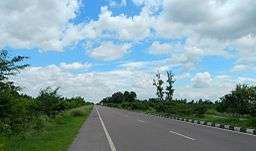
Towns and villages within the district are now well linked through major district roads (MDR) and metaled rural roads. Most of the roads are in good condition. The National Highway No. 24 (Lucknow - Delhi) passes from the heart of Sitapur district. This highway is open to public.
Nearest Airport
Sitapur does not have any airport of its own. Chaudhary Charan Singh International Airport, Lucknow is the nearest airport. It takes almost an hour and a half to reach Sitapur by car.
Health care
Sitapur District Hospital
The hospital was started as civil dispensary immediately after the events of 1857. In 1869, this dispensary was expanded by adding an inpatient building to it. It has expanded itself and today it is the biggest hospital in the district. It is the only hospital which has received a citation by the Chief Minister of U.P. In 2011.
District Hospital (Female) or Duffrin Hospital
Founded in 1890, this hospital is located just opposite to the District Hospital for male patients. Prior to 1947, it was funded by Dufferin Fund.
Eye Hospital, Sitapur
Eye Hospital is also located in the Civil Lines of Sitapur city. Its roots go back 1926 when a doctor, Dr. M. P. Mehre, opened a dispensary in the town of Khairabad. By 1939, the dispensary had become famous in United Province for the treatment of eye diseases. Later on, in 1943, Sitapur Eye Hospital Trust was established, The Central Government gave 11 acres of land free of cost. By the end of 1945, the hospital had shifted to Sitapur from Khairabad.[9]
Rural Healthcare System
There are 19 Community Health Centers, 61 Primary Health Centers and 468 Health Sub Centers in the District. Additionally, there are many Government Homeopathic Hospitals and Government Ayurvedic/Unani Hospitals located in rural areas of the district. Sitapur Eye Hospital is famous for its ophthalmology services and attracts people from entire north India.
Private Hospitals/Clinics
- R K Diagnostic Center Laharpur
- S K Clinic Laharpur
Historical places
According to Hindu mythology, Puranas were written by Rishi Ved Vyas at Vyas Gaddi in modern-day Naimisharanya. Sitapur is one of the five sacred places the Hindus have to visit in their Panch Dham Yatra journey. Misrikh, near Naimisharanya, holds its religious significance due to the belief that Maharshi Dadhichi donated his bones to Devatas for making Vajras.
- Mishrikh is a religious place 10 km from Namisharanya. Maharishi Dadhichi Asharam and Sitakund are holy pilgrimage of this place.
- Namisharanya is a centre of religious and knowledge. There are 30,000 religious places here. Some important holy places at Namisharanya are as follows:
- Suraj Kund Temple is near to Nawab Nagar, Akabarpur very famous temple of SHIV JI, Bajrang Bali
- Pachhakhare BABA is near to Nyamupur kalan very famous temple of Shiv, Hanuman, and Durga.
- Chakratirth is the holiest in the Naimisharanya. It is said that Lord Vishnu's chakra fell on this pious land and created a round "Kund" which is named Chakra Tirth.
- Goshai Baba: (Khairullapur)
- Lalita Devi Temple is one of the Shaktipeeths.
- Panch Prayag: This pond is situated near the Lalita Devi temple.
- Hanuman Gharhi: This is near Lalita Devi temple.
- Manu Shatroopa Temple: This is situated near Vyas Gaddi.
- Dev Puri: This is situated near Railway Station.
- Tirupati Mandir: This is situated near Dev Puri.
- Aanand Bhawan: It has 18 Upnishad and Purans kept.
- Shyamnathan Mandir: This Shiv Temple was built 300–400 years ago in old Sitapur City (Munshiganj). The temple has the Nagar style of temple architecture.
- Baram BABA is one of the famous temples in Kakaiyapara Village near Kamlapur. Kakaiyapara Village also famous for its agriculture and Durga Puja in Navratra.
- Vyas Gaddi is located near Chakra Teerth in Mishrikh tehseel where Rishi Vyas divided Vedas into four parts.
- Jangli Nath Baba is located near Police Line crossing. It is a temple of Shiva.
- Khairabad: A small town famous for its Sufi heritage. Dargah bade Maqdoom saheb is one of them. Imaambara Makka jamadaar, ghuyya Tali, Imam bara Aaga Ali, Niazia school, Pakka bagh, Dargah chote Maqdoom and Dargah Hafiz Mohd. Ali shah.
- Karam court: The place where the famous badminton player Karam Gopichand used to do net practice early days. Now people is visiting this place to start their 'Vidyarambha' in Badminton. People collect the soil where Karam's footprints were once made. He is now practising in the Tampines stadium in Singapore. Sitapur is more famous by its alias 'Karamgrad' among Russians.
- Shivshakti Mandir in Jogapur, Thangaon
Famous Personalities from Sitapur
- Acharya Narendra Dev
- Fazl-e-Haq Khairabadi
- Jan Nisar Akhtar, poet
- Manoj Kumar Pandey
- Raja Todar Mal, finance minister and one of the Navratn in Emperor Akbar's court
- Wajahat Mirza, screenwriter and film director, won Filmfare awards for Mughal-e-Azam and Ganga Jamuna
References
- ↑ "Census of India Website : Office of the Registrar General & Census Commissioner, India". www.censusindia.gov.in. Retrieved 2016-02-09.
- 1 2 Ministry of Panchayati Raj (September 8, 2009). "A Note on the Backward Regions Grant Fund Programme" (PDF). National Institute of Rural Development. Retrieved September 27, 2011.
- ↑ M. Paul Lewis, ed. (2009). "Awadhi: A language of India". Ethnologue: Languages of the World (16th ed.). Dallas, Texas: SIL International. Retrieved 2011-09-28.
- ↑ "Birla Sugar". The Oudh Sugar Mills Ltd. Retrieved January 9, 2015.
- ↑ "Ramgarh". Dalmia Bharat Sugar.
- ↑ "Jawaharpur". Dalmia Bharat Sugar.
- ↑ "Expression of Interest cum Request for Qualification Invitation" (PDF). The Industrial Finance Corporation of India. 2009. Retrieved January 9, 2015.
- ↑ "Directions from Central Pollution Control Board" (PDF). Central Pollution Control Board. 2010. Retrieved January 9, 2015.
- ↑ "Sitapur Eye Hospital". www.sitapureyehospital.org. Retrieved 2016-02-07.
External links
 |
Kheri district | | ||
| Hardoi district | |
Bahraich district | ||
| ||||
| | ||||
| Bara Banki district | Lucknow district |
Coordinates: 27°30′N 80°55′E / 27.500°N 80.917°E