Saharanpur district
| Saharanpur district सहारनपुर ज़िला ضلع سهارنپور | |
|---|---|
| District of Uttar Pradesh | |
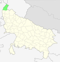 Location of Saharanpur district in Uttar Pradesh | |
| Country | India |
| State | Uttar Pradesh |
| Administrative division | Saharanpur |
| Headquarters | Saharanpur |
| Government | |
| • Lok Sabha constituencies | Saharanpur |
| • Assembly seats | Gangoh and nakud |
| Area | |
| • Total | 3,860 km2 (1,490 sq mi) |
| Population (2011) | |
| • Total | 3,464,228 |
| • Density | 900/km2 (2,300/sq mi) |
| Demographics | |
| • Literacy | 62.61[1] |
| Website | Official website |
Saharanpur district (Hindi: ज़िला सहारनपुर, Urdu: ضلع سهارنپور) is the northernmost of the districts of Uttar Pradesh state, India. Bordering the states of Haryana, Himachal Pradesh and Uttarakhand, and close to the foothills of Shivalik range, it lies in the northern part of the Doab region. It is primarily an agricultural area.
The district headquarters are Saharanpur city and it belongs to Saharanpur Division. Other principal towns are Behat, Deoband, Gangoh and Rampur Maniharan.
Historical
Ancient period
The entire Saharanpur district is a part the Yamuna-Ganges Doab region. Its physical features have been most conducive to human habitation. Archaeological surveys have provided evidence of the existence of many settlements over the ages. Excavations have been carried out in different parts of the district, such as Ambakheri, Bargaon, Hulas and Naseerpur and in Bahadrabad of Haridwar district. On the basis of artifacts discovered during these excavations, human habitation can be traced as far back as 2000 B.C. Traces of the Indus Valley civilization, and even of earlier cultures, have been found. Archaeologically, Ambakheri, Bargaon, Naseerpur and Hulas were centres of Harappan civilisation. It has witnessed the mighty war of Mahabharata in the region of present Muzaffarnagar district; when both were a part of the Kuru (East) Mahajanapada territory and Usinara and Panchala Mahajanapadas were their eastern neighbours. Though the history of the region can be traced to some extent from the days of the Vedic period, a more exact history, the system of administration of the local kings, and the lifestyle of the people will become known only with further exploration.
Medieval period
During the reign of Shamsu’d-Din Iltutmish (1211–36), the region became a part of the Delhi Sultanate. At that time, most of the area remained covered with forests and marshlands, through which the Paondhoi, Dhamola, and Ganda Nala rivers flowed. The climate was humid and malaria outbreaks were common. Muhammad bin Tughluq, the Sultan of Delhi (1325–1351), undertook a campaign in the northern doab to crush the rebellion of the Shivalik kings in 1340, when according to local tradition he learned of the presence of a sufi saint on the banks of the Paondhoi River. After visiting the sage, he ordered that henceforth this region would be known as 'Shah-Haroonpur', after the Sufi Saint Shah Haroon Chishti.[2] The simple but well-preserved tomb of this saint is situated in the oldest quarter of Saharanpur city, between the Mali Gate/Bazar Dinanath and Halwai Hatta. By the end of 14th century, the power of the Sultanate had declined and it was attacked by Emperor Timur (1336–1405) of Central Asia. Timur had marched through Saharanpur region in 1399 to sack Delhi and people of the region fought his army unsuccessfully. A weakened Sultanate was later conquered by the Central Asian Mogul king Babur (1483–1531).
Mughal period
In the 16th century, Babur, a Timurid descendant of Timur and Genghis Khan from Fergana Valley (modern-day Uzbekistan), swept across the Khyber Pass and founded the Mughal Empire, covering India, along with modern-day Afghanistan, Pakistan and Bangladesh[3] The Mughals were descended from Persianised Central Asian Turks (with significant Mongol admixture).
During the Mughal period, Akbar (1542–1605), Saharanpur became an administrative unit under the Province of Delhi. Akbar bestowed the feudal jagir of Saharanpur to the Mughal treasurer, Sah Ranveer Singh, an Agarwal[4] who laid the foundations of the present day city on the site of an army cantonment. The nearest settlements at that time were Shekhpura and Malhipur. Saharanpur was a walled city, with four gates: the Sarai Gate, the Mali Gate, the Buria Gate and the Lakhi Gate. The city was divided into the neighbourhoods named Nakhasa Bazar, Shah Behlol, Rani Bazar and Lakhi Gate. The ruins of Shah Ran Veer Singh's old fort can still be seen in the Chaudharian locality of Saharanpur, not far from the better known 'Bada-Imam-bada'. He also built a large Jain temple in Muhallah/Toli Chaundhariyan,[5] it is now known as the 'Digamber-Jain Punchayati Mandir'.
The Sayyids and Rohillas
Mughal emperors Akbar and later Shah Jehan (1592–1666) bestowed the administrative pargana of Sarwat on Muslim Sayyid families. In 1633 one of them founded a city and named it and the surrounding region Muzaffarnagar, in honour of his father, Sayyid Muzaffar Ali Khan. The Sayyids ruled the area until the 1739 invasion by Nadir Shah. After his departure, anarchy prevailed across the entire doab with the region ruled or ravaged in succession by Rajputs, Tyagis, Brahmins, and Jats. Taking advantage of this anarchy, the Rohillas took control of the entire trans-Gangetic region.
Ahmad Shah Durrani, the Afghan ruler who invaded Northwestern and Northern India in 1750's, conferred the territory of Saharanpur as Jagir on Rohilla chief Najaf Khan, who assumed the title of Nawab Najeeb-ud-Daula and took up residence in Saharanpur in 1754,. He made Gaunsgarh his capital and tried to strengthen his position against Maratha Empire attacks by entering an alliance with the Hindu Gurjar chieftain Manohar Singh. In 1759, Najeeb-ud-Daula issued a Deed of Agreement handing over 550 villages to Manohar Singh, who became the Raja of Landaura. Thus the Rohillas and the Gurjars now controlled Saharanpur.
Maratha period
In 1757, the Maratha army invaded the Saharanpur region, which resulted in Najeeb-ud-Daula losing control of Saharanpur to the Maratha rulers Raghunath Rao and Malharao Holkar. The conflict between Rohillas and Marathas came to an end on 18 December 1788 with the arrest of Ghulam Qadir, the grandson of Najeeb-ud-Daula, who was defeated by the Maratha general Mahadaji Scindia. The most significant contribution of Nawab Ghulam Qadir to Saharanpur city is the Nawab Ganj area and the Ahmedabadi fortress therein, which still stands. The death of Ghulam Qadir put an end to the Rohilla administration in Saharanpur and it became the northernmost district of the Maratha Empire. Ghani Bahadur Banda was appointed its first Maratha governor. The Maratha Regime saw the construction of the Bhuteshwar Temple and Bagheshwar Temple in Saharanpur city. In 1803, following the Second Anglo-Maratha War, when the British East India Company defeated the Maratha Empire, Saharanpur came under British suzerainty.[6]
British period
The last of the invaders were the British East India Company who marched into Saharanpur from the east in 1803. In 1804 the British created Saharanpur district. It became a very large district under the British, reaching its maximum size when the then Greater Nepal's Dehradun region was added after the British-Gurkha War of 1816. The present independent districts of Muzaffarnagar, Haridwar and Dehradun at that time formed a part of Saharanpur district.
- GaadaIn 1845 Choudhary Rao Wazir-ud-din Khan, the descendant of Raja Ram Singh was the great Zaminder of Shaikpura Qadeem (Saharanpur). Choudhary Rao Wazir-ud-din Khan became a member and voter of the Mughal Court at the Red Fort in Delhi. He was the richest person in the Saharanpur District with 27 thousand bigha of land or lord of 57 villages of the district of Saharanpur. The British governor had good relations with Rao Wazir-ud-Din and he bestowed the princely title on him. He died in 1895 at Saharanpur. He had two sons Choudhary Rao Mashooq Ali Khan and Choudhary Rao Ghafoor Muhammad Ali Khan.
Rao Ghafoor Muhammad Ali Khan had seven children out of which his eldest, Rao Maqsood Ali Khan, was noteworthy as a highly educated and spiritual person. He was the one and only one royal man of Saharanpur. He was decorated by the Indian Viceroy Lord Irwin at Dehradun . He died in 1973 at Sheikhpura Qadeem and left behind his four sons: Rao Ghulam Muhi-ud-Din Khan, Rao Zamier Haider Khan, Rao Yaqoob Khan and Rao Ghulam Hafiz.
Geography
Saharanpur is located at 29°58′N 77°33′E / 29.97°N 77.55°E,about 130 kilometres (81 mi) south-southeast from Chandigarh and 170 kilometres (110 mi) north-northeast from Delhi. It has an average elevation of 284 metres (932 ft)
Physical features
Saharanpur forms the most northerly position of the land known as the Doab which stretches between the holy rivers of the Ganges and the Yamuna. The Shivalik hills rise above it on the northern frontier. The portion of the Doab in which Saharanpur is situated was probably one of the first region of upper India occupied by the Aryans colonisers as they spread eastward from the Punjab.
The north and the north east of the district are surrounded by the Shivalik hills which separate it from the Dehradun district in the recently created state of Uttranchal. The river Yamuna forms its boundary in the west,separating it from the Karnal and Yamunanagar districts of Haryana. In the east lies the district of Haridwar which was part of the district of Saharanpur until 1989, and in the south lies the district of Muzafarnagar. At the time of the British Rule District Muzafarnagar was also a part of the district of Saharanpur. The district is rectangular in shape and lies between 29 degrees 34 minutes 45 seconds and 30 degrees 21 minutes 30 seconds north latitude and 77 degrees 9 minutes and 78 degrees 14 minutes 45 seconds east longitude. Its total area is 3860 square kilometers.
The main characteristics of the district can be divided into four parts.
1. The Shivalik Hill Tract
2. The Bhabar Land
3. Bangar Land
4. Khadar Land (Yamuna, Hindon)
5. chilkana sarsawa highway
Important Rivers
The Yamuna
The Solani
The Hindon
The Ratmau
The Nagdev
All the rivers of the district flow into either the Yamuna or the Ganges.
Climate
Saharanpur has a tropical climate because of the proximity of the Himalayan region across this Northern district. It is a sub humid region especially the upper Ganges plain areas. Saharanpur records an average temperature around 23.3 degrees during the course of the year. June is the hottest recorded month while January is the coldest one. Humidity is higher in the western area as compared to the eastern region.
Economy and Trade
The district is part of a fertile belt. A well-developed irrigation system of Gangetic-canals and tube-wells supports a thriving agricultural economy of multiple crops and bumper yields. In addition to farming of major food grain crops like wheat, rice etc., cash crops like sugar cane and potatoes etc. are cultivated on a wide scale. Fruit orchards and horticulture are also important for local and export markets. Even though Dehradun is more famous for basmati rice, a lot of it is grown in the Saharanpur area.
From the view point of industries and trade the region has great importance. The district has several agro-based industries: paper, tobacco, wood-work etc. A multinational cigarette manufacturing company, the Indian Tobacco Company (ITC Limited), is located in Saharanpur. The region produces agro-based and industrial goods which are sent to the various parts of the country. The trade flourishes and can be divided into three categories: A. Food - Grains, Vegetables and Fruits. Milk and milk products. B. Agro Based Industries - The most important industries are Sugar, Gur, (Cotton) Textile and Cigarettes. C. Industrial Goods- Paper, Sugarcane, Hosiery Material & Wood Carving.
Besides exporting goods from here the region also imports Coal, Iron–ore, Cement, Salt, Petroleum Products, Fertilizers, Oil-Seeds and Leather from Punjab, Haryana, Rajasthan, Delhi and Bihar.[7]
Demographics
According to the 2011 census the Saharanpur district had a population of 3,464,228,[8] roughly equal to the nation of Panama[9] or the US state of Connecticut.[10] This gives it a ranking of 92nd in India (out of a total of 640).[8] The district has a population density of 939 inhabitants per square kilometre (2,430/sq mi) .[8] Its population growth rate over the decade 2001-2011 was 19.59%.[8] Saharanpur has a sex ratio of 887 females for every 1000 males,[8] and a literacy rate of 72.03%.[8]
Education
Culturally, Saharanpur district is similar to the rest of western Uttar Pradesh. It is home to the Paper and Pulp Technology Institute which is affiliated to the Indian Institute of Technology, Roorkee (formerly Roorkee University) and Central Pulp and Paper Research Institute (Ministry of pulp and paper industry).
In the year 2012, the Government of Uttar Pradesh through a notification passed by the Legislature and assented by the Governor of Uttar Pradesh empowered NICE Society to establish a State University in a small town Gangoh of District Saharanpur by the name, Shobhit University, Uttar Pradesh under section 2 (f) of the University Grant Commission Act, 1956. Several colleges in the district, affiliated to the Meerut University, also conduct university level courses in a number of important science and arts subjects.
Establish university in the year 2013 Glocal University Saharanpur India which is located in delhi yamnotri state highway Mirzapur Poul Saharanpur 247001 UP India. founder by Hazi Mohmad iqbal founded in 2012.this is a world class university. A project is now underway (as of 2009), to establish a medical college in Saharanpur: Molana Mahmud Hasan Allophethic Government medical college pilkhni saharanpur (The Master Kanshi Ram Allopathic Government College).
Medical College
- Sheikh-Ul-Hind Mahmood Mahmood Hasan Medical College, a government medical college which provides healthcare for all citizens of the state and to train students. The present medical college is planned to have a 500 bed hospital with road access to the Saharanpur-Ambala National Highway. The proposed annual intake of MBBS Students is expected to be 100 from 2014-15.[12]
References
- ↑ "District-specific Literates and Literacy Rates, 2001". Registrar General, India, Ministry of Home Affairs. Retrieved 2010-10-10.
- ↑ History The Imperial Gazetteer of India, v. 21, p. 369. 1909.
- ↑ The Islamic World to 1600: Rise of the Great Islamic Empires (The Mughal Empire)
- ↑ http://www.indiatvnews.com/news/india/india-s-agrawal-community-its-history-and-prominent-personaliti-18629.html?page=4
- ↑ Madhu Jain, O. C. Handa, and Omacanda Handa, Wood Handicraft: A Study of Its Origin and Development in Saharanpur, Indus Publishing (2000), pp. 22–24. ISBN 81-7387-103-5
- ↑ Mayaram, Shail. Against history, against state: counterperspectives from the margins Cultures of history. Columbia University Press, 2003. ISBN 978-0-231-12731-8.
- ↑ http://saharanpur.nic.in/sre_geography.htm
- 1 2 3 4 5 6 "District Census 2011". Census2011.co.in. 2011. Retrieved 2011-09-30.
- ↑ US Directorate of Intelligence. "Country Comparison:Population". Retrieved 2011-10-01.
Panama 3,460,462 July 2011 est.
- ↑ "2010 Resident Population Data". U. S. Census Bureau. Retrieved 2011-09-30.
Connecticut 3,574,097
- ↑ "Saharanpur Religion Census 2011". Office of the Registrar General and Census Commissioner, India. Retrieved 2015-10-19.
- ↑ "Shaikhul Hind Medical College inaugurated". www.milligazette.com. Retrieved 16 May 2014.
 |
Sirmaur district, Himachal Pradesh | | ||
| Yamuna Nagar district | |
Haridwar district | ||
| ||||
| | ||||
| Karnal district | Shamli district | Muzaffarnagar district |
Coordinates: 29°54′N 77°41′E / 29.900°N 77.683°E