Mattapoisett, Massachusetts
| Mattapoisett, Massachusetts | ||
|---|---|---|
| Town | ||
|
Ned's Point Light | ||
| ||
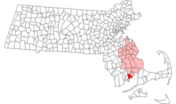 Location in Plymouth County in Massachusetts | ||
| Coordinates: 41°39′30″N 70°49′00″W / 41.65833°N 70.81667°WCoordinates: 41°39′30″N 70°49′00″W / 41.65833°N 70.81667°W | ||
| Country | United States | |
| State | Massachusetts | |
| County | Plymouth | |
| Settled | 1750 | |
| Incorporated | 1857 | |
| Government | ||
| • Type | Open town meeting | |
| Area | ||
| • Total | 24.2 sq mi (62.6 km2) | |
| • Land | 17.4 sq mi (45.0 km2) | |
| • Water | 6.8 sq mi (17.6 km2) | |
| Elevation | 25 ft (8 m) | |
| Population (2010) | ||
| • Total | 6,045 | |
| • Density | 250/sq mi (97/km2) | |
| Time zone | Eastern (UTC-5) | |
| • Summer (DST) | Eastern (UTC-4) | |
| ZIP code | 02739 | |
| Area code(s) | 508 / 774 | |
| FIPS code | 25-39450 | |
| GNIS feature ID | 0619471 | |
| Website | http://www.mattapoisett.net/ | |
Mattapoisett is a town in Plymouth County, Massachusetts, United States. The population was 6,045 at the 2010 census.[1]
For geographic and demographic information on the village of Mattapoisett Center, please see the article Mattapoisett Center, Massachusetts.
History and general information
The Mattapoisett area was originally purchased by Governor William Brenton from the Wampanoag chief Metacomet, also referred to as King Philip, in 1664. Brenton left it to his son Ebenezer, who sold it.[2] The town of Mattapoisett was settled in 1750 and officially incorporated in 1857. Originally a part of Rochester, the area had most likely been visited by European traders and sailors. There is also evidence of prior Wampanoag Indian settlements, including burial grounds, throughout the town. In fact, the word Mattapoisett is Wampanoag for "a place of resting."
Early industry included logging and farming, but Mattapoisett became best known as a center for shipbuilding and whaling. Some 400 ships were built in the town's shipyards from 1740 until the 1870s, including the Acushnet, the ship that Moby-Dick author Herman Melville sailed on and later deserted. The town supplied many of the whalers used on the East Coast in the first half of the nineteenth century. The last one, the Wanderer, was built in 1878, shortly after the discovery of oil in Pennsylvania.
With the decline of whaling and associated shipbuilding, Mattapoisett transitioned into a popular summer vacation spot for prominent New York and Boston residents, including Oliver Wendell Holmes, Jr. Today, the town is largely a suburban community, with most residents commuting to jobs in greater New Bedford, Providence or Boston, or operating businesses targeting summer tourism.[3]
A fictitious future Mattapoisett features largely in the 1976 novel Woman on the Edge of Time by Marge Piercy.
Geography
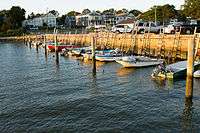
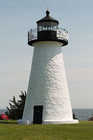
According to the United States Census Bureau, the town has a total area of 24.2 square miles (62.6 km2), of which 17.4 square miles (45.0 km2) is land and 6.8 square miles (17.6 km2), or 28.18%, is water.[4] The Mattapoisett River begins in Rochester and flows through town, emptying into Mattapoisett Harbor, an arm of Buzzards Bay. Mattapoisett is home to Haskell Swamp in the Tinkham Hill area in the northern part of town. There is also a state-managed wildlife area, Nasketucket Bay State Reservation, commonly known as Nunes Farm, along the waterfront near the Fairhaven line. There are four beaches and two parks along the waterfront, as well as Ned Point Light, which was built in 1837 and added to the National Register of Historic Places in 1987. The town is home to the Fin, Fur and Feather Club, a hunt club and shooting range located along the Mattapoisett River off Crystal Spring Road.
Mattapoisett is the southwestern-most town of Plymouth County. It is bordered by Fairhaven to the southwest, Acushnet to the northwest, Rochester to the north, and Marion to the east. Buzzards Bay lies to the south. The town is 9 miles (14 km) east of New Bedford, 38 miles (61 km) east-southeast of Providence, Rhode Island, and 60 miles (97 km) south of Boston.
Transportation
Interstate 195 runs through the town, and U.S. Route 6, is the main local road through town. I-195 has an exit for the town, Exit 19A/B, "Mattapoisett/N. Rochester," which accesses North Street.
Regional bus service can be reached in New Bedford, as can regional air service. The nearest rail service is either in Providence or at the terminus of the Middleborough-Lakeville line of the MBTA's commuter rail service to Boston. The nearest national airline service can be found at T. F. Green Airport in Warwick, Rhode Island, and the nearest international service can be reached at Logan International Airport in Boston.
Demographics
| Historical population | ||
|---|---|---|
| Year | Pop. | ±% |
| 1860 | 1,483 | — |
| 1870 | 1,361 | −8.2% |
| 1880 | 1,365 | +0.3% |
| 1890 | 1,148 | −15.9% |
| 1900 | 1,061 | −7.6% |
| 1910 | 1,233 | +16.2% |
| 1920 | 1,277 | +3.6% |
| 1930 | 1,501 | +17.5% |
| 1940 | 1,608 | +7.1% |
| 1950 | 2,265 | +40.9% |
| 1960 | 3,117 | +37.6% |
| 1970 | 4,500 | +44.4% |
| 1980 | 5,597 | +24.4% |
| 1990 | 5,850 | +4.5% |
| 2000 | 6,268 | +7.1% |
| 2010 | 6,045 | −3.6% |
| * = population estimate. Source: United States Census records and Population Estimates Program data.[5][6][7][8][9][10][11][12][13] | ||
As of the census[14] of 2000, there were 6,268 people, 2,532 households, and 1,769 families residing in the town. The population density was 380.4 people per square mile (146.9/km²). There were 3,172 housing units at an average density of 192.5 per square mile (74.3/km²). The racial makeup of the town was 96.51% White, 0.62% African American, 0.13% Native American, 0.65% Asian, 0.03% Pacific Islander, 1.10% from other races, and 0.96% from two or more races. Hispanic or Latino of any race were 0.57% of the population.
There were 2,532 households out of which 30.2% had children under the age of 18 living with them, 57.7% were married couples living together, 9.6% had a female householder with no husband present, and 30.1% were non-families. 25.5% of all households were made up of individuals and 12.7% had someone living alone who was 65 years of age or older. The average household size was 2.46 and the average family size was 2.97.
Age distribution figures show 23.9% of the population under the age of 18, 4.5% from 18 to 24, 26.0% from 25 to 44, 29.0% from 45 to 64, and 16.6% who were 65 years of age or older. The median age was 42 years. For every 100 females there were 92.0 males. For every 100 females age 18 and over, there were 88.9 males.
The median income for a household in the town was $58,466, and the median income for a family was $68,246. Males had a median income of $48,100 versus $35,938 for females. The per capita income for the town was $28,050. About 2.8% of families and 3.6% of the population were below the poverty line, including 2.5% of those under age 18 and 3.2% of those age 65 or over.
Government
Mattapoisett is represented in the Massachusetts House of Representatives as a part of the Tenth Bristol district, which also includes Fairhaven, Marion, Rochester and a portion of Middleborough. The town is represented in the Massachusetts Senate as a part of the Second Bristol and Plymouth district, which also includes Acushnet, Dartmouth, Fairhaven and New Bedford.[15] The town's I-195 highway portion is patrolled by the Seventh (Bourne) Barracks of Troop D of the Massachusetts State Police.[16]
On the national level, Mattapoisett is a part of Massachusetts's 9th congressional district, and is currently represented by William R. Keating. The state's senior member of the United States Senate is Elizabeth Warren. The junior senator is Ed Markey.
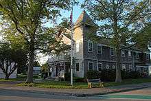
Mattapoisett uses the open town meeting form of government, led by a board of selectmen. The town hall is located on Main Street, between Route 6 and the harbor. The town has its own highly educated full-time police department and on-call fire department, both headquartered on Route 6. Interestingly the Mattapoisett Police Department runs the emergency medical system (EMS) for the town with it being one of the last towns among the Commonwealth to have a police based EMS system. All police officers are required to be at minimum EMT-Basics while some members of the police are EMT-Paramedics. The EMS also has civilian EMT-Paramedic members who reside in the community. The Mattapoisett Free Public Library, located on Barstow Street, is a member of the Southeastern Massachusetts Library System (SEMLS) and the Massachusetts Library Internet Network (MLIN). The nearest hospitals are Saint Luke's Hospital in New Bedford and Tobey Hospital in Wareham, both of which are members of the Southcoast Hospitals Group.
Education
Mattapoisett is a member of the 2,700-student Old Rochester Regional School District. The town, along with Marion and Rochester, operate a single school system with each town having its own school subcommittee. Mattapoisett operates the Center School for prekindergarten through third grade students, and the Old Hammondtown School for grades 4-6. Seventh- and eighth-grade students attend Old Rochester Regional Junior High School, and high school students attend Old Rochester Regional High School. Both regional schools are located on Route 6 in Mattapoisett, near the Marion town line. The high school, commonly known as "O.R.R.," competes in the South Coast Conference for athletics. Their mascot is the bulldog, and their colors are red and white. The town's Thanksgiving Day football rival is Apponequet Regional High School in Lakeville.
In addition to public schools, high school students may also choose to attend Old Colony Regional Vocational Technical High School, located in Rochester. The nearest private schools are Tabor Academy in Marion and Bishop Stang High School in Dartmouth.
Prior to the opening of the Old Rochester Regional High School in 1961, students in grades 10-12 attended Fairhaven High School in Fairhaven
Notable people
- Devon Barley, singer, finalist on Season One of The Voice
- Robert Brink, violinist (b. 1924)
- Courtney Fathom Sell, Filmmaker (b. 1985)
- Oliver Wendell Holmes, Jr., United States Supreme Court justice
- Geoff Smith, Boston Marathon winner, 1984–85
- Peter Uihlein, 2010 U.S. Amateur Golf Champion
- Sam Waterston, actor, Jack McCoy on NBC's Law and Order
- Michael Rock, local radio personality
- Raymond Gilmartin, President and CEO of Merck & Co, Inc., 1994-2005
- Milton Silveira, Chief Engineer of NASA (b. 1929 - d. 2013)
- Francis Davis Millet, Artist born in Mattapoisett and died on the Titanic (b. 1848 -d. 1912)
References
- ↑ "Profile of General Population and Housing Characteristics: 2010 Demographic Profile Data (DP-1): Mattapoisett town, Plymouth County, Massachusetts". U.S. Census Bureau, American Factfinder. Retrieved March 20, 2012.
- ↑ Potter, Elisha Reynolds (1835). The Early History of Narragansett. Providence: Marshall. p. 3:397. Retrieved 15 Oct 2016.
- ↑ Mattapoisett Town History - Mattapoisett Historical Society
- ↑ "Geographic Identifiers: 2010 Demographic Profile Data (G001): Mattapoisett town, Plymouth County, Massachusetts". U.S. Census Bureau, American Factfinder. Retrieved March 20, 2012.
- ↑ "TOTAL POPULATION (P1), 2010 Census Summary File 1, All County Subdivisions within Massachusetts". United States Census Bureau. Retrieved September 13, 2011.
- ↑ "Massachusetts by Place and County Subdivision - GCT-T1. Population Estimates". United States Census Bureau. Retrieved July 12, 2011.
- ↑ "1990 Census of Population, General Population Characteristics: Massachusetts" (PDF). US Census Bureau. December 1990. Table 76: General Characteristics of Persons, Households, and Families: 1990. 1990 CP-1-23. Retrieved July 12, 2011.
- ↑ "1980 Census of the Population, Number of Inhabitants: Massachusetts" (PDF). US Census Bureau. December 1981. Table 4. Populations of County Subdivisions: 1960 to 1980. PC80-1-A23. Retrieved July 12, 2011.
- ↑ "1950 Census of Population" (PDF). 1: Number of Inhabitants. Bureau of the Census. 1952. Section 6, Pages 21-10 and 21-11, Massachusetts Table 6. Population of Counties by Minor Civil Divisions: 1930 to 1950. Retrieved July 12, 2011.
- ↑ "1920 Census of Population" (PDF). Bureau of the Census. Number of Inhabitants, by Counties and Minor Civil Divisions. Pages 21-5 through 21-7. Massachusetts Table 2. Population of Counties by Minor Civil Divisions: 1920, 1910, and 1920. Retrieved July 12, 2011.
- ↑ "1890 Census of the Population" (PDF). Department of the Interior, Census Office. Pages 179 through 182. Massachusetts Table 5. Population of States and Territories by Minor Civil Divisions: 1880 and 1890. Retrieved July 12, 2011.
- ↑ "1870 Census of the Population" (PDF). Department of the Interior, Census Office. 1872. Pages 217 through 220. Table IX. Population of Minor Civil Divisions, &c. Massachusetts. Retrieved July 12, 2011.
- ↑ "1860 Census" (PDF). Department of the Interior, Census Office. 1864. Pages 220 through 226. State of Massachusetts Table No. 3. Populations of Cities, Towns, &c. Retrieved July 12, 2011.
- ↑ "American FactFinder". United States Census Bureau. Retrieved 2008-01-31.
- ↑ Index of Legislative Representation by City and Town, from Mass.gov
- ↑ Station D-7, SP Bourne
External links
| Wikimedia Commons has media related to Mattapoisett, Massachusetts. |
- Town of Mattapoisett official website
- Mattapoisett Police Department
- Mattapoisett Free Public Library
- The Wanderer, local weekly periodical
- SouthCoastToday.com: Mattapoisett
- Images of Mattapoisett
- Live area Police & Fire Scanner Radio
- SOCO magazine
