Matapédia, Quebec
| Matapédia | |
|---|---|
| Municipality | |
|
Confluence of Matapédia and Restigouche Rivers | |
 Location within Avignon RCM. | |
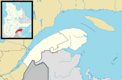 Matapédia Location in eastern Quebec. | |
| Coordinates: 47°58′N 66°57′W / 47.967°N 66.950°WCoordinates: 47°58′N 66°57′W / 47.967°N 66.950°W[1] | |
| Country |
|
| Province |
|
| Region |
Gaspésie– Îles-de-la-Madeleine |
| RCM | Avignon |
| Settled | 1808 |
| Constituted | November 4, 1905 |
| Government[2] | |
| • Mayor | Luc Lagacé |
| • Federal riding |
Gaspésie— Îles-de-la-Madeleine |
| • Prov. riding | Bonaventure |
| Area[2][3] | |
| • Total | 72.10 km2 (27.84 sq mi) |
| • Land | 72.49 km2 (27.99 sq mi) |
|
There is an apparent contradiction between two authoritative sources | |
| Population (2011)[3] | |
| • Total | 664 |
| • Density | 9.2/km2 (24/sq mi) |
| • Pop 2006-2011 |
|
| • Dwellings | 360 |
| Time zone | EST (UTC−5) |
| • Summer (DST) | EDT (UTC−4) |
| Postal code(s) | G0J 1V0 |
| Area code(s) | 418 and 581 |
| Highways |
|

Matapédia (former name: Saint-Laurent-de-Matapédia) is a municipality at the southern tip of the Gaspé peninsula, in Eastern Quebec, Canada. Matapédia is located along Quebec Route 132 on the border of New Brunswick.
In addition to Matapédia itself, the municipality also includes the hamlets of Mann Settlement,[4] Runnymede,[5] and Matapédia West.
Toponomy
Its name may derive from the Mi'kmaq word matapegiag, meaning "river junction", from the parts mata (junction) and pegiag (river), referring to the Matapédia River that crosses the town just before its confluence with the Restigouche River.[6] Another source from the late nineteenth century indicates that the Mi'kmaq named the area Magabegeak which means "roughly flowing".[7] It has also been spelled many different ways over time such as Matapediach,[8] Madapeguia[9], Matapeguia[10], Matapediac,[11] Matakpediack,[12] Madapeguia,[12] Metapedia,[13] or Matapediac.[1]
Residents and village expatriates are known as Matapedians.[14]
Geography
Matapédia is located south of the Saint Lawrence River on the south side of the Gaspé Peninsula at the eastern end of the Matapédia Valley at the mouth of the Matapédia River in junction with the Restigouche River. It is located 500 km northeast of Quebec City and 350 km southwest of the city of Gaspé. The major cities near Matapedia are Campbellton, New Brunswick 25 km to the east and Amqui 80 km to the northwest.
The municipality of Matapédia is part of the regional county municipality of Avignon in the administrative region of Gaspésie–Îles-de-la-Madeleine. It includes three hamlets:[14][15]
- Mann Settlement
- Matapédia West
- Runnymede
History
Colonization
In 1808, colonization began with the arrival of Loyalists, followed by Irish settlers in 1850, Acadians in 1860, and French Canadians in 1865.[1] The feat of colonization was no simple act, the entire valley had undergone immense forest fires at the middle of the 19th century, with building woods scarce.[16] According to a commissioned report, a thousand square miles of forest had burned in the 1864 blaze, and even worst, the river had flooded in 1865.[17][18]
In 1842, the geographic township was formed, named after the Matapédia River. In 1860, a mission is established, and in 1864, the Matapédia Post Office opened. On November 4, 1905, the place was incorporated as the Parish Municipality of Saint-Laurent-de-Matapédia, named after the local parish and township. But since 1973, it has been officially known by its abbreviated name Matapédia.[1]
Present day
The village has one general store and a designated Heritage Railway Station since 1994.[19] The economy is mainly focused on the local geography with activities such as salmon fishing,[20] fly tying,[21][22] hunting[23] and tourism. For many years the town contained a baseball field, however in recent times it has been transformed into a soccer field. Matapédia contains a CLSC, although the closest hospital is on the New Brunswick side: the Restigouche Hospital Centre on Salmon Boulevard. The town also contains a belvedere facing the main part of town over 200 metres up.[24] Fishing remains an important part of the Matapédia economy and heritage, conservation efforts have been made to help the Atlantic salmon in both rivers, such as protection of breeding grounds.[25][26] On February 27, 2010, the status of the parish municipality was changed to just municipality.[1] A ski hill exists in the village, known as Petit Chamonix since the mid-twentieth century.[27][28][29] The Provigo warehouse has been abandoned for the past 15 years, on the side of the 132 Highway.[30]
Flooding
Recurring Floods
The junction of the Matapédia River and Restigouche River floods into the village during the thaw of the ice during the onset of Spring. Notable floods (natural disasters[31]) have occurred in:[32]
- 1861 - Autumn - damage to the highway and minor damage to a bridge, the Commissioner of Public Works was warned that a breakwater could be built to help stop persistent flooding.[33]
- 1896-1897 - Spring - very devastating flooding.[34]
- 1959 - April 23 - a large ice jam developed under the Matapédia bridge, Transports Québec attempted to unblock the jam with dynamite however never revealed the outcome of the attempt.[35]
- 1974 - January 19 - a flood develops at Routhierville, Quebec which causes 3 miles of the highway to flood and the town to flood.[36]
- 1974 - April 29 to May 18 - massive flooding caused evacuations as well as flooding of the Motel Restigouche, the CCGS Tupper was eventually called in to help.[37]
- 1992 - April 23 - a fast flood developed which caused evacuations in Runnymede while for a half day the Motel Restigouche and corresponding street "Rue des Saumons" were inundated, the flood was comparative to the 1974 flood but shorter in time.[38]
- 1994 - April 16 and 17 - 4 bridges destroyed or heavily damaged, Main Street inundated, all highway links to the town flooded, 100 citizens evacuated.[39]
- 2008 - April 21 - Restigouche River overflows and causes minor damages and evacuations.[40]
Cause of Floods
Since 1962, the Environment Canada hydrologic station located on the upper portion of the Restigouche River has reported substantial increases of water flow, sometimes at over 400% above previous levels. Clear cutting of forest on both the Matapédia River and Restigouche River has created areas with no shade along the banks of the river, resulting in a faster melt than in previous years. Furthermore, the clear cut land lacks the naturally occurring moss which would help colloidal suspension in soil and retention. This creates the ideal condition for Spring thawing. Another factor in the flooding is the construction of bridges in the rivers, with the dykes acting as dams, further blocking passage of the flow. This information was sent to the United Nations Commission on Human Rights in a complaint by former owner of the Motel, Peter Dubé.[32][41]
Administration
The Matapédia municipal council consists of a mayor and six councilors elected in rotating block every four years without territorial division.[14]
| 2013 - 2017 | mayor | Luc Lagacé |
| advisors | ||
| # 1 | Sonia Rancourt | |
| # 2 | Martine Levesque | |
| # 3 | Nicole Lagacé | |
| # 4 | Daniel Bélanger | |
| # 5 | Serge Normandeau | |
| # 6 | Serge Denis |
Furthermore, Carole Bélanger is the Director-general, secretary treasurer and coordinator for emergency measures for the municipality.[14]
Tourism
The Matapédia River is internationally recognized for its many pools for fishing for Atlantic salmon. To safeguard these pools for future generations, the wildlife reserve Rivières-Matapédia-et-Patapédia was established on a part of its course to protect this resource. The Matapédia flat is located near the mouth of the Restigouche just north of the bridge.[42]
Famous Matapedians
- Jean-Eudes Dubé, lawyer and politician, born in 1926 in Matapédia;
- Maurice Harquail, politician, born in 1938 in Matapédia.
Political Representation
Provincially it is part of the riding of Bonaventure . In the 2008 Quebec general election, the outgoing MP Nathalie Normandeau, of the Quebec Liberal Party, was re-elected to represent the population of Matapédia in the National Assembly of Quebec.
Federally, Matapédia is part of the federal riding of Haute-Gaspésie—La Mitis—Matane—Matapédia. In the 2008 Canadian federal election, the incumbent Jean-Yves Roy of the Bloc Québécois was elected to represent the population Matapédia in the House of Commons of Canada.
Population
Population Change in Matapédia[43][44][45]
| Year | Population | Change |
|---|---|---|
| 2011 | 664 | -4.6% |
| 2006 | 696 | -1.6% |
| 2001 | 707 | -5.6% |
| 1996 | 749 | -4.7% |
| 1991 | 786 | -3.9% |
| 1986 | 818 |
According to Statistics Canada, the population of Matapédia, Quebec was 664 inhabitants in 2011. The demographic trend in recent years follows the overall pattern of Gaspé Peninsula and Bas-Saint-Laurent, that is to say a steady decrease.This corresponds to a decrease of 4.6% in five years. The median age of Matapédia residents is higher than in most of Quebec at 49.7 years.
The total number of dwellings in the municipality is 360 . However, only 311 of these units are occupied by permanent residents. The majority of homes are Matapedia Villas and apartment buildings.
According to Statistics Canada immigration is basically non-existent in Matapédia. 80% of the population has French listed as mother tongue and 20% are English-speaking Quebecers. However, 39% of the population masters the two official languages of Canada. For single language speakers, 46% speaks only French and 15% speak only English. No Aboriginals live in Matapedia.
The unemployment rate in the municipality was 23% in 2006. The median income of Matapédiens was 25 174 $ in 2005.
According to Statistics Canada, 32% of the population 15 years and over Matapédia has no high school diploma education. 37% of this population has only a high school diploma or vocational. 45 people have diplomas from university in Matapédia. All Matapedia graduates completed their studies in Canada. The main area of university studies for Matapédians is the business, management and public administration sectors.[46]
Demographics
Statistics
| Canada census – Matapédia, Quebec community profile | |||
|---|---|---|---|
| 2011 | 2006 | 2001 | |
| Population: | 664 (-4.6% from 2006) | 696 (-1.6% from 2001) | 707 (-5.6% from 1996) |
| Land area: | 72.49 km2 (27.99 sq mi) | 72.49 km2 (27.99 sq mi) | 72.53 km2 (28.00 sq mi) |
| Population density: | 9.2/km2 (24/sq mi) | 9.6/km2 (25/sq mi) | 9.7/km2 (25/sq mi) |
| Median age: | 49.7 (M: 48.3, F: 51.1) | 46.9 (M: 46.5, F: 47.6) | 43.3 (M: 42.0, F: 44.9) |
| Total private dwellings: | 360 | 341 | 328 |
| Median household income: | $43,139 | $36,396 | $28,390 |
| References: 2011[3] 2006[47] 2001[48] | |||
| Historical Census Data - Matapédia, Quebec[49] | ||||||||||||||||||||||||||
|---|---|---|---|---|---|---|---|---|---|---|---|---|---|---|---|---|---|---|---|---|---|---|---|---|---|---|
|
|
| ||||||||||||||||||||||||
Language
Mother tongue:[50]
- English as first language: 20%
- French as first language: 80%
- English and French as first language: 0%
- Other as first language: 0%
 |
Saint-André-de-Restigouche | | ||
| Saint-Alexis-de-Matapédia | |
Ristigouche-Partie-Sud-Est | ||
| ||||
| | ||||
| Restigouche River |
Restigouche River |
See also
- List of municipalities in Quebec
- Avignon—La Mitis—Matane—Matapédia
- Matapedia River
- Matapedia Valley
- Restigouche River
- Haute-Gaspésie—La Mitis—Matane—Matapédia
References
- 1 2 3 4 5 "Matapédia (Municipalité)" (in French). Commission de toponymie du Québec. Retrieved 2012-01-12.
- 1 2 "Matapédia". Répertoire des municipalités (in French). Ministère des Affaires municipales, des Régions et de l'Occupation du territoire. Retrieved 2012-01-11.
- 1 2 3 "Matapédia census profile". 2011 Census data. Statistics Canada. Retrieved 2012-01-11.
- ↑ New Brunswick Vital Statistics from Newspapers: 1882-1883. The Society. 1994-01-01.
- ↑ Roy, David C. (1987-01-01). North-Eastern Section of the Geological Society of America: Decade of North American Geology, Centennial Field Guides Volume 5. Geological Society of America. ISBN 9780813754055.
- ↑ Seguin, Yves (2005-01-01). Hiking in QuŽbec. Hunter Publishing, Inc. ISBN 9782894647608.
- ↑ Rand, Silas Tertius (1875-01-01). A First Reading Book in the Micmac Language: Comprising the Micmac Numerals, and the Names of the Different Kinds of Beasts, Birds, Fishes, Trees, &c. of the Maritime Provinces of Canada. Also, Some of the Indian Names of Places, and Many Familiar Words and Phrases, Translated Literally Into English. Nova Scotia Printing Company.
- ↑ (L.)), William VONDENVELDEN (and CHARLAND; CHARLAND, Louis (1803-01-01). Extraits des titres des anciennes concessions de terre en fief et Seigneurie, faites avant et depuis la conquête de la Nouvelle France par les armes Britanniques dans la partie actuellement appellée les Bas-Canada ... le tout compilé par W. V. et L. C. (in French).
- ↑ Assembly, Québec (Province) Legislature Legislative (1852-01-01). Titles and Documents Relating to the Seigniorial Tenure: In Return to an Address of the Legislative Assembly, 1851. Fréchette. p. 140.
- ↑ Québec, Archives de la province de (1928-01-01). Archives de la Province de Québec (in French). La Compagnie de "l'Eclaireur".
- ↑ Bouchette, Joseph (1832-01-01). A Topographical Dictionary of the Province of Lower Canada. Longman&Company.
- 1 2 toponymie, Québec (Province) Commission de (1994-01-01). Noms et lieux du Québec: dictionaire illustré (in French). Gouvernement du Québec, La Commission. ISBN 9782551140503.
- ↑ company, james r osgood and (1875-01-01). the maritime provinces: a handbook for travellers. p. 69.
- 1 2 3 4 "Matapédia - Répertoire des municipalités - Ministère des Affaires municipales et de l'Occupation du territoire". www.mamrot.gouv.qc.ca. Retrieved 2016-03-11.
- ↑ "Fiche descriptive". www.toponymie.gouv.qc.ca. Retrieved 2016-03-11.
- ↑ Lands, Québec (Province) Dept of Crown (1889-01-01). Description of the surveyed townships and explored territories of the province of Quebec, taken from the official reports of surveys fyled in the Crown lands department, as well as from those of the Geological survey of Canada and the other official sources. Printed by C.F. Langlois, printer to the Queen.
- ↑ Sessional Papers. The Legislature. 1870-01-01.
- ↑ Statutes of the Province of Canada. S. Derbishire & G. Desbarats, Law Printer to the Queen's Most Excellent Majesty. 1865-01-01.
- ↑ Canada, Parks Canada Agency, Government of. "Parks Canada - Historic Sites and Monuments Board of Canada - The Directory of Designated Heritage Railway Stations". www.pc.gc.ca. Retrieved 2016-03-07.
- ↑ The Atlantic Salmon Journal. Atlantic Salmon Association. 1994-01-01.
- ↑ Gladel, Emmanuel (2004-11-01). Mouches Passion Saumon (in French). Editions Cheminements. ISBN 9782844783158.
- ↑ "Horse pee and salmon fishing - Living - The Telegram". www.thetelegram.com. Retrieved 2016-03-07.
- ↑ Dobie, Duncan (2015-11-11). Dawn of American Deer Hunting: A Photographic Odyssey of Whitetail Hunting History. Krause Publications. ISBN 9781440245572.
- ↑ Fletcher, Katharine; Fletcher, Eric (2005-03-01). Quebec Off the Beaten Path. Globe Pequot. ISBN 9780762735396.
- ↑ "CN dumps 6K tonnes of rocks into Matapedia River, damages salmon habitat". www.cbc.ca. Retrieved 2016-03-07.
- ↑ "Gaspé First Nations seek to halt Belledune oil terminal to protect salmon". www.cbc.ca. Retrieved 2016-03-07.
- ↑ Bouchard, P (September 19, 1970). "Le Club de Ski le Petit Chamonix". 102, No. 38. Quebec Official Gazette.
- ↑ Auran, John Henry (1966-01-01). America's Ski Book. Scribner.
- ↑ Association, American Automobile (1972-01-01). Eastern Canada.
- ↑ ICI.Radio-Canada.ca, Zone Regions -. "Des projets qui tardent à se concrétiser". Radio-Canada.ca (in French). Retrieved 2016-03-16.
- ↑ Government of Canada, Public Safety Canada (2013-09-13). "Canadian Disaster Database". Retrieved 2016-03-14.
- 1 2 Gagne, Gilles (April 22, 2015). "Matapedia Inn Owner Files Complaint with United Nations' Human Rights Commission". 41 no.16. The Gaspe Spec. p. 7.
- ↑ Sessional Papers of the Parliament of the Province of Canada. Hunter (etc.). 1863-01-01.
- ↑ "Inondation de la Matapédia (années 1890) / Matapedia in Flood (1890s)". gaspesie.quebecheritageweb.com. Retrieved 2016-03-14.
- ↑ "Flood Details - 1959-04-23 - 1959-04-23". www.elgegl.gnb.ca. Retrieved 2016-03-14.
- ↑ "Flood Details - 1974-01-19 - 1974-01-24". www.elgegl.gnb.ca. Retrieved 2016-03-14.
- ↑ "Flood Details - 1974-04-29 - 1974-05-18". www.elgegl.gnb.ca. Retrieved 2016-03-14.
- ↑ "Flood Details - 1992-04-23 - 1992-04-23". www.elgegl.gnb.ca. Retrieved 2016-03-14.
- ↑ "Flood Details - 1994-04-14 - 1994-04-26". www.elgegl.gnb.ca. Retrieved 2016-03-14.
- ↑ "Quebec rivers rise with spring thaw, floods expected". www.cbc.ca. Retrieved 2016-03-14.
- ↑ Gagné, Gilles. "Inondations à Matapédia: un hôtelier interpelle les Nations Unies". La Presse (in French). Retrieved 2016-03-14.
- ↑ Sessional Papers ... of the ... Parliament of the Province of Canada. Parliament. 1865-01-01.
- ↑ Canada, Gouvernement du Canada, Statistique. "Statistique Canada : Profil du Recensement de 2011". www12.statcan.gc.ca. Retrieved 2016-03-11.
- ↑ Canada, Gouvernement du Canada, Statistique. "Statistique Canada: Profils des communautés de 2006". www12.statcan.gc.ca. Retrieved 2016-03-11.
- ↑ "Profils des communautés de 2001". www12.statcan.ca. Retrieved 2016-03-11.
- ↑ Canada, Gouvernement du Canada, Statistique. "Statistique Canada : Profil du Recensement de 2011". www12.statcan.gc.ca. Retrieved 2016-03-11.
- ↑ "2006 Community Profiles". Canada 2006 Census. Statistics Canada. March 30, 2011. Retrieved 2012-01-11.
- ↑ "2001 Community Profiles". Canada 2001 Census. Statistics Canada. February 17, 2012. Retrieved 2012-01-11.
- ↑ Statistics Canada: 1996, 2001, 2006, 2011 census
- ↑ "Matapédia community profile". 2006 Census data. Statistics Canada. Retrieved 2012-01-11.
| Cities & Towns | |
|---|---|
| Municipalities | |
| Townships | |
| Unorganized Territories | |
| |