Mata, Israel
| Mata | |
|---|---|
 | |
 Mata | |
| Coordinates: 31°43′3.72″N 35°3′44.28″E / 31.7177000°N 35.0623000°ECoordinates: 31°43′3.72″N 35°3′44.28″E / 31.7177000°N 35.0623000°E | |
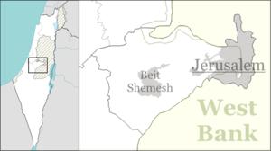
| District | Jerusalem |
| Council | Mateh Yehuda |
| Affiliation | Moshavim Movement |
| Founded | 1950 |
| Founded by | Yemenite Jews |
| Population (2015)[1] | 897 |
Mata (Hebrew: מַטָּע, lit. Grove) is a moshav in central Israel. Located in the Jerusalem corridor near Beit Shemesh, it falls under the jurisdiction of Mateh Yehuda Regional Council. In 2015 it had a population of 897.
Etymology
"The name mata is also hinted at in Ezekiel (XXXIV, 29)":[2] I will provide for them a grove.
History
The village was established in 1950 by immigrants from Yemen on land which had formerly belonged to the depopulated Arab village of Allar. After two Yemenite Jews were murdered by local Arabs, the Yemenite community eventually moved to more populated areas of Petah Tikva and Karkur. The founders were later joined by more immigrants from Morocco. Tobacco was once grown there by the early residents, but this has been replaced by grape vineyards.
Archaeology
Along the old Roman Road (now regional highway 375) are the ruins of a travelers' inn and livery stable, now called "khanut" (formerly, Khirbet el-Khan).[3]
In the 12th century, a rural monastery was established there by the Crusaders consisting of several barrel-vaulted buildings, an enclosure wall and a chapel.[4] British archaeologist Denys Pringle proposed that the complex was a Cistercian house called "Saluatio" established in 1169.[5]
A mosaic floor with Greek writing of a Byzantine church can still be seen in the remains of the structure. In the valley are various types of trees: Sweet and bitter almonds, olives, grapes, pomegranates, lemons, figs, walnuts, Syrian pears, carobs and hawthorns. To the south-east of the moshav is a natural spring called `Ain Jerash named after a nearby small Arab village (now abandoned) and which was built on a spur near the town of Tzur Hadassah (Har Kitron). Rock-carved niches used as tombs can still be seen in the abandoned village.
Landmarks
To the east of the moshav is Wadi Tannur, a riverine gulch with two natural springs - Ein Mata (Spring of the Orchard) and Ein Tanur.
At the foot of Ein Tannur ("Oven Spring") is an ancient tunnel dug deeply to catch the water at the source and increase its flow - a spring-flow tunnel.[6] According to a local legend, Noah's oven was located here before the flood. When God destroyed the world, Noah's oven began spouting water, proving Noah's great commitment to God. When the flood was over and the water subsided, the oven forgot its original purpose and water continued to flow from it. When Noah passed by in his ark, he only saw the spring rather than his oven, so he continued his journey and finally landed on Mount Ararat.[7]
References
- ↑ "List of localities, in Alphabetical order" (PDF). Israel Central Bureau of Statistics. Retrieved 16 October 2016.
- ↑ Place Names in Israel. A Compendium of Place Names in Israel compiled from various sources. Translated from Hebrew, Jerusalem 1962 (Israel Prime Minister’s Office. The Israeli Program for Scientific Translations) p111
- ↑ See Palestine Exploration Fund Map: Jerusalem (Sheet XVII), the ruin of Khurbet el-Khan), Survey of Western Palestine, 1878 Map, Map 17: IAA, Wikimedia commons, as surveyed and drawn under the direction of Lieut. C.R. Conder and H.H. Kitchener, May 1878.
- ↑ Crusader Archaeology: The Material Culture of the Latin East, Adrian J. Boas
- ↑ Pringle, 1993, pp. 47 –51
- ↑ Ein Mata, Horbat Hanut and Shevil HaKeisar
- ↑ The oven that became a spring
| Wikimedia Commons has media related to Mata, Israel. |