Agur, Israel
| Agur עגור | |
|---|---|
 | |
 Agur | |
| Coordinates: 31°41′54.83″N 34°54′38.71″E / 31.6985639°N 34.9107528°ECoordinates: 31°41′54.83″N 34°54′38.71″E / 31.6985639°N 34.9107528°E | |
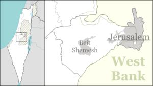
| District | Jerusalem |
| Council | Mateh Yehuda |
| Affiliation | Moshavim Movement |
| Founded | 1950 |
| Founded by | Kurdish Jews |
| Population (2015)[1] | 521 |
| Name meaning | Crane |
Agur (Hebrew: עָגוּר, lit. Crane) is a moshav in central Israel. Located near Beit Shemesh, it falls under the jurisdiction of Mateh Yehuda Regional Council. In 2015 it had a population of 521.
The village was established in 1950 by Kurdish Jews fleeing the village of Çukurca in Hakkari mountains which before WWI was mostly Jewish populated.[2] It is named for the Arab village of Ajjur, which was captured in October 1948 by the Fourth Battalion of the Giv'ati Brigade as part of Operation Yoav, and on whose land Agur stands.[3]
Agur winery produces wine from four blends – blanca, rose, kessem, and special reserve. Grapes from each vineyard in the Judean Mountains are fermented separately before being blended.[4]The owner and founder of the winery is Shuki Yashuv.[5]
References
- ↑ "List of localities, in Alphabetical order" (PDF). Israel Central Bureau of Statistics. Retrieved 16 October 2016.
- ↑ Agur Winery Archived March 10, 2013, at the Wayback Machine.
- ↑ Khalidi, Walid (1992). All That Remains: The Palestinian Villages Occupied and Depopulated by Israel in 1948. Washington D.C.: Institute for Palestine Studies. p. 207. ISBN 0-88728-224-5.
- ↑ L'Chaim - To Life
- ↑ The Judean Hills' secret Jewel, Jerusalem Post