Manatee River
| Manatee River | |
|---|---|
|
Map of Manatee river in central Florida | |
| Basin | |
| Main source | Northeast Manatee County, Florida |
| River mouth | Tampa Bay |
| Basin size | 360 square miles (930 km2) |
| Physical characteristics | |
| Length | 36 miles (58 km) |

The Manatee River is a 36-mile-long (58 km)[1] river in Manatee County, Florida.[2] The river forms in the northeastern corner of Manatee County and flows into the Gulf of Mexico at the southern edge of Tampa Bay.
Wildlife in and around the river includes alligators, herons, manatees, dolphins, and fish such as bass, bluegill, catfish, and gar. Bull sharks are occasionally found in the brackish water near its low-lying outlet. The river includes the Upper Manatee River Canoe Trail for paddlers.
Overview
The Manatee River has a watershed that is approximately 360 square miles (930 km2).[3] Lake Manatee, an artificial reservoir, is located about midway in the river's course. The lower part of the river below the dam is an estuary, with Bradenton and smaller settlements located along its banks. The river's main tributary is the Braden River, which runs through the communities of River Club and Lakewood Ranch.
Watershed
The Manatee River watershed lies in the Tampa Bay sector of Manatee County. The watershed covers approximately 360 sq mi (932.4 km2).[3] The Manatee River headwaters flow 45 mi (72.4 km) in a westerly direction towards the Gulf of Mexico and southern Tampa Bay.[3] Two major river systems make up the Manatee River Watershed — Braden River and Manatee River. These two rivers have been impounded to create two reservoirs for potable supply — Ward Lake (also known as Bill Evers Reservoir) and Lake Manatee Reservoir.[4] Ward Lake is located upstream on the narrow, winding Braden River. This reservoir, built in the 1930s, covers 255 acres and is responsible for the majority of the water for the city of Bradenton.[5] The Lake Manatee Reservoir is located upstream on the Manatee River. This reservoir, built in 1967, is a 1,174 acre artificial reservoir used as Manatee County’s primary water supply.[3][6]
The Manatee River Watershed has three different physiographic locations: plains, lowlands, and uplands.[4] These locations cause the river to contain areas that are as varied as hardwood swamps, mesic flatwoods, coastal lowlands, and marshes.[3] The highlands include areas with scattered bushes, pine trees, and oak trees. The soil in the highlands tends to be moderately well drained.[7] The marshes and swamps have very poorly drained soil and tend to have water-tolerant grasses. The uplands consist of flatwoods which have poorly drained soils. These areas contain saw palmettos and slash pines.[7]
Wildlife
Wildlife that can be found within the river itself include manatees, alligators, and various types of fish. Since Manatee River Estuary is widely used for commercial fishing many regulations apply. Everything from fin fish and invertebrates to bait and food shrimp are harvested for commercial fishing, therefore, many commercial fishing regulations apply.[8] As the name would suggest, there are also many manatees found within the river. These mammals prefer warm water so they move throughout the river towards the warmest areas depending on the season.
Around the Manatee River many birds can be found, some, such as the wood stork, considered endangered species. A few of the birds are considered threatened such as the snowy plover, bald eagle, Florida scrub-jay, and peregrine falcon. Other common birds that can be seen around the Manatee River include cattle egret, white ibis, great blue heron, and yellow-crowned night heron.[9]
Human impact
Human development has a great impact on the environment of the Manatee River and its watershed. With the increased development of the area surrounding the Manatee River, the water quality within the River has decreased. The use of organic pesticides is a rising fear in the ecological communities. The uprooting of the forested wetlands and uplands has caused excess nutrients to build up in the Bill Evers Reservoir. Also, in both reservoirs there have been increased levels of lead, zinc, and copper.[3]
References
- ↑ U.S. Geological Survey. National Hydrography Dataset high-resolution flowline data. The National Map, accessed April 18, 2011
- ↑ Peterson, Lindsay. 1990. Manatee River. in Marth, Del and Marty Marth, eds. The Rivers of Florida. Sarasota, Florida: Pineapple Press, Inc. ISBN 0-910923-70-1.
- 1 2 3 4 5 6 Manatee River Watershed. 2011. Florida Department of Environmental Protection, Water Resource Management and Environmental Assessment and Restoration, Florida, USA.
- 1 2 SWFWMD. 2001. Manatee River Comprehensive Watershed Management Plan, April 26, 2001
- ↑ Ward Lake on Manatee County wateratlas website
- ↑ Lake Manatee on Manatee County wateratlas website
- 1 2 SWFWMD. 1988. Water management Lands Trust Funds-Save Our Rivers/Preservation 2000 1998 Five-Year Plan. Brooksville, Florida
- ↑ Commercial and Recreational Fisheries. 2010. Florida Fish and Wildlife Conservation Commission, Tallahassee, Florida, USA
- ↑ Audubon Christmas Bird Count. 2011. National Audubon Society, Florida, USA
Municipalities and communities of Manatee County, Florida, United States | ||
|---|---|---|
| Cities | 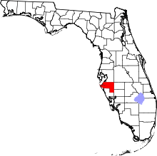 | |
| Town | ||
| CDPs | ||
| Unincorporated communities | ||
| Ghost town | ||
| Footnotes | ‡This populated place also has portions in an adjacent county or counties | |
Coordinates: 27°31′51″N 82°39′12″W / 27.5308703°N 82.6534319°W