Madaj, Maharashtra
| Madaj Mathmal | |
|---|---|
| village | |
 Madaj  Madaj Location in Maharashtra, India | |
| Coordinates: 17°55′39″N 076°37′16″E / 17.92750°N 76.62111°ECoordinates: 17°55′39″N 076°37′16″E / 17.92750°N 76.62111°E | |
| Country |
|
| State | Maharashtra |
| District | Osmanabad |
| Tahsil | Umarga |
| Government | |
| • Body | Village panchayat |
| Population (2001) | |
| • Total | 5,113 |
| Languages | |
| • Official | Marathi |
| Time zone | IST (UTC+5:30) |
| Telephone code | 02475 |
| Lok Sabha constituency | Osmanabad |
| Vidhan Sabha constituency | Umarga[1] |
Madaj is a panchayat village[2] in the state of Maharashtra, India.[3][4] Administratively, Madaj is under Umarga Tahsil of Osmanabad District in Maharashtra.[4] There is only the single village of Madaj in the Madaj gram panchayat.[4] The village of Madaj is 17 km by road north of the town of Umarga and 20 km by road southeast of the village of Sastur.
Demographics
In the 2001 census, the village of Madaj had 5,113 inhabitants, with 2,667 males (52.2%) and 2,446 females (47.8%), for a gender ratio of 917 females per thousand males.[5]
In the 2011 census, the village of Madaj reported 2,888 inhabitants.[6] No explanation has been found for the large reduction in reported population.
Temples
Madaj is an old village with several temples. These include:
- Shri Premnath Maharaj is a temple and religious place dedicated to the saint Premnath Maharaj, who was one of the disciples of Nounath. Premnath Maharaj achieved his samadhi here. Every year an annual yatra (pilgrimage fair) is held in the month of November, and people come to Madaj and the temple in large numbers to take darshan during the yatra.
- The Shri Narayana Temple is a hemadpanthi style temple with carvings in the stone.
- shri vaijnath maharaj temple is also one of the beuti of madaj.at the center of town in the lake temple is located.
Notes
- ↑ "Assembly Constituencies-Post delimitation: Maharashtra: Osmanabad District" (PDF). National Informatics Centre, Government of India.
- ↑ 2011 Village Panchayat Code for Madaj = 186073, "Reports of National Panchayat Directory: Village Panchayat Names of Omerga, Osmanabad, Maharashtra". Ministry of Panchayati Raj, Government of India.
- ↑ 2001 Census Village code for Madaj = 03651600, "2001 Census of India: List of Villages by Tehsil: Maharashtra" (PDF). Registrar General & Census Commissioner, India. p. 708. Archived (PDF) from the original on 13 November 2012.
- 1 2 3 2011 Census Village code for Madaj = 561691, "Reports of National Panchayat Directory: List of Census Villages mapped for: Madaj Gram Panchayat, Omerga, Osmanabad, Maharashtra". Ministry of Panchayati Raj, Government of India.
- ↑ "Census 2001 Population Finder: Maharashtra: Osmanabad: Umarga: Madaj". Office of The Registrar General & Census Commissioner, Ministry of Home Affairs, Government of India.
- ↑ "NPR Report: Maharashtra: Osmanabad: Umarga". National Population Register, Ministry of Home Affairs, Government of India. 2011.
External links
- "Official Website of Osmanabad District".
- "Photo:Shri Premnath Maharaj Temple". jitendradmane at Wikimapia.
Osmanabad district topics | ||
|---|---|---|
| History | 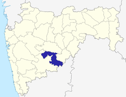 | |
| Cities and towns | ||
| Monuments | ||
| Lok Sabha constituencies | ||
| Vidhan Sabha constituencies | ||