Lysite, Wyoming
| Lysite, Wyoming | |
|---|---|
| Unincorporated community | |
 Lysite  Lysite Location within the state of Wyoming | |
| Coordinates: 43°16′5″N 107°41′25″W / 43.26806°N 107.69028°WCoordinates: 43°16′5″N 107°41′25″W / 43.26806°N 107.69028°W | |
| Country | United States |
| State | Wyoming |
| County | Fremont |
| Elevation | 5,276 ft (1,608 m) |
| Time zone | Mountain (MST) (UTC-7) |
| • Summer (DST) | MDT (UTC-6) |
| ZIP codes | 82642 |
| Area code(s) | 307 |
| GNIS feature ID | 1609118[1] |
Lysite (also Lysaght) is an unincorporated community in northeastern Fremont County, Wyoming, United States. It lies along local roads northeast of the city of Lander, the county seat of Fremont County.[2] Its elevation is 5,276 feet (1,608 m).[1] Although Lysite is unincorporated, it has a post office, with the ZIP code of 82642.[3] The Bridger Trail passed near Lysite on its way north to the gold fields of Montana in the 19th century.
Public education in the community of Lysite is provided by Fremont County School District #24. The district has three campuses – Shoshoni Elementary School (grades PK-6), Shoshoni Junior High School (grades 7-8) and Shoshoni High School (grades 9-12).
Lysite is home to the J.B. Oakley mansion, as well as the dollhouse. It has an old one room schoolhouse, library, and a general store. It also plays host to a very diverse culture. Most of the residents run cows and horses, and most residents have some background in Agriculture. Every summer the locals host the gymkhanas, which is a series of mini rodeos. On Labor Day, Lysite hosts a large rodeo, including a night of Ranch Rodeo.
It also has the Natural Gas Plant, owned and operated by encanta.
References
- 1 2 "Lysite, Wyoming". Geographic Names Information System. United States Geological Survey.
- ↑ Rand McNally. The Road Atlas '08. Chicago: Rand McNally, 2008, p. 116.
- ↑ Zip Code Lookup
Municipalities and communities of Fremont County, Wyoming, United States | ||
|---|---|---|
| Cities | 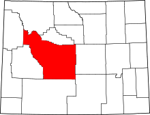 | |
| Towns | ||
| CDPs | ||
| Unincorporated communities | ||
| Ghost town | ||
| Indian reservation | ||