Loxahatchee Groves, Florida
| Loxahatchee Groves, Florida | |
|---|---|
| Motto: Florida's Last Frontier | |
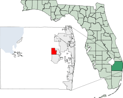 Location in Palm Beach County and the state of Florida | |
| Coordinates: 26°41′01″N 80°16′47″W / 26.68361°N 80.27972°W | |
| Country |
|
| State |
|
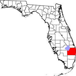
| County | Palm Beach |
| Settled | 1917 |
| Incorporated | November 1, 2006 |
| Area | |
| • Total | 12.5 sq mi (32 km2) |
| Elevation | 10 ft (3.0 m) |
| Population | |
| • Total | approx. 3,000 |
| Time zone | Eastern (EST) (UTC-5) |
| • Summer (DST) | EDT (UTC-4) |
| ZIP codes | 33470 |
| Area code(s) | 561 |
| GNIS feature ID | 294872[1] |
Loxahatchee Groves is a town in Palm Beach County, Florida, United States.
The town was incorporated November 1, 2006 as the 38th municipality in Palm Beach County. The first election for town council members was held on March 13, 2007.[2]
Loxahatchee Groves is bounded on the east by Royal Palm Beach, on the south by Wellington and on the west and north by The Acreage. It has an area of approximately 12.5 square miles (32.4 km2).
As of the census of 2010, there were 3,180 people residing in the village. The racial makeup of the village was 74.25% white, 4.21% African American and 18.7% Hispanic or Latino.
Demographics
| Historical population | |||
|---|---|---|---|
| Census | Pop. | %± | |
| 2010 | 3,180 | — | |
| Est. 2015 | 3,397 | [3] | 6.8% |
References
- ↑ "US Board on Geographic Names". United States Geological Survey. 2007-10-25. Retrieved 2008-01-31.
- ↑ Hood, Joel. (2007) "Loxahatchee fills first council seats with annexation supporters". South Florida Sun-Sentinel. March 14, 2007.
- ↑ "Annual Estimates of the Resident Population for Incorporated Places: April 1, 2010 to July 1, 2015". Retrieved July 2, 2016.
- ↑ "Census of Population and Housing". Census.gov. Retrieved June 4, 2015.
External links
- Official website
- Loxahatchee Groves - A private website with information on the town.
Coordinates: 26°41′01″N 80°16′47″W / 26.68361°N 80.27972°W
This article is issued from Wikipedia - version of the 9/19/2016. The text is available under the Creative Commons Attribution/Share Alike but additional terms may apply for the media files.