Loman, Minnesota
| Loman, Minnesota | |
|---|---|
| Unincorporated community | |
 Loman, Minnesota  Loman, Minnesota Location of the community of Loman | |
| Coordinates: 48°30′46″N 93°48′11″W / 48.51278°N 93.80306°WCoordinates: 48°30′46″N 93°48′11″W / 48.51278°N 93.80306°W | |
| Country | United States |
| State | Minnesota |
| County | Koochiching |
| Elevation | 1,096 ft (334 m) |
| Time zone | Central (CST) (UTC-6) |
| • Summer (DST) | CDT (UTC-5) |
| ZIP code | 56654 |
| Area code(s) | 218 |
| GNIS feature ID | 647004[1] |
Loman is an unincorporated community in Koochiching County, Minnesota, United States.
The community is located between International Falls and Baudette at the intersection of State Highway 11 (MN 11) and County Road 32 (Black River Road). Loman is located within Northwest Koochiching Unorganized Territory.
The Rainy River and the Black River meet at Loman. Nearby places include Indus, Pelland, and Littlefork.
Loman is located 21 miles west–southwest of International Falls; and 47 miles east–southeast of Baudette.
History
Loman was named after the George and Mary Loman Family.
References
- Rand McNally Road Atlas – 2007 edition – Minnesota entry
- Official State of Minnesota Highway Map – 2011/2012 edition
- Mn/DOT map of Koochiching County – Sheet 3 – 2011 edition
Municipalities and communities of Koochiching County, Minnesota, United States | ||
|---|---|---|
| Cities | 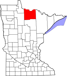 | |
| Unorganized territories | ||
| Unincorporated communities | ||
| Indian reservations | ||
| Ghost towns | ||
| Footnotes | ‡This populated place also has portions in an adjacent county or counties | |
This article is issued from Wikipedia - version of the 10/26/2016. The text is available under the Creative Commons Attribution/Share Alike but additional terms may apply for the media files.