Forest Grove, Minnesota
| Forest Grove, Minnesota | |
|---|---|
| Unincorporated community | |
 Forest Grove, Minnesota  Forest Grove, Minnesota Location of the community of Forest Grove | |
| Coordinates: 47°58′36″N 94°13′53″W / 47.97667°N 94.23139°WCoordinates: 47°58′36″N 94°13′53″W / 47.97667°N 94.23139°W | |
| Country | United States |
| State | Minnesota |
| County | Koochiching |
| Elevation | 1,365 ft (416 m) |
| Time zone | Central (CST) (UTC-6) |
| • Summer (DST) | CDT (UTC-5) |
| ZIP code | 56660 |
| Area code(s) | 218 |
| GNIS feature ID | 656295[1] |
Forest Grove is an unincorporated community in Koochiching County, Minnesota, United States; located within the Pine Island State Forest. The community is located north of Mizpah; and west of Gemmell; along Koochiching County Road 17 (CR 17).
U.S. Highway 71 and County Road 36 are also nearby. The center of Forest Grove is generally considered at the intersection of County Roads 17, 58, and 150.
Forest Grove is located within ZIP code 56660 based in Mizpah.
Geography
Forest Grove is located within Northome Unorganized Territory. Nearby places include Mizpah, Northome, Gemmell, and Kelliher. Forest Grove is located 4 miles north of Mizpah. Forest Grove is 9 miles north of Northome; and 69 miles southwest of International Falls.
The former township of Forest Grove, which was dissolved in 1950, had been located in the same vicinity as the community of Forest Grove.
References
- Mn/DOT map of Koochiching County – Sheet 1 – 2011 edition
Municipalities and communities of Koochiching County, Minnesota, United States | ||
|---|---|---|
| Cities | 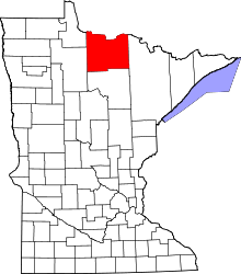 | |
| Unorganized territories | ||
| Unincorporated communities | ||
| Indian reservations | ||
| Ghost towns | ||
| Footnotes | ‡This populated place also has portions in an adjacent county or counties | |