Little Nicobar
| Native name: छोटा निकोबार | |
|---|---|
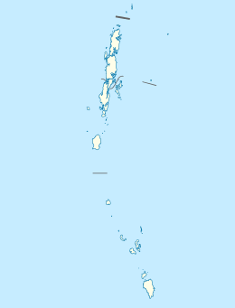 Little Nicobar Location of Little Nicobar Island in the Andaman and Nicobar Islands | |
| Geography | |
| Location | Bay of Bengal |
| Coordinates | 7°20′N 93°41′E / 7.33°N 93.68°ECoordinates: 7°20′N 93°41′E / 7.33°N 93.68°E |
| Archipelago | Nicobar Islands |
| Adjacent bodies of water | Indian Ocean |
| Total islands | 1 |
| Major islands |
|
| Area | 140 km2 (54 sq mi)[1] |
| Length | 24 km (14.9 mi) |
| Width | 12 km (7.5 mi) |
| Coastline | 71.6 km (44.49 mi) |
| Highest elevation | 435 m (1,427 ft) |
| Highest point | Mount Deoban |
| Administration | |
| District | Nicobar |
| Island group | Nicobar Islands |
| Subdivisions of India | Great Nicobar Subdivision |
| Taluk | Little Nicobar |
Largest settlement |
Puloulo (population 81) |
| Demographics | |
| Demonym | Hindi |
| Population | 278 (2014) |
| Pop. density | 2 /km2 (5 /sq mi) |
| Ethnic groups | Hindu, Nicobarese |
| Additional information | |
| Time zone | |
| PIN | 744301 |
| Telephone code | 03192 |
| Official website |
www |
| ISO Code | IN-AN-00[2] |
| Literacy | 84.4% |
| Avg. summer temperature | 32.0 °C (89.6 °F) |
| Avg. winter temperature | 28.0 °C (82.4 °F) |
| Sex ratio | ♂/♀ |
| unit_pref | Metric |
| Census Code | 35.638.0002 |
| Official Languages |
Hindi, English, Tamil Car (regional) |
Little Nicobar (Nicobarese: Ong) is one of the Nicobar Islands, India.
History
The 2004 Indian Ocean earthquake and tsunami caused extensive damage to this island.
Geography
Little Nicobar Island's area is 140 km2 (54 sq mi). There are a few smaller islands of Little Nicobar's shores: Menchal, Pulomilo, Treis/Albatei, Trak/Mafuya and Meroe. The island of Katchal is located 56 km (35 mi) to the north.
Demographics
According to the 2011 census of India, Little Nicobar Island has 278 villagers in 59 households. The effective literacy rate (i.e. the literacy rate of population excluding children aged 6 and below) is 100%. Pulopanja, Puloulo, and Makhahu (Victoria Harbour) are the main villages on the island.
Administration
The island belongs to the township of Great Nicobar of Little Nicobar Taluk.[3]
Image gallery
 Map
Map Map 2
Map 2
References
- ↑ "Islandwise Area and Population - 2011 Census" (PDF). Government of Andaman.
- ↑ Registration Plate Numbers added to ISO Code
- ↑ Tehsils
| Wikimedia Commons has media related to Little Nicobar. |
 Andaman and Nicobar Islands travel guide from Wikivoyage