List of United Kingdom locations: Pab-Pap

The United Kingdom

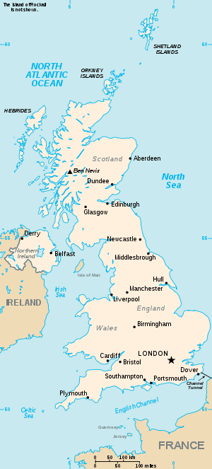
This is part of the list of United Kingdom locations: a gazetteer of place names in the United Kingdom showing each place's locality and geographical coordinates.

Pa

Location Locality Coordinates
(links to map & photo sources)
OS grid
reference
Pabail Iarach Western Isles 58°11′N 6°14′W / 58.19°N 06.23°W / 58.19; -06.23 NB5131
Pabay Highland 57°16′N 5°51′W / 57.27°N 05.85°W / 57.27; -05.85 NG677270
Pabay Mòr Western Isles 58°14′N 6°56′W / 58.23°N 06.94°W / 58.23; -06.94 NB101380
Pabbay Western Isles 57°09′N 7°19′W / 57.15°N 07.32°W / 57.15; -07.32 NF781196
Pabbay Western Isles 57°46′N 7°14′W / 57.77°N 07.23°W / 57.77; -07.23 NF892878
Pabbay Western Isles 56°51′N 7°34′W / 56.85°N 07.57°W / 56.85; -07.57 NL602876
Pabo Conwy 53°17′N 3°48′W / 53.28°N 03.80°W / 53.28; -03.80 SH8078

Pac

Location Locality Coordinates
(links to map & photo sources)
OS grid
reference
Pachesham Park Surrey 51°19′N 0°20′W / 51.31°N 00.33°W / 51.31; -00.33 TQ1659
Pacific Heights Cheshire 53°16′N 2°53′W / 53.26°N 02.88°W / 53.26; -02.88 SJ4175
Packers Hill Dorset 50°53′N 2°25′W / 50.88°N 02.41°W / 50.88; -02.41 ST7110
Packington Leicestershire 52°43′N 1°28′W / 52.72°N 01.46°W / 52.72; -01.46 SK3614
Packmoor City of Stoke-on-Trent 53°05′N 2°13′W / 53.08°N 02.21°W / 53.08; -02.21 SJ8654
Packmores Warwickshire 52°17′N 1°35′W / 52.28°N 01.59°W / 52.28; -01.59 SP2865
Packwood Warwickshire 52°21′N 1°45′W / 52.35°N 01.75°W / 52.35; -01.75 SP1773
Packwood Gullet Warwickshire 52°22′N 1°46′W / 52.36°N 01.76°W / 52.36; -01.76 SP1674

Pad

Location Locality Coordinates
(links to map & photo sources)
OS grid
reference
Padnaram Angus 56°38′N 2°56′W / 56.64°N 02.94°W / 56.64; -02.94 NO4251
Padbury Buckinghamshire 51°58′N 0°57′W / 51.96°N 00.95°W / 51.96; -00.95 SP7230
Paddington City of Westminster 51°31′N 0°11′W / 51.51°N 00.18°W / 51.51; -00.18 TQ2681
Paddington Cheshire 53°23′N 2°33′W / 53.39°N 02.55°W / 53.39; -02.55 SJ6389
Paddlesworth Kent 51°06′N 1°07′E / 51.10°N 01.12°E / 51.10; 01.12 TR1939
Paddlesworth Kent 51°20′N 0°25′E / 51.33°N 00.41°E / 51.33; 00.41 TQ6862
Paddock Kent 51°13′N 0°50′E / 51.21°N 00.84°E / 51.21; 00.84 TQ9950
Paddock Kirklees 53°38′N 1°49′W / 53.64°N 01.81°W / 53.64; -01.81 SE1216
Paddockhaugh Moray 57°36′N 3°20′W / 57.60°N 03.34°W / 57.60; -03.34 NJ2058
Paddockhill Cheshire 53°18′N 2°17′W / 53.30°N 02.28°W / 53.30; -02.28 SJ8179
Paddock Wood Kent 51°10′N 0°23′E / 51.17°N 00.38°E / 51.17; 00.38 TQ6744
Paddolgreen Shropshire 52°53′N 2°44′W / 52.88°N 02.74°W / 52.88; -02.74 SJ5032
Padfield Derbyshire 53°28′N 1°58′W / 53.46°N 01.97°W / 53.46; -01.97 SK0296
Padgate Cheshire 53°24′N 2°33′W / 53.40°N 02.55°W / 53.40; -02.55 SJ6390
Padham's Green Essex 51°38′N 0°22′E / 51.64°N 00.36°E / 51.64; 00.36 TQ6497
Padiham Lancashire 53°47′N 2°19′W / 53.79°N 02.32°W / 53.79; -02.32 SD7933
Padog Conwy 53°02′N 3°44′W / 53.04°N 03.73°W / 53.04; -03.73 SH8451
Padside North Yorkshire 54°01′N 1°45′W / 54.02°N 01.75°W / 54.02; -01.75 SE1659
Padside Green North Yorkshire 54°01′N 1°45′W / 54.02°N 01.75°W / 54.02; -01.75 SE1659
Padson Devon 50°45′N 4°02′W / 50.75°N 04.04°W / 50.75; -04.04 SX5697
Padstow Cornwall 50°32′N 4°57′W / 50.53°N 04.95°W / 50.53; -04.95 SW9175
Padworth Berkshire 51°23′N 1°07′W / 51.38°N 01.11°W / 51.38; -01.11 SU6266
Padworth Common Hampshire 51°22′N 1°07′W / 51.37°N 01.11°W / 51.37; -01.11 SU6264

Pag

Location Locality Coordinates
(links to map & photo sources)
OS grid
reference
Paganhill Gloucestershire 51°44′N 2°14′W / 51.74°N 02.23°W / 51.74; -02.23 SO8405
Page Bank Durham 54°43′N 1°38′W / 54.71°N 01.64°W / 54.71; -01.64 NZ2335
Page Moss Knowsley 53°25′N 2°52′W / 53.41°N 02.87°W / 53.41; -02.87 SJ4291
Page's Green Suffolk 52°14′N 1°08′E / 52.24°N 01.13°E / 52.24; 01.13 TM1465
Pagham West Sussex 50°46′N 0°45′W / 50.76°N 00.75°W / 50.76; -00.75 SZ8897
Paglesham Churchend Essex 51°36′N 0°46′E / 51.60°N 00.77°E / 51.60; 00.77 TQ9293
Paglesham Eastend Essex 51°35′N 0°47′E / 51.59°N 00.79°E / 51.59; 00.79 TQ9492

Pai

Location Locality Coordinates
(links to map & photo sources)
OS grid
reference
Paignton Devon 50°25′N 3°34′W / 50.42°N 03.56°W / 50.42; -03.56 SX8960
Pailton Warwickshire 52°25′N 1°19′W / 52.42°N 01.31°W / 52.42; -01.31 SP4781
Painleyhill Staffordshire 52°53′N 1°57′W / 52.89°N 01.95°W / 52.89; -01.95 SK0333
Painscastle Powys 52°06′N 3°13′W / 52.10°N 03.22°W / 52.10; -03.22 SO1646
Painshawfield Northumberland 54°56′N 1°54′W / 54.93°N 01.90°W / 54.93; -01.90 NZ0660
Pains Hill Surrey 51°14′N 0°01′E / 51.24°N 00.01°E / 51.24; 00.01 TQ4151
Painsthorpe East Riding of Yorkshire 54°01′N 0°46′W / 54.01°N 00.76°W / 54.01; -00.76 SE8158
Painswick Gloucestershire 51°46′N 2°12′W / 51.77°N 02.20°W / 51.77; -02.20 SO8609
Painter's Forstal Kent 51°17′N 0°51′E / 51.28°N 00.85°E / 51.28; 00.85 TQ9958
Painter's Green Hertfordshire 51°50′N 0°09′W / 51.84°N 00.15°W / 51.84; -00.15 TL2718
Painters Green Wrexham 52°57′N 2°44′W / 52.95°N 02.74°W / 52.95; -02.74 SJ5040
Painthorpe Wakefield 53°38′N 1°32′W / 53.63°N 01.53°W / 53.63; -01.53 SE3115
Paintmoor Somerset 50°52′N 2°56′W / 50.87°N 02.93°W / 50.87; -02.93 ST3409
Pairc Western Isles 58°01′N 6°32′W / 58.01°N 06.54°W / 58.01; -06.54 NB315119
Pairc Shiaboist Western Isles 58°19′N 6°41′W / 58.31°N 06.68°W / 58.31; -06.68 NB2646
Paisley Renfrewshire 55°50′N 4°25′W / 55.83°N 04.42°W / 55.83; -04.42 NS4863

Pak

Location Locality Coordinates
(links to map & photo sources)
OS grid
reference
Pakefield Suffolk 52°26′N 1°42′E / 52.44°N 01.70°E / 52.44; 01.70 TM5289
Pakefield Suffolk 52°26′N 1°43′E / 52.44°N 01.72°E / 52.44; 01.72 TM5390
Pakenham Suffolk 52°16′N 0°49′E / 52.26°N 00.81°E / 52.26; 00.81 TL9267

Pal

Location Locality Coordinates
(links to map & photo sources)
OS grid
reference
Palacefields Cheshire 53°19′N 2°41′W / 53.31°N 02.69°W / 53.31; -02.69 SJ5480
Pale Green Essex 52°03′N 0°24′E / 52.05°N 00.40°E / 52.05; 00.40 TL6542
Palehouse Common East Sussex 50°56′N 0°07′E / 50.94°N 00.11°E / 50.94; 00.11 TQ4918
Palestine Hampshire 51°09′N 1°37′W / 51.15°N 01.62°W / 51.15; -01.62 SU2640
Paley Street Berkshire 51°28′N 0°46′W / 51.47°N 00.76°W / 51.47; -00.76 SU8676
Palfrey Walsall 52°34′N 1°59′W / 52.57°N 01.98°W / 52.57; -01.98 SP0197
Palgrave Suffolk 52°21′N 1°05′E / 52.35°N 01.09°E / 52.35; 01.09 TM1178
Pallaflat Cumbria 54°29′N 3°34′W / 54.49°N 03.56°W / 54.49; -03.56 NX9912
Pallington Dorset 50°43′N 2°19′W / 50.71°N 02.31°W / 50.71; -02.31 SY7891
Pallion Sunderland 54°54′N 1°25′W / 54.90°N 01.42°W / 54.90; -01.42 NZ3757
Pallister Middlesbrough 54°34′N 1°13′W / 54.56°N 01.21°W / 54.56; -01.21 NZ5119
Palmarsh Kent 51°03′N 1°02′E / 51.05°N 01.03°E / 51.05; 01.03 TR1333
Palmer Moor Derbyshire 52°53′N 1°48′W / 52.89°N 01.80°W / 52.89; -01.80 SK1333
Palmersbridge Cornwall 50°34′N 4°33′W / 50.56°N 04.55°W / 50.56; -04.55 SX1977
Palmers Cross Surrey 51°09′N 0°32′W / 51.15°N 00.54°W / 51.15; -00.54 TQ0240
Palmers Cross Staffordshire 52°36′N 2°10′W / 52.60°N 02.17°W / 52.60; -02.17 SJ8801
Palmer's Flat Gloucestershire 51°46′N 2°37′W / 51.77°N 02.61°W / 51.77; -02.61 SO5809
Palmer's Green Kent 51°08′N 0°24′E / 51.14°N 00.40°E / 51.14; 00.40 TQ6841
Palmers Green Enfield 51°37′N 0°07′W / 51.62°N 00.12°W / 51.62; -00.12 TQ3093
Palmerstown The Vale Of Glamorgan 51°25′N 3°15′W / 51.41°N 03.25°W / 51.41; -03.25 ST1369
Palmersville North Tyneside 55°01′N 1°32′W / 55.02°N 01.54°W / 55.02; -01.54 NZ2970
Palmstead Kent 51°11′N 1°05′E / 51.18°N 01.08°E / 51.18; 01.08 TR1647
Palnackie Dumfries and Galloway 54°53′N 3°50′W / 54.88°N 03.84°W / 54.88; -03.84 NX8256
Palterton Derbyshire 53°12′N 1°17′W / 53.20°N 01.29°W / 53.20; -01.29 SK4768

Pam

Location Locality Coordinates
(links to map & photo sources)
OS grid
reference
Pamber End Hampshire 51°19′N 1°07′W / 51.31°N 01.12°W / 51.31; -01.12 SU6158
Pamber Green Hampshire 51°19′N 1°08′W / 51.32°N 01.14°W / 51.32; -01.14 SU6059
Pamber Heath Hampshire 51°21′N 1°07′W / 51.35°N 01.12°W / 51.35; -01.12 SU6162
Pamington Gloucestershire 51°59′N 2°05′W / 51.99°N 02.08°W / 51.99; -02.08 SO9433
Pamphill Dorset 50°47′N 2°01′W / 50.79°N 02.01°W / 50.79; -02.01 ST9900
Pampisford Cambridgeshire 52°07′N 0°10′E / 52.11°N 00.17°E / 52.11; 00.17 TL4948

Pan

Location Locality Coordinates
(links to map & photo sources)
OS grid
reference
Pan Isle of Wight 50°41′N 1°17′W / 50.68°N 01.29°W / 50.68; -01.29 SZ5088
Panborough Somerset 51°12′N 2°46′W / 51.20°N 02.76°W / 51.20; -02.76 ST4745
Panbride Angus 56°30′N 2°42′W / 56.50°N 02.70°W / 56.50; -02.70 NO5735
Pancakehill Gloucestershire 51°47′N 1°55′W / 51.79°N 01.91°W / 51.79; -01.91 SP0611
Pancrasweek Devon 50°49′N 4°25′W / 50.81°N 04.42°W / 50.81; -04.42 SS2905
Pancross The Vale Of Glamorgan 51°25′N 3°23′W / 51.41°N 03.38°W / 51.41; -03.38 ST0469
Pandeewon Burn North Ayrshire 55°47′N 4°42′W / 55.78°N 04.70°W / 55.78; -04.70 NS306574
Pandy Monmouthshire 51°53′N 2°58′W / 51.89°N 02.97°W / 51.89; -02.97 SO3322
Pandy Wrexham 52°59′N 2°52′W / 52.98°N 02.86°W / 52.98; -02.86 SJ4243
Pandy Gwynedd 52°44′N 3°53′W / 52.73°N 03.89°W / 52.73; -03.89 SH7217
Pandy Powys 52°37′N 3°37′W / 52.62°N 03.62°W / 52.62; -03.62 SH9004
Pandy Wrexham 52°54′N 3°12′W / 52.90°N 03.20°W / 52.90; -03.20 SJ1935
Pandy Gwynedd 52°35′N 4°02′W / 52.59°N 04.03°W / 52.59; -04.03 SH6202
Pandy Gwynedd 52°50′N 3°40′W / 52.84°N 03.67°W / 52.84; -03.67 SH8729
Pandy'r Capel Denbighshire 53°02′N 3°22′W / 53.03°N 03.37°W / 53.03; -03.37 SJ0850
Pandy Tudur Conwy 53°10′N 3°43′W / 53.16°N 03.72°W / 53.16; -03.72 SH8564
Panfield Essex 51°53′N 0°31′E / 51.89°N 00.51°E / 51.89; 00.51 TL7325
Pangbourne Berkshire 51°28′N 1°05′W / 51.47°N 01.09°W / 51.47; -01.09 SU6376
Panhall Fife 56°07′N 3°07′W / 56.11°N 03.12°W / 56.11; -03.12 NT3092
Panks Bridge Herefordshire 52°07′N 2°33′W / 52.12°N 02.55°W / 52.12; -02.55 SO6248
Pannal North Yorkshire 53°57′N 1°32′W / 53.95°N 01.54°W / 53.95; -01.54 SE3051
Pannal Ash North Yorkshire 53°58′N 1°33′W / 53.96°N 01.55°W / 53.96; -01.55 SE2952
Pannel's Ash Essex 52°02′N 0°33′E / 52.04°N 00.55°E / 52.04; 00.55 TL7542
Panpunton Shropshire 52°20′N 3°03′W / 52.34°N 03.05°W / 52.34; -03.05 SO2872
Panshanger Hertfordshire 51°48′N 0°11′W / 51.80°N 00.18°W / 51.80; -00.18 TL2513
Pant Merthyr Tydfil 51°46′N 3°22′W / 51.76°N 03.36°W / 51.76; -03.36 SO0608
Pant Wrexham 52°59′N 3°03′W / 52.99°N 03.05°W / 52.99; -03.05 SJ2945
Pant Wrexham 53°05′N 2°58′W / 53.08°N 02.97°W / 53.08; -02.97 SJ3555
Pant Denbighshire 53°03′N 3°11′W / 53.05°N 03.19°W / 53.05; -03.19 SJ2052
Pant Flintshire 53°15′N 3°18′W / 53.25°N 03.30°W / 53.25; -03.30 SJ1374
Pant Powys 52°35′N 3°24′W / 52.58°N 03.40°W / 52.58; -03.40 SJ0500
Pant Shropshire 52°47′N 3°05′W / 52.79°N 03.08°W / 52.79; -03.08 SJ2722
Pant Gwynedd 52°50′N 4°39′W / 52.84°N 04.65°W / 52.84; -04.65 SH2131
Pantasaph Flintshire 53°16′N 3°16′W / 53.26°N 03.26°W / 53.26; -03.26 SJ1675
Pantdu Neath Port Talbot 51°36′N 3°46′W / 51.60°N 03.77°W / 51.60; -03.77 SS7791
Panteg Ceredigion 52°14′N 4°16′W / 52.23°N 04.27°W / 52.23; -04.27 SN4562
Panteg Torfaen 51°41′N 2°59′W / 51.68°N 02.99°W / 51.68; -02.99 ST3199
Pantersbridge Cornwall 50°29′N 4°36′W / 50.48°N 04.60°W / 50.48; -04.60 SX1568
Pantglas Gwynedd 52°59′N 4°17′W / 52.99°N 04.28°W / 52.99; -04.28 SH4747
Pant-glas Shropshire 52°53′N 3°05′W / 52.88°N 03.08°W / 52.88; -03.08 SJ2732
Pant Mawr Powys 52°25′N 3°42′W / 52.42°N 03.70°W / 52.42; -03.70 SN8482
Pantmawr Cardiff 51°31′N 3°14′W / 51.52°N 03.24°W / 51.52; -03.24 ST1481
Panton Lincolnshire 53°17′N 0°14′W / 53.28°N 00.24°W / 53.28; -00.24 TF1778
Pant-pastynog Denbighshire 53°08′N 3°26′W / 53.13°N 03.43°W / 53.13; -03.43 SJ0461
Pantperthog Gwynedd 52°37′N 3°52′W / 52.61°N 03.86°W / 52.61; -03.86 SH7404
Pantside Caerphilly 51°40′N 3°08′W / 51.66°N 03.14°W / 51.66; -03.14 ST2197
Pant-y-Caws Carmarthenshire 51°54′N 4°42′W / 51.90°N 04.70°W / 51.90; -04.70 SN1426
Pant-y-crug Ceredigion 52°23′N 3°59′W / 52.38°N 03.98°W / 52.38; -03.98 SN6578
Pant-y-dwr Powys 52°21′N 3°29′W / 52.35°N 03.49°W / 52.35; -03.49 SN9874
Pant-y-ffridd Powys 52°36′N 3°15′W / 52.60°N 03.25°W / 52.60; -03.25 SJ1502
Pantyffynnon Swansea 51°46′N 4°00′W / 51.77°N 04.00°W / 51.77; -04.00 SN6210
Pantyffynnon Carmarthenshire 51°50′N 4°11′W / 51.83°N 04.19°W / 51.83; -04.19 SN4917
Pantygasseg Caerphilly 51°41′N 3°05′W / 51.68°N 03.08°W / 51.68; -03.08 ST2599
Pantymwyn Flintshire 53°10′N 3°13′W / 53.16°N 03.21°W / 53.16; -03.21 SJ1964
Pant-y-pyllau Bridgend 51°31′N 3°33′W / 51.52°N 03.55°W / 51.52; -03.55 SS9282
Pant-yr-awel Bridgend 51°34′N 3°33′W / 51.57°N 03.55°W / 51.57; -03.55 SS9287
Pant y Wacco Flintshire 53°16′N 3°17′W / 53.27°N 03.29°W / 53.27; -03.29 SJ1476
Panxworth Norfolk 52°40′N 1°27′E / 52.66°N 01.45°E / 52.66; 01.45 TG3413

Pap

Location Locality Coordinates
(links to map & photo sources)
OS grid
reference
Papa Shetland Islands 60°07′N 1°21′W / 60.12°N 01.35°W / 60.12; -01.35 HU361374
Papa Little Shetland Islands 60°19′N 1°23′W / 60.32°N 01.39°W / 60.32; -01.39 HU335606
Papa Stour Shetland Islands 60°20′N 1°42′W / 60.33°N 01.70°W / 60.33; -01.70 HU162607
Papa Stronsay Orkney Islands 59°09′N 2°35′W / 59.15°N 02.58°W / 59.15; -02.58 HY664297
Papa Westray Orkney Islands 59°21′N 2°53′W / 59.35°N 02.89°W / 59.35; -02.89 HY491523
Papcastle Cumbria 54°40′N 3°23′W / 54.66°N 03.39°W / 54.66; -03.39 NY1031
Papermill Bank Shropshire 52°49′N 2°40′W / 52.82°N 02.66°W / 52.82; -02.66 SJ5525
Papigoe Highland 58°26′N 3°04′W / 58.44°N 03.06°W / 58.44; -03.06 ND3851
Papil Shetland Islands 60°04′N 1°21′W / 60.06°N 01.35°W / 60.06; -01.35 HU3631
Papley Northamptonshire 52°29′N 0°23′W / 52.48°N 00.38°W / 52.48; -00.38 TL1089
Papplewick Nottinghamshire 53°03′N 1°11′W / 53.05°N 01.19°W / 53.05; -01.19 SK5451
Paps of Jura Argyll and Bute 55°54′N 6°00′W / 55.90°N 06.00°W / 55.90; -06.00 NR497751
Papworth Everard Cambridgeshire 52°15′N 0°07′W / 52.25°N 00.12°W / 52.25; -00.12 TL2863
Papworth St Agnes Cambridgeshire 52°16′N 0°09′W / 52.26°N 00.15°W / 52.26; -00.15 TL2664
This article is issued from Wikipedia - version of the 5/30/2016. The text is available under the Creative Commons Attribution/Share Alike but additional terms may apply for the media files.