List of Cincinnati neighborhoods
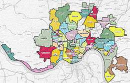
Map of Cincinnati neighborhoods
Cincinnati consists of fifty-two neighborhoods.
Many of these neighborhoods were once villages that have been annexed by the City of Cincinnati. The most important of them retain their former names, such as Walnut Hills and Mount Auburn.[1]
List
Neighborhoods are numbered and categorized by Cincinnati Police districts. Many neighborhoods have smaller communities and/or historic districts primarily within their boundaries, and those are denoted with bullet points.
District One
- Downtown
- Mount Adams
- Over-the-Rhine
- Brewery District
- Gateway Quarter
- Mohawk District
- Northern Liberties
- Schwartz's Point
- Sycamore-13th Street District
- Pendleton
- Queensgate
- West End
- Betts-Longworth District
- Brighton
- City West (Lincoln Court)
- Dayton Street District
- Frenchman's Corner
- Laurel Homes
District Two
- Columbia-Tusculum
- Fulton
- East Walnut Hills
- DeSales Corner
- Edgecliff
- Evanston
- Idlewild
- O'Bryonville
- Hyde Park
- Observatory District
- Dutchtown
- Kennedy Heights
- Linwood
- Madisonville
- Mount Lookout
- Mount Washington
- Oakley
- Pleasant Ridge
- Dallman's Corner
District Three
- East Price Hill
- Incline District
- St Lawrence Corners
- East Westwood
- English Woods
- Lower Price Hill
- Millvale
- Moosewood
- North Fairmount
- Knox Hill
- Riverside
- Anderson Ferry (Constance)
- Sayler Park
- Sedamsville
- South Cumminsville
- South Fairmount
- Barrsville
- The Villages of Roll Hill (formerly Fay Apartments)[2]
- West Price Hill
- Old Covedale
- Cedar Grove
- Westwood
- Lafeuille Terrace
- Werk Place
- Western Hills
- Westwood Town Center
District Four
- Avondale
- Bond Hill
- Carthage
- Corryville
- Short Vine District
- Vernon Gardens
- Hartwell
- Mount Auburn (Keys Hill)
- Glencoe (Inwood, formerly Little Bethlehem)
- Goat Hill
- Jerusalem
- Prospect Hill
- North Avondale
- Paddock Hills
- Roselawn
- Walnut Hills
- Gilbert-Sinton District
- Gilbert Row
- Peebles' Corner
District Five
- Camp Washington
- Clifton
- Gaslight District
- Ludlow Avenue District
- College Hill
- Hollywood (Teakwood)
- CUF
- Clifton Heights
- Fairview
- University Heights
- The Heights
- Rohs Hill
- Mount Airy
- Fox Acres
- Northside (formerly Cumminsville)
- Hoffner District
- Knowlton's Corner
- Spring Grove Village (formerly Winton Place)
- Winton Hills
- Winton Terrace
See also
Many communities within the Cincinnati – Northern Kentucky metropolitan area are considered by local residents to be neighborhoods of Cincinnati, but do not fall within the actual city limits, Hamilton county boundaries, or even within Ohio state borders.
Ohio
- Communities of Brown County
- Communities of Butler County
- Communities of Clermont County
- Communities of Hamilton County
- Communities of Warren County
Kentucky
- Communities of Boone County
- Communities of Bracken County
- Communities of Campbell County
- Communities of Gallatin County
- Communities of Grant County
- Communities of Kenton County
- Communities of Pendleton County
Indiana
References
- ↑ Kenny, Daniel J. (1895). "Illustrated Guide to Cincinnati and the World's Columbian Exposition". R. Clarke. p. 52. Retrieved 2013-05-22.
- ↑ http://www.urbancincy.com/2010/10/fay-apartments-to-be-renamed-the-villages-of-roll-hill-undergo-36m-renovation/
- Cincinnati Department of Trade & Development
- In-Depth Neighborhood Guides
- Cincinnati, OH Neighborhood Guide
External links
- Cincinnati Heat Map displays the average real estate price for each neighborhood.
| Neighborhoods |
| .png) | |||||||||||||||||||
|---|---|---|---|---|---|---|---|---|---|---|---|---|---|---|---|---|---|---|---|---|---|
| History |
| ||||||||||||||||||||
| Sports |
| ||||||||||||||||||||
| Education |
| ||||||||||||||||||||
This article is issued from Wikipedia - version of the 10/9/2016. The text is available under the Creative Commons Attribution/Share Alike but additional terms may apply for the media files.