Lipson Cove
| Lipson Cove | |
|---|---|
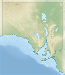 Lipson Cove Location in South Australia | |
| Location | South Australia |
| Coordinates | 34°15′36″S 136°15′47″E / 34.26000°S 136.26306°ECoordinates: 34°15′36″S 136°15′47″E / 34.26000°S 136.26306°E[1] |
| Type | Bay |
| Etymology | Thomas Lipson[1] |
| Part of | Spencer Gulf |
| Basin countries | Australia |
| Max. length | about1.1 kilometres (0.68 mi)[2] |
| Average depth | 5.5 metres (18 ft)[3] |
| Islands | Lipson Island |
| Settlements | Lipson |
Lipson Cove is a tranquil sandy bay on the western shore of Spencer Gulf, Eyre Peninsula, South Australia.
Location and access
Lipson Cove lies 215 km west-northwest of Adelaide and 63 km northeast of Port Lincoln. The nearest townships are Lipson, inland to the southwest and Port Neill to the north east. It can be accessed from the Lincoln Highway via the Lipson Cove Road. The road is unsealed, but well maintained and always passable for 2-wheel drive vehicles. Basic camping facility are present behind the dunes at the foreshore.
History and development
Lipson Cove was named in 1840 by Governor George Gawler after Thomas Lipson R.N., who was South Australia's first harbor master and collector of customs.
A privately-owned jetty was built in 1882 to facilitate local sheep and wool exports, but was demolished in 1949. [4] The cove is renowned for its shore-based fishing and an old talc mine which is located nearby. Coastal features include granite hills and cliffs which extend northwards from Lipson Cove to Port Neill. It is also known for its camping, fishing, coastal and marine habitats and is regarded as a safe swimming beach.[2]
Lipson Cove is also the site of the wreck of the ketch, Three Sisters. She was lost on the 13th of March, 1899.[5] The remains of the wooden vessel can sometimes be seen protruding from the beach sand.
The cove is adjacent to the proposed site of Centrex Metals Ltd's Port Spencer iron ore port development.
Lipson Island Conservation Park
Lipson Island lies 150 metres out from the Lipson Cove beach can be accessed when the tide is low, but care must be taken not to become stranded as the tide rises. The island and surrounding intertidal zone constitute the Lipson Island Conservation Park which was proclaimed in 1967 and which is a designated IUCN Category III "natural monument."[6] The island is an important rookery for roosting sea birds, including colonies of black-faced cormorant, crested tern and little penguin. Sooty oystercatchers have also been recorded on the island and New Zealand fur seals visit and haul out there occasionally.[7]
Lipson Island also bears the alternative French name of Ile d'Alembert, so named by French explorer Nicolas Baudin.
Wildlife
Species of conservation significance known to inhabit or visit the area include hooded plovers, fairy terns, white-bellied sea eagles, great white sharks, southern right whales and bottlenose dolphins.[7]
Gallery
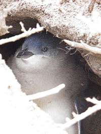 Little penguin in burrow on Lipson Island, Spencer Gulf, South Australia
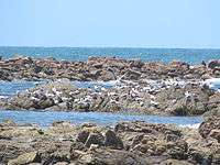 Crested terns at Lipson Cove, Spencer Gulf, South Australia
 Bottlenosed dolphins at Lipson Cove, Spencer Gulf, South Australia
 Southern right whale at Lipson Cove, Spencer Gulf, South Australia. Lipson Island Conservation Park appears in the background.
See also
References
- 1 2 ""Search results for Lipson Cove (Bay)"(Record No. SA0039616)". Department of Planning, Transport and Infrastructure. Retrieved 28 March 2016.
- 1 2 "Lipson Cove, unpatrolled beach". Surf Life Saving Australia. Retrieved 28 March 2016.
- ↑ National Geospatial-Intelligence Agency (NGA) (2010). Pub175, Sailing directions (enroute) north, west, and south coast of Australia (PDF) (10th ed.). National Geospatial-Intelligence Agency. p. 179. Retrieved 16 May 2014.
- ↑ http://trove.nla.gov.au/newspaper/article/96778319
- ↑ The Wreck Site "Three Sisters" Retrieved 2013-11-05.
- ↑ "Lipson Island | Protected Planet". www.protectedplanet.net. Retrieved 2015-11-06.
- 1 2 Atlas of Living Australia "Lipson Cove - All Species within 1km radius" Retrieved 2013-11-05.