Encounter Bay
| Encounter Bay | |
|---|---|
|
Encounter Bay from Port Elliot, South Australia | |
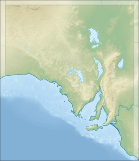 Encounter Bay Location in South Australia | |
| Location | Fleurieu and Sir Richard Peninsulas, South Australia |
| Coordinates | 35°34′40″S 138°35′35″E / 35.57778°S 138.59306°ECoordinates: 35°34′40″S 138°35′35″E / 35.57778°S 138.59306°E[1] |
| Type | Bay |
| Primary inflows | River Murray |
| Basin countries | Australia |
| Islands | Granite Island, Pullen Island, Seal Island, Wright Island |
| Settlements |
Victor Harbor Goolwa, Middleton & Port Elliot |

Encounter Bay is a bay on the south central coast of South Australia about 100 kilometres (62 mi) south of the Adelaide city centre. It was named by Matthew Flinders after his encounter on 8 April 1802 with Nicolas Baudin, the commander of the Baudin expedition of 1800-03. It is the site of both the mouth of the River Murray and the regional city of Victor Harbor. It is one of four ‘historic bays’ located on the South Australian coast.
Extent
There are at least two definitions of the bay’s extent. Firstly, an American source states that Newland Head is its westerly extremity while the mouth of the River Murray is the easterly extremity.[2] Secondly, Australian authorities consider the bay’s extent consists of all of the sea north of a line running east from the southern tip of Rosetta Head to the Younghusband Peninsula.[3] Encounter Bay is one of four bays on the South Australian coast considered by the Australian government to be a ‘historic bay’ under the Seas and Submerged Lands Act 1973 and was proclaimed as such in 1987 and again in 2006 and 2016 with the result that the mouth of the bay is on the territorial seas baseline and the waters within the bay are internal waters as per the definition used in United Nations Convention on the Law of the Sea.[4][5]
Description
Traditionally the land of the Ramindjeri clan of the Ngarrindjeri people, the bay's coastline is the site for the following settlements: Victor Harbor, Port Elliot, Middleton and Goolwa. The Murray, Inman and Hindmarsh Rivers drain into the bay.
Islands located within Encounter Bay include (from west to east): Wright Island, Granite Island, Seal Island (also known as Seal Rock) and Pullen Island.[6]
European discovery
Encounter Bay was named by Matthew Flinders on 8 April 1802 after his encounter with Nicolas Baudin, both of whom were charting the Australian coastline for their respective countries (Britain and France). The encounter between the scientists was peaceful, even though their countries were at war at the time.[7]
Protected areas
The following protected areas exist within the bay’s waters: the Granite Island Recreation Park, the Pullen Island Conservation Park and the West Island Conservation Park while the bay’s waters are within the boundaries of the Encounter Marine Park. The following protected areas adjoin the shores of the bay: the Coorong National Park.[8][9][10][11]
See also
References
- ↑ "Encounter Bay (SA)". Gazetteer of Australia online. Geoscience Australia, Australian Government.
- ↑ Pub175, Sailing directions (enroute) north, west, and south coast of Australia (PDF) (10th ed.). National Geospatial-Intelligence Agency. 2010. p. 215. Retrieved 16 May 2014.
- ↑ "Seas and Submerged Lands (Historic Bays) Proclamation 2006". Commonwealth of Australia. Retrieved 29 July 2014.
- ↑ "Seas and Submerged Lands (Historic Bays) Proclamation 2006". Commonwealth of Australia. 15 February 2006. Retrieved 29 July 2014.
- ↑ "Seas and Submerged Lands (Historic Bays) Proclamation 2016". Commonwealth of Australia. 10 March 2016. Retrieved 11 October 2016.
- ↑ Property Location Browser V2 Government of South Australia. Accessed 2014-02-12.
- ↑ Flinders, Matthew (1966) [1814]. A Voyage to Terra Australis : undertaken for the purpose of completing the discovery of that vast country, and prosecuted in the years 1801, 1802, and 1803 in His Majesty's ship the Investigator, and subsequently in the armed vessel Porpoise and Cumberland Schooner; with an account of the shipwreck of the Porpoise, arrival of the Cumberland at Mauritius, and imprisonment of the commander during six years and a half in that island. (Facsimile ed.). Adelaide; Facsimile reprint of: London : G. and W. Nicol, 1814 ed. In two volumes, with an Atlas (3 volumes): Libraries Board of South Australia. p. 263. Retrieved 3 January 2014.
- ↑ "Island Conservation Parks of Backstairs Passage and Encounter Bay" (PDF). Department of Environment Water & Natural Resources. Retrieved 23 January 2014.
- ↑ "Encounter Marine park". Department of Environment Water & Natural Resources. Retrieved 23 January 2014.
- ↑ "Coorong National Park". Department of Environment Water & Natural Resources. Retrieved 23 January 2014.
- ↑ "Granite Island Recreation Park". Department of Environment, Water and Natural Resources. Retrieved 27 July 2014.
Further reading
| Wikimedia Commons has media related to Encounter Bay. |
- Hodge, Charles Reynolds (1932). Encounter Bay, the miniature Naples of Australia : a short history of the romantic south coast of South Australia (Reprinted 1979 ed.). Hampstead Gardens, Adelaide, S.A.: Austaprint. ISBN 0-85872-320-4.