Lincoln, Alabama
| Lincoln, Alabama | |
|---|---|
| City | |
| Motto: "Come Grow With Us" | |
 Location in Talladega County and the state of Alabama | |
| Coordinates: 33°35′35″N 86°8′20″W / 33.59306°N 86.13889°W | |
| Country | United States |
| State | Alabama |
| County | Talladega |
| Area | |
| • Total | 21.4 sq mi (55.5 km2) |
| • Land | 21.3 sq mi (55.2 km2) |
| • Water | 0.1 sq mi (0.3 km2) |
| Elevation | 502 ft (153 m) |
| Population (2013)[1] | |
| • Total | 6,326 |
| • Density | 213.9/sq mi (82.5/km2) |
| Time zone | Central (CST) (UTC-6) |
| • Summer (DST) | CDT (UTC-5) |
| ZIP code | 35096 |
| Area code(s) | 205 256 |
| FIPS code | 01-43120 |
| GNIS feature ID | 0112832 |
| Website | http://www.lincolnalabama.com/ |
Lincoln is a city in Talladega County, Alabama, United States. It incorporated in 1911.[2] At the 2010 census the population was 6,266. It was named for Major General Benjamin Lincoln, who served in the American Army during the Revolutionary War.
Geography
Lincoln is located at 33°35′35″N 86°8′20″W / 33.59306°N 86.13889°W (33.593156, -86.138879).[3] It is home to Honda Manufacturing of Alabama, employing over 4,000 people. The famed Talladega Superspeedway race track is located near the city.
According to the U.S. Census Bureau, the city has a total area of 21.5 square miles (56 km2), of which 21.3 square miles (55 km2) is land and 0.1 square miles (0.26 km2) (0.61%) is water.
Education
Lincoln has three public schools in the Talladega County Board of Education, Lincoln Elementary School, Charles R. Drew Middle School, and Lincoln High School, Home of The Golden Bears. The first graduate of Lincoln High School was the famous Cities Service Company CEO Burl S. Watson, who graduated from LHS in 1912.
The Birmingham Supplementary School Inc. (BSS, バーミングハム日本語補習校 Bāminguhamu Nihongo Hoshūkō), a part-time Japanese school, has its offices at the Honda Manufacturing of Alabama, LLC facility in unincorporated Talladega County, near Lincoln. It holds its classes at the Shelby-Hoover campus of Jefferson State Community College in Hoover. The school first opened on September 1, 2001.[4][5][6]
Demographics
| Historical population | |||
|---|---|---|---|
| Census | Pop. | %± | |
| 1920 | 498 | — | |
| 1930 | 429 | −13.9% | |
| 1940 | 420 | −2.1% | |
| 1950 | 547 | 30.2% | |
| 1960 | 629 | 15.0% | |
| 1970 | 1,127 | 79.2% | |
| 1980 | 2,081 | 84.6% | |
| 1990 | 2,941 | 41.3% | |
| 2000 | 4,577 | 55.6% | |
| 2010 | 6,266 | 36.9% | |
| Est. 2015 | 6,524 | [7] | 4.1% |
| U.S. Decennial Census[8] 2013 Estimate[9] | |||
As of the census of 2000, there were 4,577 people, 1,831 households, and 1,354 families residing in the city. The population density was 214.6 people per square mile (82.8/km²). There were 2,297 housing units at an average density of 107.7 per square mile (41.6/km²). The racial makeup of the city was 71.90% White, 27.05% Black or African American, 0.31% Native American, 0.07% Asian, 0.07% from other races, and 0.61% from two or more races. 0.70% of the population were Hispanic or Latino of any race.
There were 1,831 households out of which 28.5% had children under the age of 18 living with them, 58.0% were married couples living together, 12.7% had a female householder with no husband present, and 26.0% were non-families. 22.3% of all households were made up of individuals and 5.9% had someone living alone who was 65 years of age or older. The average household size was 2.50 and the average family size was 2.89.
In the city the population was spread out with 22.9% under the age of 18, 8.3% from 18 to 24, 28.4% from 25 to 44, 28.8% from 45 to 64, and 11.6% who were 65 years of age or older. The median age was 39 years. For every 100 females there were 95.2 males. For every 100 females age 18 and over, there were 92.5 males.
The median income for a household in the city was $34,053, and the median income for a family was $36,900. Males had a median income of $29,407 versus $24,102 for females. The per capita income for the city was $18,442. About 9.4% of families and 13.4% of the population were below the poverty line, including 17.6% of those under age 18 and 26.1% of those age 65 or over.
2010 census
As of the census of 2010, there were 6,266 people, 2,478 households, and 1,785 families residing in the city. The population density was 294.2 people per square mile (113.5/km²). There were 3,197 housing units at an average density of 150.1 per square mile (57.9/km²). The racial makeup of the city was 73.3% White, 23.4% Black or African American, 0.5% Native American, 0.4% Asian, 1.0% from other races, and 1.4% from two or more races. 1.9% of the population were Hispanic or Latino of any race.
There were 1,831 households out of which 29.3% had children under the age of 18 living with them, 51.5% were married couples living together, 15.3% had a female householder with no husband present, and 28.0% were non-families. 22.9% of all households were made up of individuals and 7.5% had someone living alone who was 65 years of age or older. The average household size was 2.51 and the average family size was 2.94.
In the city the population was spread out with 23.1% under the age of 18, 7.8% from 18 to 24, 27.4% from 25 to 44, 29.2% from 45 to 64, and 12.5% who were 65 years of age or older. The median age was 39.4 years. For every 100 females there were 96.8 males. For every 100 females age 18 and over, there were 95.0 males.
The median income for a household in the city was $36,919, and the median income for a family was $42,139. Males had a median income of $36,991 versus $21,804 for females. The per capita income for the city was $19,123. About 11.1% of families and 14.3% of the population were below the poverty line, including 22.4% of those under age 18 and 16.7% of those age 65 or over.
Industry
Honda, through its subsidiary, Honda Manufacturing of Alabama, operates a manufacturing plant in Lincoln. As of 2013, the Acura MDX, Honda Odyssey, Honda Pilot, and Honda Ridgeline are built there, as well as the Honda J V6 engine.
Notable people
- Pleasant Crump, last verifiable veteran who fought for the Confederacy during the American Civil War
- Burl S. Watson, President and CEO of Cities Service Company during parts of the 1950s and 1960s
References
- ↑ "Population Estimates". United States Census Bureau. Retrieved 2014-06-07.
- ↑ http://www.encyclopediaofalabama.org/article/h-3164
- ↑ "US Gazetteer files: 2010, 2000, and 1990". United States Census Bureau. 2011-02-12. Retrieved 2011-04-23.
- ↑ "About Birmingham Supplementary School" (Archive). Birmingham Supplementary School. Retrieved on May 11, 2014. "Mailing Address 1800 Honda Drive Lincoln, AL 35096 c/o Honda Manufacturing of Alabama, LLC" and "Facility Jefferson State Community College, Shelby Campus 4600 Valleydale Road Birmingham, AL 35242 " Japanese page: "学校の概要" (Archive).
- ↑ "2010 CENSUS - CENSUS BLOCK MAP: Hoover city, AL." (Archive). U.S. Census Bureau. Retrieved on May 11, 2014.
- ↑ "Shelby-Hoover Campus." Jefferson State University. Retrieved on May 11, 2014. Use the Google Maps function to see the buildings and where they are in relation to the city limits.
- ↑ "Annual Estimates of the Resident Population for Incorporated Places: April 1, 2010 to July 1, 2015". Retrieved July 2, 2016.
- ↑ United States Census Bureau. "Census of Population and Housing". Retrieved November 20, 2013.
- ↑ "Annual Estimates of the Resident Population: April 1, 2010 to July 1, 2013". Retrieved June 7, 2014.
External links
Coordinates: 33°35′35″N 86°08′20″W / 33.593156°N 86.138879°W
Municipalities and communities of Talladega County, Alabama, United States | ||
|---|---|---|
| Cities | 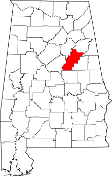 | |
| Towns | ||
| CDPs | ||
| Unincorporated communities | ||
| Ghost town | ||
| Footnotes | ‡This populated place also has portions in an adjacent county or counties | |