Fayetteville, Alabama
| Fayetteville, Alabama | |
|---|---|
| Census-designated place | |
 Fayetteville, Alabama | |
| Coordinates: 33°08′44″N 86°24′21″W / 33.14556°N 86.40583°WCoordinates: 33°08′44″N 86°24′21″W / 33.14556°N 86.40583°W | |
| Country | United States |
| State | Alabama |
| County | Talladega |
| Area[1] | |
| • Total | 19.773 sq mi (51.21 km2) |
| • Land | 17.443 sq mi (45.18 km2) |
| • Water | 2.330 sq mi (6.03 km2) |
| Elevation | 436 ft (133 m) |
| Population (2010)[2] | |
| • Total | 1,284 |
| • Density | 65/sq mi (25/km2) |
| Time zone | Central (CST) (UTC-6) |
| • Summer (DST) | CDT (UTC-5) |
| Area code(s) | 256 & 938 |
| GNIS feature ID | 118227[3] |
Fayetteville is a census-designated place and unincorporated community in Talladega County, Alabama, United States. Its population was 1,284 as of the 2010 census.[2]
The following is found on a sign erected by the Alabama Historical Association:
"In 1814, Tennessee Troops joined Andrew Jackson's force which won the Creek Indian War. After Indian removal in 1836, these veterans brought their families here, named this community for their old home in Tennessee. Fayetteville Academy was built in 1850."
In the 1920s high school was built in the Fayetteville community called Fayetteville High School.
References
- ↑ "US Gazetteer files: 2010, 2000, and 1990". United States Census Bureau. 2011-02-12. Retrieved 2011-04-23.
- 1 2 "American FactFinder". United States Census Bureau. Retrieved 2011-05-14.
- ↑ "Fayetteville". Geographic Names Information System. United States Geological Survey.
Municipalities and communities of Talladega County, Alabama, United States | ||
|---|---|---|
| Cities | 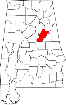 | |
| Towns | ||
| CDPs | ||
| Unincorporated communities | ||
| Ghost town | ||
| Footnotes | ‡This populated place also has portions in an adjacent county or counties | |
This article is issued from Wikipedia - version of the 11/22/2016. The text is available under the Creative Commons Attribution/Share Alike but additional terms may apply for the media files.