Kahatchie, Talladega County, Alabama
| Kahatchie, Alabama | |
|---|---|
| Unincorporated community | |
 Kahatchie, Alabama  Kahatchie, Alabama | |
| Coordinates: 33°12′08″N 86°24′30″W / 33.20222°N 86.40833°WCoordinates: 33°12′08″N 86°24′30″W / 33.20222°N 86.40833°W | |
| Country | United States |
| State | Alabama |
| County | Talladega |
| Elevation | 495 ft (151 m) |
| Time zone | Central (CST) (UTC-6) |
| • Summer (DST) | CDT (UTC-5) |
| Area code(s) | 256 & 938 |
| GNIS feature ID | 164208[1] |
Kahatchie, also known as Handytown, Achates, Cohatchie, or Keyhatchie, is an unincorporated community in Talladega County, Alabama, United States.
History
The community's name comes from the same name of an Upper Creek town which was located here. It also lends its name to nearby Kahatchee Creek and the Kahatchie Hills.[2] In Creek, Kahatchie means "cane creek", in reference to the river cane which grows along waterways throughout Alabama.[3] A post office called Handytown was established in 1873, and remained in operation until it was discontinued in 1874. A post office was then operated in the area under the name Achates from 1882 until it was closed in 1894.[4]
References
- ↑ "Kahatchie". Geographic Names Information System. United States Geological Survey.
- ↑ Wright, Jr., Amos J. (2003). Historic Indian Towns in Alabama, 1540-1838. University of Alabama Press. p. 95. ISBN 0-8173-1251-X.
- ↑ Read, William A. (1984). Indian Place Names in Alabama. Tuscaloosa: The University of Alabama Press. p. 37. ISBN 0-8173-0231-X.
- ↑ "Talladega County". Jim Forte Postal History. Retrieved 29 October 2014.
Municipalities and communities of Talladega County, Alabama, United States | ||
|---|---|---|
| Cities | 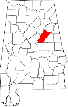 | |
| Towns | ||
| CDPs | ||
| Unincorporated communities | ||
| Ghost town | ||
| Footnotes | ‡This populated place also has portions in an adjacent county or counties | |
This article is issued from Wikipedia - version of the 7/31/2016. The text is available under the Creative Commons Attribution/Share Alike but additional terms may apply for the media files.