Laurel, Batangas
| Laurel | ||
|---|---|---|
| Municipality | ||
 | ||
| ||
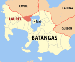 Location within Batangas province | ||
.svg.png) Laurel Location within the Philippines | ||
| Coordinates: 14°03′N 120°54′E / 14.05°N 120.9°ECoordinates: 14°03′N 120°54′E / 14.05°N 120.9°E | ||
| Country | Philippines | |
| Region | Calabarzon (Region IV-A) | |
| Province | Batangas | |
| District | 3rd District | |
| Founded | May 25, 1961 but changed to June 21,1969 | |
| Barangays | 23 (see Barangays) | |
| Government [1] | ||
| • Type | Sangguniang Bayan | |
| • Mayor | Randy James Amo (Liberal) | |
| Area[2] | ||
| • Total | 71.29 km2 (27.53 sq mi) | |
| Population (2015 census)[3] | ||
| • Total | 39,444 | |
| • Density | 550/km2 (1,400/sq mi) | |
| • Voter (2016)[4] | 22,020 | |
| Time zone | PST (UTC+8) | |
| ZIP code | 4221 | |
| IDD : area code | +63 (0)43 | |
| Income class | 3rd class | |
| PSGC | 041011000 | |
| Website |
laurelbatangas | |

Laurel, officially the Municipality of Laurel (Filipino: Bayan ng Laurel), is a municipality in the province of Batangas in the Calabarzon (Region IV-A) of the Philippines. The population was 39,444 at the 2015 census.[3] In the 2016 election, it had 22,020 registered voters.[4]
Laurel had been part of Talisay, its current neighbor town. The town used to be known as Bayuyungan. On May 25, 1961, the town of Talisay was divided into two municipalities, and the new town was renamed "Laurel" after Miguel Laurel, known as the first Laurel in the Philippines and a longtime patriarch of the place.
Geography
Laurel is located at 14°03′N 120°54′E / 14.05°N 120.9°E.
According to the Philippine Statistics Authority, the municipality has a land area of 71.29 square kilometres (27.53 sq mi)[2] constituting 2.29% of the 3,119.75-square-kilometre- (1,204.54 sq mi) total area of Batangas.
Barangays
Laurel is politically subdivided into 21 barangays.[5]
| PSGC | Barangay | Population | ±% p.a. | ||
|---|---|---|---|---|---|
| 2015[3] | 2010[6] | ||||
| 041011001 | As‑Is | 6.0% | 2,354 | 2,133 | +1.89% |
| 041011002 | Balakilong | 10.4% | 4,118 | 3,974 | +0.68% |
| 041011004 | Berinayan | 5.1% | 2,008 | 1,613 | +4.26% |
| 041011006 | Bugaan East | 5.1% | 2,028 | 1,811 | +2.18% |
| 041011007 | Bugaan West | 6.0% | 2,374 | 2,290 | +0.69% |
| 041011008 | Buso‑buso | 6.8% | 2,692 | 2,445 | +1.85% |
| 041011010 | Dayap Itaas | 1.9% | 752 | 494 | +8.33% |
| 041011011 | Gulod | 7.0% | 2,746 | 2,501 | +1.80% |
| 041011012 | J. Leviste | 6.0% | 2,351 | 1,884 | +4.31% |
| 041011013 | Molinete | 3.8% | 1,480 | 1,442 | +0.50% |
| 041011014 | Niyugan | 3.1% | 1,219 | 1,252 | −0.51% |
| 041011015 | Paliparan | 2.2% | 887 | 760 | +2.99% |
| 041011016 | Barangay 1 (Poblacion) | 1.4% | 570 | 507 | +2.26% |
| 041011017 | Barangay 2 (Poblacion) | 3.6% | 1,438 | 1,265 | +2.47% |
| 041011018 | Barangay 3 (Poblacion) | 1.7% | 663 | 759 | −2.54% |
| 041011019 | Barangay 4 (Poblacion) | 1.5% | 610 | 593 | +0.54% |
| 041011020 | Barangay 5 (Poblacion) | 2.0% | 790 | 674 | +3.07% |
| 041011021 | San Gabriel | 6.5% | 2,559 | 2,340 | +1.72% |
| 041011022 | San Gregorio | 8.7% | 3,433 | 2,931 | +3.06% |
| 041011023 | Santa Maria | 5.6% | 2,217 | 1,986 | +2.12% |
| 041011024 | Ticub | 5.5% | 2,155 | 2,020 | +1.24% |
| Total | 39,444 | 35,674 | +1.93% | ||
Demographics
| Population census of Laurel | |||||||||||||||||||||||||
|---|---|---|---|---|---|---|---|---|---|---|---|---|---|---|---|---|---|---|---|---|---|---|---|---|---|
|
| ||||||||||||||||||||||||
| Source: PSA[3][6][7] | |||||||||||||||||||||||||
In the 2015 census, Laurel had a population of 39,444.[3] The population density was 550 inhabitants per square kilometre (1,400/sq mi).
In the 2016 election, it had 22,020 registered voters.[4]
Economy
- Fishing – Laurel's main economical source is fish culture in Taal Lake where most of local residents base their trade.
- Farming – Small rice paddies on the foothills of Taal canyon ridge provide for ricefields to farmers.
- Real estate – The town's vast land resource provide ideal location for real estate developers such as Megaworld and Fil-Estate which are mostly based in Metro Manila. Among the major real estate subdivisions located in Barangay San Gregorio are Canyon Woods and Twin Lakes.[8]
Government

Elected municipal officials:[4]
- Mayor: Randy James Amo (LP) (2010–present)
- Vice Mayor: Felimon Palo Austria (LP) (2013–present)
- Councilors:
- Rachelle Ogalinola (LP) (2013–present)
- Angelito Rodriguez (LP) (2013–present)
- Vincent Endaya (Ind.) (2010–present)
- Romulo Macaraig (UNA) (2013–present)
- Marivic Mayuga (UNA) (2013–present)
- Marvin Vergara (Ind.) (2013–present)
- Gina Landicho (LP) (2010–present)
- Andreo Landicho (LP) (2004-2013) and (2013–present)
Former mayors
- Placido Amo: (1972-1986) and (1988-1992), 18 years in service
- Joven De Grano: (1992-1995), 3 years in service
- Natalio Panganiban: (1986-1988) and (1995-2004), 11 years in service
- John Benedict Panganiban: (2004-2010), 6 years in service
References
- ↑ "Municipality". Quezon City, Philippines: Department of the Interior and Local Government. Retrieved 31 May 2013.
- 1 2 "Province: Batangas". PSGC Interactive. Makati City, Philippines: Philippine Statistics Authority. Retrieved 26 November 2016.
- 1 2 3 4 5 "Region IV-A (CALABARZON)". Census of Population (2015): Total Population by Province, City, Municipality and Barangay (Report). PSA. Retrieved 20 June 2016.
- 1 2 3 4 "2016 National and Local Elections Statistics". Commission on Elections. 2016.
- ↑ "Municipal: Laurel, Batangas". PSGC Interactive. Quezon City, Philippines: Philippine Statistics Authority. Retrieved 8 January 2016.
- 1 2 "Region IV-A (CALABARZON)". Census of Population and Housing (2010): Total Population by Province, City, Municipality and Barangay (Report). NSO. Retrieved 29 June 2016.
- ↑ "Region IV-A (CALABARZON)". Census of Population (1995, 2000 and 2007): Total Population by Province, City and Municipality (Report). NSO. Archived from the original on 24 June 2011.
- ↑ "Twin Lakes : Tagaytay Philippines". Twinlakestagaytay.com.ph. Retrieved 2016-11-26.
External links
| Wikimedia Commons has media related to Laurel, Batangas. |
 |
Nasugbu | Alfonso, Cavite / Tagaytay, Cavite | Talisay | |
| |
Taal Lake | |||
| ||||
| | ||||
| Calaca | Lemery / Agoncillo |
Batangas (capital) | |
| Municipalities | |
| Component cities | |