Lake Victoria, Michigan
| Lake Victoria, Michigan | |
|---|---|
| Census-designated place | |
 Lake Victoria Location within the state of Michigan | |
| Coordinates: 42°55′03″N 84°22′32″W / 42.91750°N 84.37556°WCoordinates: 42°55′03″N 84°22′32″W / 42.91750°N 84.37556°W | |
| Country | United States |
| State | Michigan |
| County | Clinton County |
| Township | Victor Township |
| Area | |
| • Total | 1.0 sq mi (2.7 km2) |
| • Land | 0.8 sq mi (2.1 km2) |
| • Water | 0.2 sq mi (0.6 km2) |
| Elevation | 790 ft (240 m) |
| Population (2010) | |
| • Total | 930 |
| • Density | 1,131/sq mi (436.7/km2) |
| Time zone | Eastern (EST) (UTC-5) |
| • Summer (DST) | EDT (UTC-4) |
| Area code(s) | 517 |
| FIPS code | 26-45190[1] |
| GNIS feature ID | 2583748[2] |
Lake Victoria is an unincorporated community and census-designated place (CDP) in Victor Township, Clinton County in the U.S. state of Michigan. As of the 2010 census it had a population of 930.[1]
Geography
The Lake Victoria CDP consists of a residential development surrounding a lake of the same name in eastern Victor Township. The eastern edge of the CDP is the eastern border of the township (and county), with Sciota Township of Shiawassee County to the east.
The CDP has a total area of 1.0 square mile (2.7 km2), of which 0.81 square miles (2.1 km2) is land and 0.23 square miles (0.6 km2), or 21.75%, is water.[1]
References
- 1 2 3 "Geographic Identifiers: 2010 Demographic Profile Data (G001): Lake Victoria CDP, Michigan". U.S. Census Bureau, American Factfinder. Retrieved October 1, 2014.
- ↑ U.S. Geological Survey Geographic Names Information System: Lake Victoria Census Designated Place
Municipalities and communities of Clinton County, Michigan, United States | ||
|---|---|---|
| Cities | 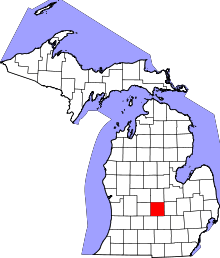 | |
| Villages | ||
| Charter townships | ||
| General law townships | ||
| CDPs | ||
| Footnotes | ‡This populated place also has portions in an adjacent county or counties | |
This article is issued from Wikipedia - version of the 4/15/2016. The text is available under the Creative Commons Attribution/Share Alike but additional terms may apply for the media files.