Westphalia, Michigan
| Westphalia, Michigan | |
|---|---|
| Village | |
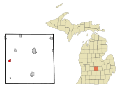 Location of Westphalia, Michigan | |
| Coordinates: 42°55′43″N 84°47′52″W / 42.92861°N 84.79778°W | |
| Country | United States |
| State | Michigan |
| County | Clinton |
| Area[1] | |
| • Total | 1.14 sq mi (2.95 km2) |
| • Land | 1.11 sq mi (2.87 km2) |
| • Water | 0.03 sq mi (0.08 km2) |
| Elevation | 761 ft (232 m) |
| Population (2010)[2] | |
| • Total | 923 |
| • Estimate (2012[3]) | 927 |
| • Density | 831.5/sq mi (321.0/km2) |
| Time zone | Eastern (EST) (UTC-5) |
| • Summer (DST) | EDT (UTC-4) |
| ZIP code | 48894 |
| Area code(s) | 989 |
| FIPS code | 26-86120[4] |
| GNIS feature ID | 1616225[5] |

Westphalia is a village in Clinton County in the U.S. state of Michigan. The population was 923 at the 2010 census.
The village is within Westphalia Township in the western portion of Clinton County, about 8 miles north of Interstate 96 on Grange Road and about 25 miles northwest of Lansing.
History
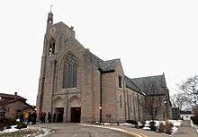
Westphalia was founded in 1836 by a group of German settlers. It was named after the province of Westphalia in Germany.[6] These settlers were German Catholics who emigrated from the Westphalia region cities of Wimbach, Meerhof, and Hesse, Germany, among others, and found the rich soil ideal for farming. Some family members stayed in Detroit, while others moved into the wilderness to clear farmland. Cholera took a toll on early families.
Geography
According to the United States Census Bureau, the village has a total area of 1.14 square miles (2.95 km2), of which 1.11 square miles (2.87 km2) is land and 0.03 square miles (0.08 km2) is water.[1]
Demographics
| Historical population | |||
|---|---|---|---|
| Census | Pop. | %± | |
| 1890 | 350 | — | |
| 1900 | 374 | 6.9% | |
| 1910 | 366 | −2.1% | |
| 1920 | 325 | −11.2% | |
| 1930 | 328 | 0.9% | |
| 1940 | 386 | 17.7% | |
| 1950 | 459 | 18.9% | |
| 1960 | 560 | 22.0% | |
| 1970 | 806 | 43.9% | |
| 1980 | 896 | 11.2% | |
| 1990 | 780 | −12.9% | |
| 2000 | 876 | 12.3% | |
| 2010 | 923 | 5.4% | |
| Est. 2015 | 937 | [7] | 1.5% |
2010 census
As of the census[2] of 2010, there were 923 people, 355 households, and 267 families residing in the village. The population density was 831.5 inhabitants per square mile (321.0/km2). There were 364 housing units at an average density of 327.9 per square mile (126.6/km2). The racial makeup of the village was 98.2% White, 0.1% African American, 0.1% Native American, 0.1% Asian, 1.0% from other races, and 0.5% from two or more races. Hispanic or Latino of any race were 3.0% of the population.
There were 355 households of which 30.7% had children under the age of 18 living with them, 67.0% were married couples living together, 6.2% had a female householder with no husband present, 2.0% had a male householder with no wife present, and 24.8% were non-families. 22.3% of all households were made up of individuals and 12.6% had someone living alone who was 65 years of age or older. The average household size was 2.60 and the average family size was 3.04.
The median age in the village was 39.4 years. 27.5% of residents were under the age of 18; 6.2% were between the ages of 18 and 24; 23.8% were from 25 to 44; 20.1% were from 45 to 64; and 22.4% were 65 years of age or older. The gender makeup of the village was 48.3% male and 51.7% female.
2000 census
As of the census[4] of 2000, there were 876 people, 342 households, and 251 families residing in the village. The population density was 765.7 per square mile (296.7/km²). There were 350 housing units at an average density of 305.9 per square mile (118.5/km²). The racial makeup of the village was 99.43% White, 0.23% Native American, and 0.34% from two or more races.
There were 342 households out of which 32.7% had children under the age of 18 living with them, 66.7% were married couples living together, 4.7% had a female householder with no husband present, and 26.6% were non-families. 24.9% of all households were made up of individuals and 13.7% had someone living alone who was 65 years of age or older. The average household size was 2.56 and the average family size was 3.07.
In the village the population was spread out with 27.9% under the age of 18, 6.6% from 18 to 24, 26.6% from 25 to 44, 21.7% from 45 to 64, and 17.2% who were 65 years of age or older. The median age was 36 years. For every 100 females there were 94.7 males. For every 100 females age 18 and over, there were 93.9 males.
The median income for a household in the village was $52,500, and the median income for a family was $58,864. Males had a median income of $40,781 versus $31,827 for females. The per capita income for the village was $20,112. There are 3.5% of families living below the poverty line and 4.2% of the population, including 4.3% of under eighteens and 9.0% of those over 64.
References
- 1 2 "US Gazetteer files 2010". United States Census Bureau. Retrieved 2012-11-25.
- 1 2 "American FactFinder". United States Census Bureau. Retrieved 2012-11-25.
- ↑ "Population Estimates". United States Census Bureau. Retrieved 2013-06-03.
- 1 2 "American FactFinder". United States Census Bureau. Retrieved 2008-01-31.
- ↑ U.S. Geological Survey Geographic Names Information System: Westphalia, Michigan
- ↑ Daboll, Sherman B. assisted by Dean W. Kelley Past and present of Clinton County, Michigan. Chicago: The S.J. Clarke publishing co., 1906. pp. 490-92
- ↑ "Annual Estimates of the Resident Population for Incorporated Places: April 1, 2010 to July 1, 2015". Retrieved July 2, 2016.
- ↑ "Census of Population and Housing". Census.gov. Retrieved June 4, 2015.
External links
Municipalities and communities of Clinton County, Michigan, United States | ||
|---|---|---|
| Cities | 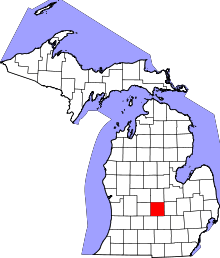 | |
| Villages | ||
| Charter townships | ||
| General law townships | ||
| CDPs | ||
| Footnotes | ‡This populated place also has portions in an adjacent county or counties | |
Coordinates: 42°55′46″N 84°47′55″W / 42.92944°N 84.79861°W