Lah, Victoria
| Lah Victoria | |||||||
|---|---|---|---|---|---|---|---|
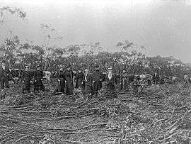 A group of men and women in front of a bullock team pulling a Mallee roller in Lah district, 1897 | |||||||
 Lah | |||||||
| Coordinates | 36°12′0″S 142°28′0″E / 36.20000°S 142.46667°ECoordinates: 36°12′0″S 142°28′0″E / 36.20000°S 142.46667°E | ||||||
| Population | >261 (2011 census)[1] | ||||||
| Postcode(s) | 3393 | ||||||
| Elevation | 147[2] m (482 ft) | ||||||
| Location |
| ||||||
| LGA(s) | Shire of Yarriambiack | ||||||
| State electorate(s) | Lowan | ||||||
| Federal Division(s) | Mallee | ||||||
| |||||||
Lah (/ˈlɑː/ LAH) is a town in the Wimmera, Victoria, situated between Warracknabeal and Brim on the Henty Highway.
References
This article is issued from Wikipedia - version of the 4/28/2016. The text is available under the Creative Commons Attribution/Share Alike but additional terms may apply for the media files.