Lac-des-Plages, Quebec
| Lac-des-Plages | |
|---|---|
| Municipality | |
 | |
 Location within Papineau RCM | |
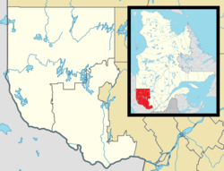 Lac-des-Plages Location in western Quebec | |
| Coordinates: 46°00′N 74°54′W / 46.000°N 74.900°WCoordinates: 46°00′N 74°54′W / 46.000°N 74.900°W[1] | |
| Country |
|
| Province |
|
| Region | Outaouais |
| RCM | Papineau |
| Constituted | January 1, 1950 |
| Government[2] | |
| • Mayor | Josée Simon |
| • Federal riding | Argenteuil—Papineau—Mirabel |
| • Prov. riding | Papineau |
| Area[2][3] | |
| • Total | 168.20 km2 (64.94 sq mi) |
| • Land | 152.96 km2 (59.06 sq mi) |
| Population (2011)[3] | |
| • Total | 522 |
| • Density | 3.4/km2 (9/sq mi) |
| • Pop 2006-2011 |
|
| • Dwellings | 673 |
| Time zone | EST (UTC−5) |
| • Summer (DST) | EDT (UTC−4) |
| Postal code(s) | J0T 1K0 |
| Area code(s) | 819 |
| Highways |
|
| Website |
www |
Lac-des-Plages is a town and municipality in the Outaouais region of Quebec, Canada, part of the Papineau Regional County Municipality. It is named after Lac des Plages (French for "Lake of Beaches") which attracts many vacationers with the beauty of its beaches.[4]
History
The community and post office have been identified under several other names, following the name changes of the adjacent lake. It was first known as Lac Rond (Round Lake), Lac Désormeaux (in honor of pioneer Norbert Désormeaux who arrived in the territory in 1890), as well as Lac des Sables (Sand Lake).[4]
In 1950, the Municipality of Lac-des-Plages was formed when its territory detached from the United Township Municipality of Suffolk-et-Addington.[4]
Demographics
Population trend:[5]
- Population in 2011: 522 (2006 to 2011 population change: 29.5%)
- Population in 2006: 403
- Population in 2001: 362
- Population in 1996: 380 (1991 to 1996 population change: 1.8%)
- Population in 1991: 374
Private dwellings occupied by usual residents: 269 (total dwellings: 673)
Mother tongue:
- English as first language: 0%
- French as first language: 90%
- English and French as first language: 10%
- Other as first language: 0%

References
- ↑ Reference number 33055 of the Commission de toponymie du Québec (French)
- 1 2 Geographic code 80130 in the official Répertoire des municipalités (French)
- 1 2 "(Code 2480130) Census Profile". 2011 census. Statistics Canada. 2012.
- 1 2 3 "Lac-des-Plages (Municipalité)" (in French). Commission de toponymie du Québec. Retrieved 2009-01-19.
- ↑ Statistics Canada: 1996, 2001, 2006, 2011 census
| Wikimedia Commons has media related to Lac-des-Plages. |
 |
La Minerve | | ||
| Duhamel | |
Amherst | ||
| ||||
| | ||||
| Lac-Simon | Chénéville, St-Émile-de-Suffolk | Boileau |
| Cities | |
|---|---|
| Municipalities | |
| Townships | |
| |