Plaisance, Quebec
| Plaisance | |
|---|---|
| Municipality | |
|
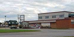
Plaisance cheese factory | |
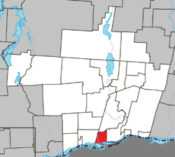 Location within Papineau RCM. | |
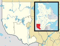 Plaisance Location in western Quebec. | |
| Coordinates: 45°37′N 75°07′W / 45.617°N 75.117°WCoordinates: 45°37′N 75°07′W / 45.617°N 75.117°W[1] | |
| Country |
|
| Province |
|
| Region | Outaouais |
| RCM | Papineau |
| Constituted | October 31, 1900 |
| Government[2] | |
| • Mayor | Paulette Lalande |
| • Federal riding | Argenteuil—Papineau—Mirabel |
| • Prov. riding | Papineau |
| Area[2][3] | |
| • Total | 50.20 km2 (19.38 sq mi) |
| • Land | 36.23 km2 (13.99 sq mi) |
| Population (2011)[3] | |
| • Total | 1,103 |
| • Density | 30.4/km2 (79/sq mi) |
| • Pop 2006-2011 |
|
| • Dwellings | 514 |
| Time zone | EST (UTC−5) |
| • Summer (DST) | EDT (UTC−4) |
| Postal code(s) | J0V 1S0 |
| Area code(s) | 819 |
| Highways |
|
| Website |
www |
Plaisance is a municipality in Papineau Regional County Municipality in western Quebec, Canada. The village is situated on the Ottawa River near the mouth of the Petite-Nation River, 70 km from Gatineau and 160 km from Montreal on Route 148.
The village is well known for its waterfalls located just north of town as well as a local cheese factory which was previously quite popular in the Outaouais region. There is also the Plaisance National Park, a large bird reserve between the main highway and the Ottawa River.
Demographics
Population trend:[4]
- Population in 2011: 1103 (2006 to 2011 population change: 7.7%)
- Population in 2006: 1024
- Population in 2001: 1101 (adjusted for boundary change)
- 2001 to 2006 population change: -7.0 %
- Population in 1996: 992
- Population in 1991: 992
Private dwellings (occupied by usual residents): 471
Languages:
- English as first language: 1.5%
- French as first language: 98.5%
- English and French as first language: 0%
- Other as first language: 0%
According to the Canada 2001 Census:
- Population: 1,004
- % Change (1996-2001): 1.2
- Dwellings: 413
- Area (km²): 30.75
- Density (persons per km²): 32.7
References
- ↑ Reference number 49772 of the Commission de toponymie du Québec (French)
- 1 2 Geographic code 80045 in the official Répertoire des municipalités (French)
- 1 2 "(Code 2480045) Census Profile". 2011 census. Statistics Canada. 2012.
- ↑ Statistics Canada: 1996, 2001, 2006, 2011 census
External links
 |
Saint-André-Avellin | | ||
| Lochaber | |
Papineauville | ||
| ||||
| | ||||
| Ottawa River / |
| Cities | |
|---|---|
| Municipalities | |
| Townships | |
| |
This article is issued from Wikipedia - version of the 12/13/2013. The text is available under the Creative Commons Attribution/Share Alike but additional terms may apply for the media files.