Lac-Achouakan, Quebec
| Lac-Achouakan | |
|---|---|
| Unorganized territory | |
 | |
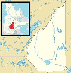 Lac-Achouakan Location in Saguenay–Lac-Saint-Jean Quebec. | |
| Coordinates: 48°07′N 71°39′W / 48.117°N 71.650°WCoordinates: 48°07′N 71°39′W / 48.117°N 71.650°W[1] | |
| Country |
|
| Province |
|
| Region | Saguenay–Lac-Saint-Jean |
| RCM | Lac-Saint-Jean-Est |
| Constituted | January 1, 1986 |
| Government[2] | |
| • Federal riding | Roberval—Lac-Saint-Jean |
| • Prov. riding | Lac-Saint-Jean |
| Area[2][3] | |
| • Total | 240.90 km2 (93.01 sq mi) |
| • Land | 227.35 km2 (87.78 sq mi) |
| Population (2011)[3] | |
| • Total | 0 |
| • Density | 0.0/km2 (0/sq mi) |
| • Pop 2006-2011 |
|
| • Dwellings | 0 |
| Time zone | EST (UTC-5) |
| • Summer (DST) | EDT (UTC-4) |
| Highways |
|
Lac-Achouakan is an unorganized territory in the Canadian province of Quebec, located in the regional county municipality of Lac-Saint-Jean-Est. It had a population of zero in the Canada 2006 Census, and covered a land area of 227.35 km2,[4] entirely within the Laurentides Wildlife Reserve. The western boundary of the territory is Bark River (Rivière aux Écorces), while Quebec Route 169 forms the eastern boundary.
The eponymous Lake Achouakan (48°06′34″N 71°38′55″W / 48.10944°N 71.64861°W) is near and drains into the Bark River. Its name comes from the Innu-aimun language and means "bridge lake".[5]
See also
References
- ↑ Reference number 149748 of the Commission de toponymie du Québec (French)
- 1 2 Ministère des Affaires municipales, des Régions et de l'Occupation du territoire - Répertoire des municipalités: Lac-Achouakan
- 1 2 "Lac-Achouakan census profile". 2011 Census data. Statistics Canada. Retrieved 2010-10-29.
- ↑ Canada 2006 Census Community Profiles: Lac-Achouakan. Statistics Canada.
- ↑ "Lac Achouakan" (in French). Commission de toponymie du Québec. Retrieved 2010-10-29.
 |
Lac-Ministuk | | ||
| Belle-Rivière | |
Lac-Ministuk | ||
| ||||
| | ||||
| Lac-Moncouche | Mont-Apica |
| Cities | |
|---|---|
| Municipalities | |
| Parishes | |
| Villages | |
| Unorganized territories | |
| |
This article is issued from Wikipedia - version of the 7/29/2016. The text is available under the Creative Commons Attribution/Share Alike but additional terms may apply for the media files.