Hébertville-Station, Quebec
| Hébertville-Station | |
|---|---|
| Village municipality | |
 | |
 | |
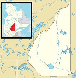 Hébertville-Station Location in Saguenay–Lac-Saint-Jean Quebec. | |
| Coordinates: 48°44′N 71°40′W / 48.733°N 71.667°WCoordinates: 48°44′N 71°40′W / 48.733°N 71.667°W[1] | |
| Country |
|
| Province |
|
| Region | Saguenay–Lac-Saint-Jean |
| RCM | Lac-Saint-Jean-Est |
| Constituted | February 18, 1903 |
| Named for | Nicolas-Tolentin Hébert[1] |
| Government[2] | |
| • Mayor | Réal Côté |
| • Federal riding | Roberval—Lac-Saint-Jean |
| • Prov. riding | Lac-Saint-Jean |
| Area[2][3] | |
| • Total | 32.70 km2 (12.63 sq mi) |
| • Land | 31.71 km2 (12.24 sq mi) |
| Population (2011)[3] | |
| • Total | 1,216 |
| • Density | 38.3/km2 (99/sq mi) |
| • Pop 2006-2011 |
|
| • Dwellings | 518 |
| Time zone | EST (UTC−5) |
| • Summer (DST) | EDT (UTC−4) |
| Postal code(s) | G0W 1T0 |
| Area code(s) | 418 and 581 |
| Highways |
|
| Census profile | 2493025[3] |
| MAMROT info | 93025[2] |
| Toponymie info | 28326[1] |
| Climate | Dfb |
Hébertville-Station is a village municipality in Lac-Saint-Jean-Est Regional County Municipality in the Saguenay–Lac-Saint-Jean region of Quebec.
See also
References
- 1 2 3 Reference number 28326 of the Commission de toponymie du Québec (French)
- 1 2 3 Ministère des Affaires municipales, des Régions et de l'Occupation du territoire - Répertoire des municipalités: Hébertville-Station
- 1 2 3 "(Code 2493025) Census Profile". 2011 census. Statistics Canada. 2012.
 |
Saint-Bruno | | ||
| Saint-Gédéon | |
Larouche | ||
| ||||
| | ||||
| Hébertville |
| Cities | |
|---|---|
| Municipalities | |
| Parishes | |
| Villages | |
| Unorganized territories | |
| |
This article is issued from Wikipedia - version of the 8/8/2016. The text is available under the Creative Commons Attribution/Share Alike but additional terms may apply for the media files.