La Paz, Abra
| La Paz | ||
|---|---|---|
| Municipality | ||
| ||
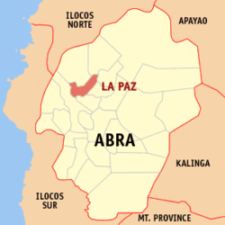 Location within Abra province | ||
.svg.png) La Paz Location within the Philippines | ||
| Coordinates: 17°41′N 120°41′E / 17.68°N 120.69°ECoordinates: 17°41′N 120°41′E / 17.68°N 120.69°E | ||
| Country | Philippines | |
| Region | Cordillera Administrative Region (CAR) | |
| Province | Abra | |
| District | Lone District of Abra | |
| Barangays | 12 (see Barangays) | |
| Government [1] | ||
| • Type | Sangguniang Bayan | |
| • Mayor | Joseph Sto. Niño B. Bernos | |
| Area[2] | ||
| • Total | 51.41 km2 (19.85 sq mi) | |
| Population (2015 census)[3] | ||
| • Total | 15,437 | |
| • Density | 300/km2 (780/sq mi) | |
| • Voter (2016)[4] | 9,018 | |
| Time zone | PST (UTC+8) | |
| ZIP code | 2826 | |
| IDD : area code | +63 (0)74 | |
| Income class | 5th class | |
| PSGC | 140108000 | |

La Paz, officially the Municipality of La Paz (Ilocano: Ili ti La Paz, Filipino: Bayan ng La Paz), is a municipality in the province of Abra in the Cordillera Administrative Region (CAR) of the Philippines. The population was 15,437 at the 2015 census.[3] In the 2016 election, it had 9,018 registered voters.[4]
Geography
La Paz is located at 17°41′N 120°41′E / 17.68°N 120.69°E.
According to the Philippine Statistics Authority, the municipality has a land area of 51.41 square kilometres (19.85 sq mi)[2] constituting 1.23% of the 4,165.25-square-kilometre- (1,608.21 sq mi) total area of Abra.
Barangays
La Paz is politically subdivided into 12 barangays.[5]
| PSGC | Barangay | Population | ±% p.a. | ||
|---|---|---|---|---|---|
| 2015[3] | 2010[6] | ||||
| 140108002 | Benben (Bonbon) | 3.6% | 554 | 551 | +0.10% |
| 140108003 | Bulbulala | 8.3% | 1,288 | 1,183 | +1.63% |
| 140108004 | Buli | 9.9% | 1,531 | 1,453 | +1.00% |
| 140108005 | Canan (Gapan) | 9.0% | 1,384 | 1,155 | +3.50% |
| 140108006 | Liguis | 6.3% | 973 | 911 | +1.26% |
| 140108007 | Malabbaga | 8.7% | 1,338 | 1,243 | +1.41% |
| 140108008 | Mudeng | 7.5% | 1,165 | 1,153 | +0.20% |
| 140108009 | Pidipid | 5.4% | 831 | 950 | −2.52% |
| 140108010 | Poblacion | 22.9% | 3,538 | 3,687 | −0.78% |
| 140108011 | San Gregorio | 8.9% | 1,374 | 1,178 | +2.97% |
| 140108012 | Toon | 6.2% | 960 | 928 | +0.65% |
| 140108013 | Udangan | 3.2% | 501 | 490 | +0.42% |
| Total | 15,437 | 14,882 | +0.70% | ||
Demographics
| Population census of La Paz | |||||||||||||||||||||||||
|---|---|---|---|---|---|---|---|---|---|---|---|---|---|---|---|---|---|---|---|---|---|---|---|---|---|
|
| ||||||||||||||||||||||||
| Source: PSA[3][6][7] | |||||||||||||||||||||||||
In the 2015 census, La Paz had a population of 15,437.[3] The population density was 300 inhabitants per square kilometre (780/sq mi).
In the 2016 election, it had 9,018 registered voters.[4]
References
- ↑ "Municipality". Quezon City, Philippines: Department of the Interior and Local Government. Retrieved 31 May 2013.
- 1 2 "Province: Abra". PSGC Interactive. Makati City, Philippines: Philippine Statistics Authority. Retrieved 28 October 2016.
- 1 2 3 4 5 "CORDILLERA ADMINISTRATIVE REGION (CAR)". Census of Population (2015): Total Population by Province, City, Municipality and Barangay (Report). PSA. Retrieved 20 June 2016.
- 1 2 3 "2016 National and Local Elections Statistics". Commission on Elections. 2016.
- ↑ "Municipal: La Paz, Abra". PSGC Interactive. Quezon City, Philippines: Philippine Statistics Authority. Retrieved 8 January 2016.
- 1 2 "CORDILLERA ADMINISTRATIVE REGION (CAR)". Census of Population and Housing (2010): Total Population by Province, City, Municipality and Barangay (Report). NSO. Retrieved 29 June 2016.
- ↑ "CORDILLERA ADMINISTRATIVE REGION (CAR)". Census of Population (1995, 2000 and 2007): Total Population by Province, City and Municipality (Report). NSO. Archived from the original on 24 June 2011.
External links
| Wikimedia Commons has media related to La Paz, Abra. |
 |
Danglas | Lagayan | | |
| Bangued | |
San Juan Dolores | ||
| ||||
| | ||||
| Tayum |
Bangued (capital) | |
| Municipalities | |
| Barangays | |