Kirkwood, California
| Kirkwood | |
|---|---|
| census-designated place | |
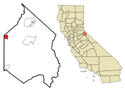 Location in Alpine County and the state of California | |
 Kirkwood Location in the United States | |
| Coordinates: 38°42′10″N 120°04′22″W / 38.70278°N 120.07278°WCoordinates: 38°42′10″N 120°04′22″W / 38.70278°N 120.07278°W | |
| Country |
|
| State |
|
| Counties | Alpine & Amador and El Dorado |
| Government | |
| • State Senate |
Ted Gaines (R) and Tom Berryhill (R)[1] |
| • State Assembly | Frank Bigelow (R)[2] |
| • U. S. Congress | Tom McClintock (R)[3] |
| Area | |
| • Total | 5.334 sq mi (13.815 km2) |
| • Land | 4.359 sq mi (11.290 km2) |
| • Water | 0.975 sq mi (2.525 km2) 18.28% |
| Elevation | 7,690 ft (2,344 m) |
| Population (2010) | |
| • Total | 158 |
| • Density | 30/sq mi (11/km2) |
| Time zone | Pacific (PST) (UTC-8) |
| • Summer (DST) | PDT (UTC-7) |
| ZIP code | 95646 |
| Area code(s) | 209 |
| FIPS code | 06-38646 |
| GNIS feature IDs | 262202, 2408489 |
Kirkwood (formerly, Kirk, Kirkwood's, and Roundtop)[4] is a census-designated place in Alpine and Amador[5] counties, California, United States. The population was 158 at the 2010 census.[6] Kirkwood's main attraction is the Kirkwood Mountain Resort. The town is accessible by State Route 88. Kirkwood is within the Eldorado National Forest.
History
Zack Kirkwood, a cattle rancher who had settled in the area, opened an inn, named Kirkwood's, in 1863 with the opening of the Amador/Nevada Wagon Toll Road, the primary route through the Sierra Nevada Mountains. The following year, Alpine County was created and the redrawing of the county borders placed the inn at the convergence of Alpine, El Dorado, and Amador counties (the borders were later changed so the inn is no longer in El Dorado County, but the original signpost marking the intersection of the three is still in the building). Eventually, the inn became a fashionable summer resort.
After Zack's death, the inn stayed in the family and continued to operate until 1966, when it was sold to an investment group, who then converted it into the present-day Kirkwood Mountain Resort.
Geography
According to the United States Census Bureau, the CDP has a total area of 5.3 square miles (14 km2), of which 4.4 square miles (11 km2) is land and 1.0 square mile (2.6 km2) (18.28%) is water.
Climate
Area has a Köppen Climate Classification of Csb, which is a dry-summer subtropical climate often referred to as "Mediterranean".[7]
| Climate data for Kirkwood, California | |||||||||||||
|---|---|---|---|---|---|---|---|---|---|---|---|---|---|
| Month | Jan | Feb | Mar | Apr | May | Jun | Jul | Aug | Sep | Oct | Nov | Dec | Year |
| Average high °C (°F) | 3 (38) |
4 (39) |
6 (42) |
8 (47) |
12 (54) |
17 (63) |
22 (72) |
22 (71) |
18 (65) |
13 (56) |
7 (45) |
4 (40) |
12 (53) |
| Average low °C (°F) | −9 (15) |
−9 (16) |
−8 (18) |
−6 (22) |
−2 (29) |
2 (36) |
6 (42) |
6 (42) |
3 (37) |
−1 (30) |
−6 (22) |
−8 (17) |
−3 (27) |
| Average precipitation mm (inches) | 221 (8.7) |
193 (7.6) |
168 (6.6) |
97 (3.8) |
53 (2.1) |
28 (1.1) |
15 (0.6) |
15 (0.6) |
30 (1) |
64 (2.5) |
132 (5.2) |
185 (7.3) |
1,190 (47) |
| Source: Weatherbase [8] | |||||||||||||
Demographics
2010
The 2010 United States Census[9] reported that Kirkwood had a population of 158. The population density was 29.6 people per square mile (11.4/km²). The racial makeup of Kirkwood was 153 (96.8%) White, 0 (0.0%) African American, 4 (2.5%) Native American, 1 (0.6%) Asian, 0 (0.0%) Pacific Islander, 0 (0.0%) from other races, and 0 (0.0%) from two or more races. Hispanic or Latino of any race were 6 persons (3.8%).
The Census reported that 134 people (84.8% of the population) lived in households, 24 (15.2%) lived in non-institutionalized group quarters, and 0 (0%) were institutionalized.
There were 72 households, out of which 13 (18.1%) had children under the age of 18 living in them, 26 (36.1%) were opposite-sex married couples living together, 1 (1.4%) had a female householder with no husband present, 2 (2.8%) had a male householder with no wife present. There were 7 (9.7%) unmarried opposite-sex partnerships, and 1 (1.4%) same-sex married couples or partnerships. 31 households (43.1%) were made up of individuals and 8 (11.1%) had someone living alone who was 65 years of age or older. The average household size was 1.86. There were 29 families (40.3% of all households); the average family size was 2.72.
The population was spread out with 20 people (12.7%) under the age of 18, 21 people (13.3%) aged 18 to 24, 41 people (25.9%) aged 25 to 44, 51 people (32.3%) aged 45 to 64, and 25 people (15.8%) who were 65 years of age or older. The median age was 44.5 years. For every 100 females there were 150.8 males. For every 100 females age 18 and over, there were 176.0 males.
There were 757 housing units at an average density of 141.9 per square mile (54.8/km²). 72 (9.5%) housing units were occupied year-round, of which 45 (62.5%) were owner-occupied, and 27 (37.5%) were occupied by renters. The homeowner vacancy rate was 5.6%; the rental vacancy rate was 10.0%. 96 people (60.8% of the population) lived in owner-occupied housing units and 38 people (24.1%) lived in rental housing units. 673 (88.9%) housing units were designated as seasonal use only.
2000
As of the census[10] of 2000, there were 96 people, 19 households, and 4 families residing in the CDP. The population density was 43.5 people per square mile (16.8/km²). There were 82 housing units at an average density of 37.1 per square mile (14.3/km²). The racial makeup of the CDP was 87.50% White, 2.08% Native American, 2.08% Asian, 1.04% Pacific Islander, and 7.29% from two or more races. 5.21% of the population were Hispanic or Latino of any race.
There were 19 households out of which 5.3% had children under the age of 18 living with them, 21.1% were married couples living together, and 78.9% were non-families. 5.3% of all households were made up of individuals and 5.3% had someone living alone who was 65 years of age or older. The average household size was 5.05 and the average family size was 2.75.
In the CDP the population was spread out with 7.3% under the age of 18, 62.5% from 18 to 24, 24.0% from 25 to 44, 5.2% from 45 to 64, and 1.0% who were 65 years of age or older. The median age was 22 years. For every 100 females there were 255.6 males. For every 100 females age 18 and over, there were 256.0 males.
The median income for a household in the CDP was $46,250, and the median income for a family was $0. Males had a median income of $17,917 versus $11,250 for females. The per capita income for the CDP was $14,853. There were no families and 0.9% of the population living below the poverty line, including 0.0% of those under 18 and 0.0% of those over 64.
Kirkwood in popular culture
In episode 4 of season 2 of The West Wing entitled "In This White House", Deputy White House Communications Director Sam Seaborn references Kirkwood in a television program debate about school funding, though he mistakenly states that Kirkwood is located in Oregon. His debate competitor corrects him by noting that the town is located in California.[11]
References
- ↑ "Senators". State of California. Retrieved March 18, 2013.
- ↑ "Members Assembly". State of California. Retrieved March 18, 2013.
- ↑ "California's 4th Congressional District - Representatives & District Map". Civic Impulse, LLC. Retrieved March 1, 2013.
- ↑ Durham, David L. (1998). California's Geographic Names: A Gazetteer of Historic and Modern Names of the State. Clovis, Calif.: Word Dancer Press. p. 1175. ISBN 1-884995-14-4.
- ↑ U.S. Geological Survey Geographic Names Information System: Kirkwood, California
- ↑ http://factfinder2.census.gov/faces/tableservices/jsf/pages/productview.xhtml?pid=DEC_10_PL_GCTPL1.ST13&prodType=table US Census Bureau
- ↑ Climate Summary for Kirkwood, California
- ↑ "Weatherbase.com". Weatherbase. 2013. Retrieved on August 21, 2013.
- ↑ "2010 Census Interactive Population Search: CA - Kirkwood CDP". U.S. Census Bureau. Retrieved July 12, 2014.
- ↑ "American FactFinder". United States Census Bureau. Retrieved 2008-01-31.
- ↑ http://westwing.bewarne.com/second/26ainsley.html
External links
Municipalities and communities of Alpine County, California, United States | ||
|---|---|---|
| CDPs | 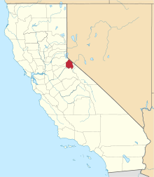 | |
| Unincorporated communities | ||
| Ghost towns |
| |
| Footnotes | ‡This populated place also has portions in an adjacent county or counties | |
Municipalities and communities of Amador County, California, United States | ||
|---|---|---|
| Cities |  | |
| CDPs | ||
| Unincorporated communities | ||
| Ghost towns |
| |
| Footnotes | ‡This CDP also has portions in an adjacent county or counties | |