Khursa
| Khursa | |
|---|---|
| Other transcription(s) | |
| • Arabic | كرزه |
| • Also spelled | Kharsa (official) |
 Khursa Location of Khursa within the Palestinian territories | |
| Coordinates: 31°26′25.31″N 34°59′56.62″E / 31.4403639°N 34.9990611°ECoordinates: 31°26′25.31″N 34°59′56.62″E / 31.4403639°N 34.9990611°E | |
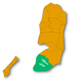
| Governorate | Hebron |
| Government | |
| • Type | Village council |
| Population (2007) | |
| • Jurisdiction | 3,440 |
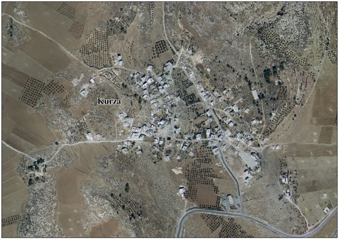
Khursa (Arabic: كرزه) is a Palestinian village located seven kilometers south-west of Hebron. The village is in the Hebron Governorate Southern West Bank. According to the Palestinian Central Bureau of Statistics, the village had a population of 3,440 in 2007.[1] The primary health care facilities for the village are designated by the Ministry of Health as level 2.[2]
Etymology
According to Palmer, the name Khirbet Kurza means "the ruin of kurza", a pine cone.[3]
History
In 1883, the Palestine Exploration Fund's Survey of Western Palestine found here "walls, caves, a well, and a vault, probably a cistern. There were several cisterns and a sacred place to the west. Some of the ruins appear to be modern, some ancient."[4]
Footnotes
- ↑ 2007 PCBS Census Palestinian Central Bureau of Statistics. p.119.
- ↑ West Bank Health care
- ↑ Palmer, 1881, p 400
- ↑ Conder and Kitchener, 1883, SWP III, p. 359
Bibliography
- Conder, Claude Reignier; Kitchener, H. H. (1883). The Survey of Western Palestine: Memoirs of the Topography, Orography, Hydrography, and Archaeology. 3. London: Committee of the Palestine Exploration Fund.
- Palmer, E. H. (1881). The Survey of Western Palestine: Arabic and English Name Lists Collected During the Survey by Lieutenants Conder and Kitchener, R. E. Transliterated and Explained by E.H. Palmer. Committee of the Palestine Exploration Fund.
External links
- Survey of Western Palestine, Map 21: IAA, Wikimedia commons
- Kurza Village (fact sheet)
- Kurza Village profile
- Kurza Village aerial photo
- The priorities and needs for development in Kurza village based on the community and local authorities’ assessment
| Cities |
|  |
|---|---|---|
| Towns |
| |
| Villages |
| |
| Refugee camps | ||