Khirbat al-Simia
| Khirbat al-Simia | |
|---|---|
| Other transcription(s) | |
| • Arabic | خربة السيميا |
| • Also spelled | As-Simiya (official) |
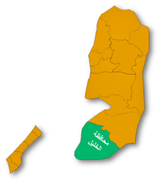
 Khirbat al-Simia Location of Khirbat al-Simia within the Palestinian territories | |
| Coordinates: 31°25′18.06″N 35°02′01.30″E / 31.4216833°N 35.0336944°ECoordinates: 31°25′18.06″N 35°02′01.30″E / 31.4216833°N 35.0336944°E | |
| Governorate | Hebron |
| Government | |
| • Type | Village council |
| Population (2006) | |
| • Jurisdiction | 1,705 |
Khirbat al-Simia (Arabic: خربة السيميا) is a Palestinian village located four kilometers north-west of As-Samu .The village is in the Hebron Governorate Southern West Bank. According to the Palestinian Central Bureau of Statistics, the village had a population of 1,705 in mid-year 2006.[1]
Since the Six-Day War in 1967, the village has been under Israeli occupation. The population in the 1967 census conducted by the Israeli authorities was 267.[2]
Footnotes
- ↑ Projected Mid -Year Population for Hebron Governorate by Locality 2004- 2006 Palestinian Central Bureau of Statistics
- ↑ Perlmann, Joel (November 2011 – February 2012). "The 1967 Census of the West Bank and Gaza Strip: A Digitized Version" (PDF). Levy Economics Institute. Retrieved 24 June 2016.
Bibliography
- Conder, Claude Reignier; Kitchener, H. H. (1883). The Survey of Western Palestine: Memoirs of the Topography, Orography, Hydrography, and Archaeology. 3. London: Committee of the Palestine Exploration Fund. (pp. 313, 378-9)
- Guérin, Victor (1869). Description Géographique Historique et Archéologique de la Palestine (in French). 1: Judee, pt. 3. Paris: L'Imprimerie Nationale.
- Hütteroth, Wolf-Dieter; Abdulfattah, Kamal (1977). Historical Geography of Palestine, Transjordan and Southern Syria in the Late 16th Century. Erlanger Geographische Arbeiten, Sonderband 5. Erlangen, Germany: Vorstand der Fränkischen Geographischen Gesellschaft. ISBN 3-920405-41-2. (p. 123)
- Mills, E., ed. (1932). Census of Palestine 1931. Population of Villages, Towns and Administrative Areas (PDF). Jerusalem: Government of Palestine. (p. 33: Kh. Simia counted under As-Samu)
- Palmer, E. H. (1881). The Survey of Western Palestine: Arabic and English Name Lists Collected During the Survey by Lieutenants Conder and Kitchener, R. E. Transliterated and Explained by E.H. Palmer. Committee of the Palestine Exploration Fund. (p. 408)
External links
- Welcome To Khirbat al-Simya
- Survey of Western Palestine, Map 21: IAA, Wikimedia commons
| Cities |
|  |
|---|---|---|
| Towns |
| |
| Villages |
| |
| Refugee camps | ||
This article is issued from Wikipedia - version of the 11/3/2016. The text is available under the Creative Commons Attribution/Share Alike but additional terms may apply for the media files.