Kawthaung
| Kawthaung ကော့သောင်းမြို့ | |
|---|---|
| Town | |
|
Border crossing at Kawthaung | |
 Kawthaung Location in Burma | |
| Coordinates: 9°59′N 98°33′E / 9.983°N 98.550°ECoordinates: 9°59′N 98°33′E / 9.983°N 98.550°E | |
| Country |
|
| Region | Tanintharyi Region |
| District | Kawthaung District |
| Township | Kawthaung Township |
| Time zone | MST (UTC+6.30) |

Kawthaung (Burmese: ကော့သောင်းမြို့; MLCTS: kau. saung: mrui., IPA: [kɔ̰θáʊɴ mjo̰]; Thai: เกาะสอง; rtgs: Ko Song, pronounced [kɔ̀ʔ sɔ̌ːŋ]; Malay: Pulodua, ڤولودوا) is in the southernmost part of Myanmar, located in Tanintharyi Region. During British rule in Burma between 1824 and 1948, it was known as Victoria Point.
History
Rakhine and Tanintharyi were transferred to British rule after the first Anglo-Burmese War of 1823-1826.
In 1859, a local group of Chinese and Thais settled at Maliwan (Thai Language) to the north of Kawthaung, a place with numerous lakes and flowering trees. In 1865, an Arab-Malay group led by Nayuda Ahmed, traveling and collecting sea products around Mergui Archipelago started a base and village at the bay of Victoria Point.
In 1872 the third mayor of Mergui District, Sir Ashly Din (1870–1875) assigned the first police officer to be stationed at Maliwan, a village 24 miles north of current Victoria Point. In 1891, the local government offices were moved from Maliwan to Kawthaung because Maliwan is located on the bank of a small shallow river, Maliwan Creek, unsuitable for large ships to enter and waiting tide water.
Geography
Kawthaung is located about 10°N and 98.30°E at the mouth of Kyan River on the Malay Peninsula. To its east is the Thai border town of Ranong. To its west, and south-west, the Andaman Sea opens up to the Indian Ocean and Bokpyin Township is located to the north. Most of the terrain in the area is mountainous.
Climate
Kawthaung has a tropical monsoon climate (Köppen climate classification Am). Temperatures are hot throughout the year. There is a winter dry season (December-March) and a summer wet season (April-November). Torrential rain falls from May to September, with over 500 millimetres (20 in) falling in each month.
| Climate data for Kawthaung | |||||||||||||
|---|---|---|---|---|---|---|---|---|---|---|---|---|---|
| Month | Jan | Feb | Mar | Apr | May | Jun | Jul | Aug | Sep | Oct | Nov | Dec | Year |
| Average high °C (°F) | 30.8 (87.4) |
32.1 (89.8) |
32.8 (91) |
32.9 (91.2) |
30.8 (87.4) |
29.0 (84.2) |
28.8 (83.8) |
28.5 (83.3) |
28.5 (83.3) |
29.2 (84.6) |
29.6 (85.3) |
29.9 (85.8) |
30.24 (86.43) |
| Average low °C (°F) | 22.1 (71.8) |
23.0 (73.4) |
23.8 (74.8) |
24.6 (76.3) |
24.3 (75.7) |
23.7 (74.7) |
23.5 (74.3) |
23.4 (74.1) |
23.2 (73.8) |
23.0 (73.4) |
23.0 (73.4) |
22.4 (72.3) |
23.33 (74) |
| Average precipitation mm (inches) | 16 (0.63) |
32 (1.26) |
22 (0.87) |
114 (4.49) |
500 (19.69) |
664 (26.14) |
692 (27.24) |
713 (28.07) |
638 (25.12) |
378 (14.88) |
155 (6.1) |
34 (1.34) |
3,958 (155.83) |
| Source: NOAA (1961-1990) [1] | |||||||||||||
Demographics
The majority of Kawthaung's population is made up of Bamar, Thai and other ethnic minorities such as the Shan, Karen, and Mon. Some Thai Muslims, alongside the Salone Sea Gypsies and Malays can also be found in Kawthaung. Burmese Chinese and Burmese Indians, who migrated to Kawthaung during colonial rule for tin mining and other industries also inhabit Kawthaung. Peranakan or Straits Chinese, called Pashu by the Burmese, can also be found in Kawthaung.[2]
The most common spoken language is Burmese, followed by Thai and Southern Thai as well as Shan, Moken, Karen, Mon, Kedah Malay and Chinese and Indian languages..
Most of the Bamar, Thai, Shan, Karen, Mon, Burmese Chinese and some portions of the Salone adhere to Theravada Buddhism. The Malays and Thai Muslims practice Islam.
Economy and local products
The main agriculture products are rubber, betel nut, cashew nut, coconut and oil palm. Mining and wood log industries which flourished in the past have now dried out. Although Kawthaung has a large port the fishing industry is not as large as in the past because of the government restriction on fishing vessels. Fishing still plays a significant role but engines are restricted to 28 hp. Tourism is bound to play a larger role for the local economy in the future as Myanmar's government is gradually lifting travel and immigration restrictions in the area. Since September 2013, tourists entering the country through Kawthaung are able to continue their journeys on land and exit through any other border crossing.[3]
An 8 megawatt coal-fired power plant was completed in 2012, amid local concerns on pollution issues.[4]
Immigration and Visa entry

Thai people can cross into Burma through Kawthaung with their Thai pass book. Other foreigners must have a passport that is valid for at least another 6 months and pay a fee. The border is popular for visa renewal with tourists staying in Phuket, Ko Tao, Ko Pha Ngan and other places in southern Thailand. A three-day (two-night) visa to Burma costs US$10.
Sister cities
See also
References
- ↑ "Kawthaung Climate Normals 1961-1990". National Oceanic and Atmospheric Administration. Retrieved January 12, 2013.
- ↑ http://peranakan.org.sg/index.php?option=com_content&task=view&id=247&Itemid=2
- ↑ "Myanmar Eases Travel Restrictions", http://www.burmaboating.com/blog/2013/9/4/myanmar-eases-travel-restrictions
- ↑ Aye Nai (5 March 2012). "Coal plant stirs unease in southern Burma". Democratic Voice of Burma. Retrieved 5 March 2012.
External links
 Kawthoung travel guide from Wikivoyage
- Kawthaung Map from Google Earth
- http://www.bugbitten.com/blogs/Asia/suziep_nz/Myanmar_Kawthaung.html
Capital: Dawei | ||
| Dawei District |  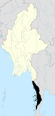 | |
| Kawthaung District |
| |
| Myeik District | ||
| Main cities and towns | ||