Kamothe
| Kamothe कामोठे Mansarovar / Khandeshwar | |
|---|---|
| Town | |
|
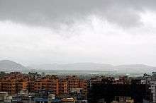
Kamothe-Sector36 at night | |
 Kamothe | |
| Coordinates: 19°01′00″N 73°05′47″E / 19.016804°N 73.096461°ECoordinates: 19°01′00″N 73°05′47″E / 19.016804°N 73.096461°E | |
| Country | India |
| State | Maharashtra |
| District | Raigad |
| Languages | |
| Time zone | IST (UTC+5:30) |
| PIN | 410209 |
| Telephone code | 022 -------- |
| Vehicle registration | MH 43,MH 46 and MH 06 |
| Nearest city | Mumbai |
| Climate | Pleasant except Hot and Humid during May–August (Köppen) |

Kamothe is a node of Navi Mumbai developed and maintained by CIDCO. Kamothe is located on the Sion Panvel Highway. It is the third node after Panvel and Khandeshwar towards Mumbai.
Introduction
Navi Mumbai is envisaged as a metro sized counter magnet to reduce the pressure on the Mumbai metropolis. It is planned as a polycentric new town with a series of nodal concentrations along mass transport corridors. When fully built, it is expected to have 14 such townships with a combined population holding capacity of four millions and one million jobs.
Location
The site of Kamothe adjoins the Central Business District of Belapur (CBD Belapur) of Navi Mumbai and is surrounded by Kharghar in its north, Taloja in north-east, Kalamboli in its east and Panvel in its south. The western region of Kamothe is a wet land area with enormous mangroves.
Characteristics
Kamothe is divided into 48 Sectors. Though these sectors are not placed evenly, they are systematic and are in a planned manner. Each sector has its own information map. Kamothe is one of the slum-free and modern node of Navi Mumbai.
Infrastructure
With Rs 40, 000 million (US $1140 million) worth of basic infrastructure already in place, Navi Mumbai is ready, willing and able to absorb the imminent, large scale shift of population, business, commerce and industry from Mumbai and elsewhere. Kamothe has large network of wide roads.
Almost all the bank branches have come in Kamothe. Today there are number of hotels and restaurants are functioning. Lots of schools and play schools have already started functioning in Kamothe. Now some big schools are also coming there.
Daily light cuts for one mint at least but on Tuesday light cuts up to 10 hrs.
CIDCO Garabage collection system is not up to the mark, at times garbage are seen remain in the dustbin till next day.
A big sewage plant is functioning in Kamothe.
Due to heavy rains and shoddy work most of the part of the year roads are in very bad condition with too much of potholes. Even two wheeler traffic is very difficult in these roads.
Hawkers and small vendors have taken the entire footpath area and public are forced to walk over the road.
Kamothe drainage are directly dump in to sea & river.
Pollution is too much, sometime it's so much that breathing become difficult with chest pain & watery eye too sometime
Mtnl Landlines and all other private telephone network is available at Kamothe for communication purpose.
Kamothe Police Station is in Plot#1, Sector 7 and started fully functioning in 2013.
Kamothe boasts of number of ready and under-construction projects both in the commercial and residential segments. Bhoomi Homes, Manas are some of the oldest residential complexes of Kamothe.
The upcoming Navi Mumbai International Airport near Kamothe has boomed the real estate of Kamothe on new heights.
There are a number of residential projects sprung up in Kamothe. CIDCO also has plans to build shopping malls which should make the town one of the better locations in Navi Mumbai
Transportation
Kamothe is located on the outskirts of Mumbai. It lies in what is commonly regarded as the Konkan part of Maharashtra and falls in Raigad district.
Kamothe has two railway stations Mansarovar and Khandeshwar that lie on the harbour line, a part of Mumbai suburban railways. It takes 70 minutes from Mumbai CST (छत्रपति शिवाजी टर्मिनस) for a local to reach Mansarovar and 73minutes to Khandeshwar.

The new wide road that connects Mansarovar and Khandeshwar railway stations will become operational soon. Auto rickshaws provide the primary means of personal local transportation. They ply from Mansarovar railway station to the Mumbai-Pune Expressway. Also from Khandeshwar station to Sector 22/24 kamothe, Sector 18 kamothe & Khanda colony. These auto rickshaws serve share-rickshaw facility.
NMMT and MSRTC/ST buses serve as a much cheaper means of transportation over a long distance to various nodes through Navi Mumbai. Buses starting from Panvel halt at Kamothe bus stop on the highway allowing passengers direct and fast passage to destinations across Mumbai, Thane and Navi Mumbai. NMMT bus stand had come up near Mansarovar & Khandeshwar railway station.
NMMT had started Route No. 57 from Mansarovar Railway station to Khandeshwar Railway Station from 01/01/2015. This had become most profitable route ever for NMMT in its history. Now days Route no. 59 also started from Khandeshwar railway station to Vichumbe ( New Panvel) via khanda colony.
BEST buses are available between Kalamboli and Dadar and has a stop for Kamothe on highway. There are BEST AC Kinglong bus from Kalamboli to Wadala at a frequency of 25 minutes.

Navi Mumbai Metro Railway (proposed)
The first phase of Navi Mumbai metro railway (proposed) is likely to be operational in later half of 2011-20 decade. Kamothe will have its metro station in Sector-10.It will ease the load of passengers travelling during peak hours.
Navi Mumbai International Airport
The proposed new international airport is expected to be functional by 2018 in the Kopra area of Panvel, adjoining Kamothe. This project was sanctioned by CIDCO on August 1, 2009. The site is approximately at a distance of 2 miles from Kamothe. There is a plan to build a sea link (Mumbai trans-harbour link) between Nhava Sheva and Sewri in Mumbai thus making the new airport accessible to not only Navi Mumbai residents but also the residents of south Mumbai and Pune.
| Wikimedia Commons has media related to Navi Mumbai. |