Jefferson, Ohio
| Jefferson, Ohio | |
|---|---|
| Village | |
|
| |
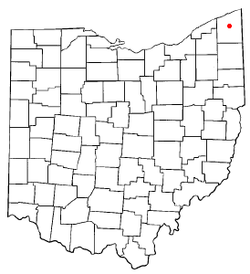 Location of Jefferson, Ohio | |
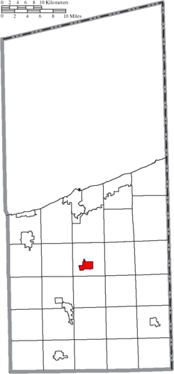 Location of Jefferson in Ashtabula County | |
| Coordinates: 41°44′14″N 80°46′19″W / 41.73722°N 80.77194°WCoordinates: 41°44′14″N 80°46′19″W / 41.73722°N 80.77194°W | |
| Country | United States |
| State | Ohio |
| County | Ashtabula |
| Government | |
| • Mayor | Judy Maloney |
| Area[1] | |
| • Total | 2.52 sq mi (6.53 km2) |
| • Land | 2.52 sq mi (6.53 km2) |
| • Water | 0 sq mi (0 km2) |
| Elevation[2] | 958 ft (292 m) |
| Population (2010)[3] | |
| • Total | 3,120 |
| • Estimate (2012[4]) | 3,088 |
| • Density | 1,238.1/sq mi (478.0/km2) |
| Time zone | Eastern (EST) (UTC-5) |
| • Summer (DST) | EDT (UTC-4) |
| ZIP code | 44047 |
| Area code(s) | 440 |
| FIPS code | 39-38500[5] |
| GNIS feature ID | 1042061[2] |
| Website | http://www.jeffersonohio.us/ |
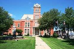
Jefferson is a village in Ashtabula County, Ohio, United States. The population was 3,120 at the 2010 census. It is the county seat of Ashtabula County.[6] Modern-day Jefferson sports the world's only perambulator museum and a historical complex including several restored 19th-century buildings. Joshua Giddings' law office has also been restored as a museum. Annual village events include the Ashtabula County Fair, the Strawberry Festival, Jefferson Days, and the Covered Bridge Festival.
History
Jefferson was officially founded by Gideon Granger—U.S. Postmaster General during Thomas Jefferson's administration—in 1803. He envisioned the new settlement as a "Philadelphia of the West," and early plans for the village were based upon the layout of that city. A cabin was erected by Granger's agent in 1804, but the settlement's first permanent residents arrived only in 1805: the Samuel Wilson family. Wilson, misled by land agents, moved to Ohio in late autumn expecting to find a thriving city on Granger's land. Instead, he found a wilderness, broken only by trees emblazoned with Philadelphian street names, marking where future streets would be built. Wilson himself died after two weeks of herculean effort to prepare for the winter, but his family stayed on as the first citizens of Jefferson.
Jefferson's two most famous sons were Congressman Joshua Giddings and Senator Benjamin Wade, two prominent Republican abolitionists. In 1831 the two men formed a law practice in Jefferson (which became the county seat of newly formed Ashtabula County in 1811) and worked together until Giddings was elected to Congress in 1838. Wade successfully ran for the Ohio State Senate in 1837, then won election to the US Senate in 1851. Both were instrumental in the foundation of the Republican Party and defied the "Gag Rule" barring discussion of slavery prior to the American Civil War. Jefferson itself was a hotbed of abolitionism. John Brown spoke in the village, and several of its houses acted as stations on the Underground Railway. During the American Civil War, it trained Union recruits at Fort Giddings, which stood in the village at the current site of the fairgrounds.
E.T. Ernest, the first American to drive an automobile from coast to coast, was also a Jefferson resident.
Geography
Jefferson is located at 41°44′14″N 80°46′19″W / 41.73722°N 80.77194°W (41.737118, -80.772019).[7]
According to the United States Census Bureau, the village has a total area of 2.52 square miles (6.53 km2), all land.[1]
The village's principal watercourse is Mill Creek.
Demographics
| Historical population | |||
|---|---|---|---|
| Census | Pop. | %± | |
| 1850 | 439 | — | |
| 1860 | 658 | 49.9% | |
| 1870 | 869 | 32.1% | |
| 1880 | 1,008 | 16.0% | |
| 1890 | 1,346 | 33.5% | |
| 1900 | 1,319 | −2.0% | |
| 1910 | 1,461 | 10.8% | |
| 1920 | 1,532 | 4.9% | |
| 1930 | 1,691 | 10.4% | |
| 1940 | 1,676 | −0.9% | |
| 1950 | 1,844 | 10.0% | |
| 1960 | 2,116 | 14.8% | |
| 1970 | 2,472 | 16.8% | |
| 1980 | 2,952 | 19.4% | |
| 1990 | 3,331 | 12.8% | |
| 2000 | 3,572 | 7.2% | |
| 2010 | 3,120 | −12.7% | |
| Est. 2015 | 3,041 | [8] | −2.5% |
2010 census
As of the census[3] of 2010, there were 3,120 people, 1,290 households, and 809 families residing in the village. The population density was 1,238.1 inhabitants per square mile (478.0/km2). There were 1,400 housing units at an average density of 555.6 per square mile (214.5/km2). The racial makeup of the village was 97.1% White, 1.1% African American, 0.1% Native American, 0.4% Asian, 0.1% from other races, and 1.3% from two or more races. Hispanic or Latino of any race were 1.0% of the population.
There were 1,290 households of which 30.9% had children under the age of 18 living with them, 43.4% were married couples living together, 14.3% had a female householder with no husband present, 5.0% had a male householder with no wife present, and 37.3% were non-families. 32.1% of all households were made up of individuals and 16.3% had someone living alone who was 65 years of age or older. The average household size was 2.30 and the average family size was 2.89.
The median age in the village was 43 years. 22.5% of residents were under the age of 18; 7.1% were between the ages of 18 and 24; 22.7% were from 25 to 44; 27.3% were from 45 to 64; and 20.4% were 65 years of age or older. The gender makeup of the village was 45.6% male and 54.4% female.
2000 census
As of the census[5] of 2000, there were 3,572 people, 1,357 households, and 933 families residing in the village. The population density was 1,566.5 people per square mile (604.9/km²). There were 1,425 housing units at an average density of 625.0 per square mile (241.3/km²). The racial makeup of the village was 97.17% White, 1.43% African American, 0.25% Native American, 0.22% Asian, 0.14% from other races, and 0.78% from two or more races. Hispanic or Latino of any race were 0.62% of the population. 19.1% were of German, 14.6% English, 12.7% Italian, 11.3% Irish and 10.8% American ancestry according to Census 2000.
There were 1,357 households out of which 34.0% had children under the age of 18 living with them, 51.1% were married couples living together, 14.2% had a female householder with no husband present, and 31.2% were non-families. 27.7% of all households were made up of individuals and 13.1% had someone living alone who was 65 years of age or older. The average household size was 2.47 and the average family size was 2.99.
In the village the population was spread out with 25.3% under the age of 18, 9.9% from 18 to 24, 26.8% from 25 to 44, 21.0% from 45 to 64, and 17.1% who were 65 years of age or older. The median age was 37 years. For every 100 females there were 85.4 males. For every 100 females age 18 and over, there were 82.4 males.
The median income for a household in the village was $36,883, and the median income for a family was $46,313. Males had a median income of $34,341 versus $25,036 for females. The per capita income for the village was $18,371. About 3.9% of families and 5.8% of the population were below the poverty line, including 6.4% of those under age 18 and 8.0% of those age 65 or over.
Notable people

- Julius C. Burrows - U.S. Representative and a U.S. Senator from Michigan.
- Theodore Elijah Burton - U.S. Representative and U.S. Senator
- Joshua Reed Giddings - American statesman, prominent in the anti-slavery conflict
- Matthew Hatchette - former NFL wide receiver with Minnesota Vikings and New York Jets
- John L. Hervey - prominent authority on thoroughbred horses
- Elbert L. Lampson - Lieutenant Governor of Ohio, former state Senator
- Platt Rogers Spencer - creator of Spencerian penmanship, a popular system of cursive handwriting
- George Van Tassel - UFO enthusiast and religious cult leader
- Benjamin Franklin Wade - lawyer and U.S. Senator, President pro tempore of Senate
References
- 1 2 "US Gazetteer files 2010". United States Census Bureau. Retrieved 2013-01-06.
- 1 2 "US Board on Geographic Names". United States Geological Survey. 2007-10-25. Retrieved 2008-01-31.
- 1 2 "American FactFinder". United States Census Bureau. Retrieved 2013-01-06.
- ↑ "Population Estimates". United States Census Bureau. Retrieved 2013-06-17.
- 1 2 "American FactFinder". United States Census Bureau. Retrieved 2008-01-31.
- ↑ "Find a County". National Association of Counties. Retrieved 2011-06-07.
- ↑ "US Gazetteer files: 2010, 2000, and 1990". United States Census Bureau. 2011-02-12. Retrieved 2011-04-23.
- ↑ "Annual Estimates of the Resident Population for Incorporated Places: April 1, 2010 to July 1, 2015". Retrieved July 2, 2016.
- ↑ "Census of Population and Housing". Census.gov. Retrieved June 4, 2015.
External links
Municipalities and communities of Ashtabula County, Ohio, United States | ||
|---|---|---|
| Cities | 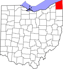 | |
| Villages | ||
| Townships | ||
| CDPs | ||
| Unincorporated communities | ||