Ithaca, Ohio
| Ithaca, Ohio | |
|---|---|
| Village | |
|
Entering Ithaca from the north | |
 Location in Darke County and the state of Ohio. | |
| Coordinates: 39°56′18″N 84°33′12″W / 39.93833°N 84.55333°WCoordinates: 39°56′18″N 84°33′12″W / 39.93833°N 84.55333°W | |
| Country | United States |
| State | Ohio |
| County | Darke |
| Township | Twin |
| Area[1] | |
| • Total | 0.03 sq mi (0.08 km2) |
| • Land | 0.03 sq mi (0.08 km2) |
| • Water | 0 sq mi (0 km2) |
| Elevation[2] | 1,033 ft (315 m) |
| Population (2010)[3] | |
| • Total | 136 |
| • Estimate (2012[4]) | 135 |
| • Density | 4,533.3/sq mi (1,750.3/km2) |
| Time zone | Eastern (EST) (UTC-5) |
| • Summer (DST) | EDT (UTC-4) |
| ZIP code | 45304 |
| Area code(s) | 937 |
| FIPS code | 39-37604[5] |
| GNIS feature ID | 1064893[2] |

Ithaca is a village in Darke County, Ohio, United States. The population was 102 at the 2000 census and 136 in 2010.[6]
History
John Colville platted Ithaca in 1832 and gave it the name of "Twinsborough." Its location on an established highway and along the Ohio Electric Railway caused the community to grow rapidly.[7] The present name is a transfer from Ithaca, New York.[8]
Geography
Ithaca is located at 39°56′18″N 84°33′12″W / 39.93833°N 84.55333°W (39.938274, -84.553396).[9]
According to the United States Census Bureau, the village has a total area of 0.03 square miles (0.08 km2), all land.[1]
Demographics
| Historical population | |||
|---|---|---|---|
| Census | Pop. | %± | |
| 1870 | 150 | — | |
| 1880 | 128 | −14.7% | |
| 1890 | 135 | 5.5% | |
| 1900 | 113 | −16.3% | |
| 1910 | 100 | −11.5% | |
| 1920 | 82 | −18.0% | |
| 1930 | 76 | −7.3% | |
| 1940 | 142 | 86.8% | |
| 1950 | 146 | 2.8% | |
| 1960 | 153 | 4.8% | |
| 1970 | 161 | 5.2% | |
| 1980 | 130 | −19.3% | |
| 1990 | 119 | −8.5% | |
| 2000 | 102 | −14.3% | |
| 2010 | 136 | 33.3% | |
| Est. 2015 | 134 | [10] | −1.5% |
2010 census
As of the census[3] of 2010, there were 136 people, 44 households, and 35 families residing in the village. The population density was 4,533.3 inhabitants per square mile (1,750.3/km2). There were 52 housing units at an average density of 1,733.3 per square mile (669.2/km2). The racial makeup of the village was 99.3% White and 0.7% Asian. Hispanic or Latino of any race were 3.7% of the population.
There were 44 households of which 40.9% had children under the age of 18 living with them, 75.0% were married couples living together, 4.5% had a female householder with no husband present, and 20.5% were non-families. 6.8% of all households were made up of individuals. The average household size was 3.09 and the average family size was 3.37.
The median age in the village was 34.3 years. 27.9% of residents were under the age of 18; 12.6% were between the ages of 18 and 24; 27.2% were from 25 to 44; 19.9% were from 45 to 64; and 12.5% were 65 years of age or older. The gender makeup of the village was 46.3% male and 53.7% female.
2000 census
As of the census[5] of 2000, there were 102 people, 36 households, and 28 families residing in the village. The population density was 3,363.0 people per square mile (1,312.7/km²). There were 38 housing units at an average density of 1,252.9 per square mile (489.1/km²). The racial makeup of the village was 100.00% White.
There were 36 households out of which 41.7% had children under the age of 18 living with them, 63.9% were married couples living together, 8.3% had a female householder with no husband present, and 22.2% were non-families. 16.7% of all households were made up of individuals and 8.3% had someone living alone who was 65 years of age or older. The average household size was 2.83 and the average family size was 3.21.
In the village the population was spread out with 30.4% under the age of 18, 8.8% from 18 to 24, 29.4% from 25 to 44, 22.5% from 45 to 64, and 8.8% who were 65 years of age or older. The median age was 36 years. For every 100 females there were 112.5 males. For every 100 females age 18 and over, there were 97.2 males.
The median income for a household in the village was $39,500, and the median income for a family was $47,083. Males had a median income of $33,750 versus $27,500 for females. The per capita income for the village was $14,647. None of the population and none of the families were below the poverty line.
Village Officers
Mayor, David H. Peterson
Council President, Kim McCoy
Council Members: Barbara Rice Mary Ray Bo Ray Dick Hoover Rob Brown
References
- 1 2 "US Gazetteer files 2010". United States Census Bureau. Retrieved 2013-01-06.
- 1 2 "US Board on Geographic Names". United States Geological Survey. 2007-10-25. Retrieved 2008-01-31.
- 1 2 "American FactFinder". United States Census Bureau. Retrieved 2013-01-06.
- ↑ "Population Estimates". United States Census Bureau. Retrieved 2013-06-17.
- 1 2 "American FactFinder". United States Census Bureau. Retrieved 2008-01-31.
- ↑ http://factfinder2.census.gov/faces/tableservices/jsf/pages/productview.xhtml?pid=DEC_10_DP_DPDP1&prodType=table
- ↑ Wilson, Frazer Ells (1914). History of Darke County, Ohio, from its earliest settlement to the present time, Vol. 1. Milford, Ohio: Hobart Publishing Company. p. 595.
- ↑ Overman, William Daniel (1958). Ohio Town Names. Akron, OH: Atlantic Press. p. 65.
- ↑ "US Gazetteer files: 2010, 2000, and 1990". United States Census Bureau. 2011-02-12. Retrieved 2011-04-23.
- ↑ "Annual Estimates of the Resident Population for Incorporated Places: April 1, 2010 to July 1, 2015". Retrieved July 2, 2016.
- ↑ "Census of Population and Housing". Census.gov. Retrieved June 4, 2015.
Municipalities and communities of Darke County, Ohio, United States | ||
|---|---|---|
| City | 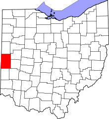 | |
| Villages | ||
| Townships | ||
| Unincorporated communities | ||
| Footnotes | ‡This populated place also has portions in an adjacent county or counties | |