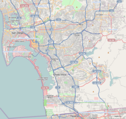
Initial Point of Boundary Between U.S. and Mexico
| Initial Point of Boundary Between U.S. and Mexico | |
|---|---|
|
The monument in a 1974 photo | |
| Location | S of Imperial Beach off Monument Rd., Imperial Beach, California |
| Coordinates | 32°32′4″N 117°7′19″W / 32.53444°N 117.12194°WCoordinates: 32°32′4″N 117°7′19″W / 32.53444°N 117.12194°W |
| Area | 0.1 acres (0.040 ha) |
| Built | 1851 |
| Governing body | Federal |
| Designated | September 6, 1974 |
| Reference no. | 74000550[1] |
 | |
.jpg)
The Initial Point of Boundary Between U.S. and Mexico, Monument No. 258, was first established as a cairn of rocks in 1849 following the signing of the Treaty of Guadalupe Hidalgo. A white marble shaft was manufactured in New York, transported around Cape Horn on the USS Supply to San Diego, and erected and dedicated at the site in Imperial Beach in June, 1851. The marble monument was an obelisk about 20 feet (6.1 m) in height, resting on a marble pedestal. On its top was an inverted acorn to symbolize the strength and stature of the California live oak tree.[2]
In 1894 it was found that the initial monument had become so mutilated by visitors that its outlines were nearly destroyed, and its inscriptions partly obliterated. The Barlow-Blanco Commission had the monument renovated in San Diego, reconstructed at the site, and protected with an enclosure in 1894. Excepting for normal wear and tear and some slight vandalism, as of 1974 the marble monument as reconstructed in 1894 still stood at its original site.[2]
The significance of the monument is stated in the inscription on the west side of the original marble shaft:[2]
"Initial point of Boundary between the United States and Mexico, established by the Joint Commission, 10 October, A.D. 1849, Agreeably to the Treaty dated at the City of Guadalupe, Hidalgo, February 2, A.D. 1848. John B. Weller, U.S. Commissioner. Andrew B. Gray, U.S. Surveyor.
The monument is the westernmost boundary marker on the international boundary between the United States and Mexico and as such has since its erection and will throughout the future mark the southwestern corner of the Continental United States.[2]
Pursuant to President Richard Nixon's "Legacy of Parks", Mrs. Pat Nixon in August 1971 turned over 372 acres (151 ha) of surplus Navy land, formerly known as Border Field, to the people of California as a beach park. The area is now known as Border Field State Park.[2]
References
- ↑ National Park Service (2010-07-09). "National Register Information System". National Register of Historic Places. National Park Service.
- 1 2 3 4 5 Raney, Morris H. International Boundary and Water Commission, U.S. Section. Nomination form to the National Register of Historic Places (copied verbatim, allowed as per WP:PD, as the author is a federal employee acting in an official capacity)
| Border crossing facilities |  | |
|---|---|---|
| Buildings and facilities on the border | ||
| Communities and areas | ||
| Cities | ||
| Counties and municipalities | ||
| Subregions | ||
| Authorities | ||
| Related | ||
| ||
| Topics | |
|---|---|
| Lists by states |
|
| Lists by insular areas | |
| Lists by associated states | |
| Other areas | |
| |