Hines, Oregon
| Hines, Oregon | |
|---|---|
| City | |
|
Hines Middle School and water tower | |
 Location in Oregon | |
| Coordinates: 43°33′33″N 119°5′0″W / 43.55917°N 119.08333°WCoordinates: 43°33′33″N 119°5′0″W / 43.55917°N 119.08333°W | |
| Country | United States |
| State | Oregon |
| County | Harney |
| Incorporated | 1930 |
| Government | |
| • Mayor | Nikki Morgan |
| Area[1] | |
| • Total | 2.13 sq mi (5.52 km2) |
| • Land | 2.08 sq mi (5.39 km2) |
| • Water | 0.05 sq mi (0.13 km2) |
| Elevation | 4,155 ft (1,266 m) |
| Population (2010)[2] | |
| • Total | 1,563 |
| • Estimate (2012[3]) | 1,521 |
| • Density | 751.4/sq mi (290.1/km2) |
| Time zone | Pacific (UTC-8) |
| • Summer (DST) | Pacific (UTC-7) |
| ZIP code | 97738 |
| Area code(s) | 541 |
| FIPS code | 41-34250[2] |
| GNIS feature ID | 1121843[4] |
| Website | ci.hines.or.us |

Hines is a city in Harney County, Oregon, United States. The population was 1,563 at the 2010 census.
History
A community named Herrick was formed just southwest of Burns when railroad promoter and sawmill operator Fred Herrick founded a lumber company there.[5] Edward Hines bought the railroad and lumber company from Herrick in 1928, and a post office named Hines was established in 1931 to serve the Edward Hines Lumber Company mill and surrounding community.[5] The mill has since changed hands at least two more times.[5]
Geography
According to the United States Census Bureau, the city has a total area of 2.13 square miles (5.52 km2), of which, 2.08 square miles (5.39 km2) is land and 0.05 square miles (0.13 km2) is water.[1]
Demographics
| Historical population | |||
|---|---|---|---|
| Census | Pop. | %± | |
| 1940 | 677 | — | |
| 1950 | 918 | 35.6% | |
| 1960 | 1,207 | 31.5% | |
| 1970 | 1,407 | 16.6% | |
| 1980 | 1,632 | 16.0% | |
| 1990 | 1,452 | −11.0% | |
| 2000 | 1,664 | 14.6% | |
| 2010 | 1,563 | −6.1% | |
| Est. 2015 | 1,525 | [6] | −2.4% |
2010 census
As of the census of 2010, there were 1,563 people, 678 households, and 423 families residing in the city. The population density was 751.4 inhabitants per square mile (290.1/km2). There were 738 housing units at an average density of 354.8 per square mile (137.0/km2). The racial makeup of the city was 94.9% White, 0.3% African American, 1.0% Native American, 0.4% Asian, 1.2% from other races, and 2.4% from two or more races. Hispanic or Latino of any race were 3.1% of the population.[2]
There were 678 households of which 28.8% had children under the age of 18 living with them, 49.7% were married couples living together, 9.9% had a female householder with no husband present, 2.8% had a male householder with no wife present, and 37.6% were non-families. 32.0% of all households were made up of individuals and 17.9% had someone living alone who was 65 years of age or older. The average household size was 2.25 and the average family size was 2.83.[2]
The median age in the city was 42.5 years. 24.1% of residents were under the age of 18; 6% were between the ages of 18 and 24; 21.8% were from 25 to 44; 28.2% were from 45 to 64; and 19.8% were 65 years of age or older. The gender makeup of the city was 49.6% male and 50.4% female.[2]
2000 census
As of the census of 2000, there were 1,623 people, 641 households, and 473 families residing in the city. The population density was 684.8 people per square mile (264.4/km²). There were 689 housing units at an average density of 290.7 per square mile (112.2/km²). The racial makeup of the city was 94.39% White, 0.12% African American, 2.71% Native American, 0.55% Asian, 0.06% Pacific Islander, 0.12% from other races, and 2.03% from two or more races. Hispanic or Latino of any race were 1.66% of the population.[2]
There were 641 households out of which 31.8% had children under the age of 18 living with them, 63.5% were married couples living together, 6.4% had a female householder with no husband present, and 26.2% were non-families. 21.8% of all households were made up of individuals and 8.7% had someone living alone who was 65 years of age or older. The average household size was 2.50 and the average family size was 2.89.[2]
In the city the population was dispersal was 26.6% under the age of 18, 6.3% from 18 to 24, 27.0% from 25 to 44, 26.1% from 45 to 64, and 14.0% who were 65 years of age or older. The median age was 40 years. For every 100 females there were 106.5 males. For every 100 females age 18 and over, there were 98.7 males.[2]
The median income for a household in the city was $40,917, and the median income for a family was $43,452. Males had a median income of $32,772 versus $22,458 for females. The per capita income for the city was $15,783. About 6.6% of families and 9.9% of the population were below the poverty line, including 10.1% of those under age 18 and 17.3% of those age 65 or over.[2]
References
- 1 2 "US Gazetteer files 2010". United States Census Bureau. Archived from the original on January 24, 2012. Retrieved 2012-12-21.
- 1 2 3 4 5 6 7 8 9 "American FactFinder". United States Census Bureau. Retrieved 2012-12-21.
- ↑ "Population Estimates". United States Census Bureau. Archived from the original on June 17, 2013. Retrieved 2013-06-02.
- ↑ "US Board on Geographic Names". United States Geological Survey. 2007-10-25. Retrieved 2008-01-31.
- 1 2 3 McArthur, Lewis A.; McArthur, Lewis L. (2003) [1928]. Oregon Geographic Names (7th ed.). Portland, Oregon: Oregon Historical Society Press. p. 469. ISBN 978-0875952772.
- ↑ "Annual Estimates of the Resident Population for Incorporated Places: April 1, 2010 to July 1, 2015". Retrieved July 2, 2016.
- ↑ "Census of Population and Housing". Census.gov. Archived from the original on May 11, 2015. Retrieved June 4, 2015.
External links
![]() Media related to Hines, Oregon at Wikimedia Commons
Media related to Hines, Oregon at Wikimedia Commons
- City of Hines Profile from Harney County Economic Development
- Company Towns in The Oregon Encyclopedia
- Hines in the Oregon Blue Book
- Hines and the Edward Hines Lumber Company in The Oregon Encyclopedia
Municipalities and communities of Harney County, Oregon, United States | ||
|---|---|---|
| Cities | 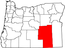 | |
| CDP | ||
| Other unincorporated communities | ||
| Indian reservation | ||
| Ghost town | ||