Harveyville, Kansas
| Harveyville, Kansas | |
|---|---|
| City | |
 Location within Wabaunsee County and Kansas | |
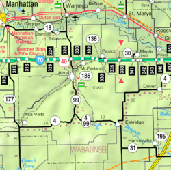 KDOT map of Wabaunsee County (legend) | |
| Coordinates: 38°47′26″N 95°57′44″W / 38.79056°N 95.96222°WCoordinates: 38°47′26″N 95°57′44″W / 38.79056°N 95.96222°W | |
| Country | United States |
| State | Kansas |
| County | Wabaunsee |
| Government | |
| • Type | Mayor–Council |
| • Mayor | Dustin Kuntz[1] |
| • City Clerk | Ellen Bayless[1] |
| Area[2] | |
| • Total | 0.13 sq mi (0.34 km2) |
| • Land | 0.13 sq mi (0.34 km2) |
| • Water | 0 sq mi (0 km2) |
| Elevation | 1,138 ft (347 m) |
| Population (2010)[3] | |
| • Total | 236 |
| • Estimate (2012[4]) | 237 |
| • Density | 1,800/sq mi (690/km2) |
| Time zone | Central (CST) (UTC-6) |
| • Summer (DST) | CDT (UTC-5) |
| ZIP code | 66431 |
| Area code | 785 |
| FIPS code | 20-30575 [5] |
| GNIS feature ID | 0479431 [6] |
Harveyville is a city in Wabaunsee County, Kansas, United States. As of the 2010 census, the city population was 236.[7] It is 8.5 miles (13.7 km) northwest of the city of Burlingame.
History
Harveyville was founded in 1880. It was named for Henry Harvey, a missionary to the Shawnee Indians and early settler at the town site.[8] Harveyville was incorporated as a city in 1905.[9]
2012 Tornado
On February 28, 2012, around 9:02 pm, an EF-2 tornado caused damage to Harveyville.[10][11] Approximately 40 percent of Harveyville's buildings had significant damage and one of the town's two churches was completely destroyed. Preliminary damage assessments in Harveyville listed 28 homes as not livable with 36 sustaining moderate damage, six with minor damage and one commercial building damaged.[12] Twelve people were injured and one death, but no missing people.[13][14] The National Weather Service determined the tornado was on the ground for 4 minutes and had a maximum width of 150 yards (140 m). It touched down about 1 mile (1.6 km) southwest of Harveyville and ended 4 miles (6.4 km) northeast.[10]
Geography
Harveyville is located at 38°47′26″N 95°57′44″W / 38.79056°N 95.96222°W (38.790657, -95.962211),[15] in the Osage Cuestas of the Great Plains. According to the United States Census Bureau, the city has a total area of 0.13 square miles (0.34 km2), all of it land.[2]
Climate
The climate in this area is characterized by hot, humid summers and generally mild to cool winters. According to the Köppen Climate Classification system, Harveyville has a humid subtropical climate, abbreviated "Cfa" on climate maps.[16]
Demographics
| Historical population | |||
|---|---|---|---|
| Census | Pop. | %± | |
| 1910 | 331 | — | |
| 1920 | 333 | 0.6% | |
| 1930 | 321 | −3.6% | |
| 1940 | 302 | −5.9% | |
| 1950 | 236 | −21.9% | |
| 1960 | 204 | −13.6% | |
| 1970 | 279 | 36.8% | |
| 1980 | 280 | 0.4% | |
| 1990 | 267 | −4.6% | |
| 2000 | 267 | 0.0% | |
| 2010 | 236 | −11.6% | |
| Est. 2015 | 243 | [17] | 3.0% |
| U.S. Decennial Census | |||
Harveyville is part of the Topeka, Kansas Metropolitan Statistical Area.
2010 census
As of the census[3] of 2010, there were 236 people, 93 households, and 66 families residing in the city. The population density was 1,815.4 inhabitants per square mile (700.9/km2). There were 106 housing units at an average density of 815.4 per square mile (314.8/km2). The racial makeup of the city was 95.3% White, 1.3% Native American, 1.7% Asian, and 1.7% from two or more races. Hispanic or Latino of any race were 2.1% of the population.
There were 93 households of which 40.9% had children under the age of 18 living with them, 59.1% were married couples living together, 8.6% had a female householder with no husband present, 3.2% had a male householder with no wife present, and 29.0% were non-families. 25.8% of all households were made up of individuals and 8.6% had someone living alone who was 65 years of age or older. The average household size was 2.54 and the average family size was 2.98.
The median age in the city was 40 years. 25.4% of residents were under the age of 18; 8.9% were between the ages of 18 and 24; 20.8% were from 25 to 44; 33.1% were from 45 to 64; and 11.9% were 65 years of age or older. The gender makeup of the city was 51.3% male and 48.7% female.
2000 census

As of the census[5] of 2000, there were 267 people, 100 households, and 77 families residing in the city. The population density was 1,943.4 people per square mile (736.4/km²). There were 109 housing units at an average density of 793.4 per square mile (300.6/km²). The racial makeup of the city was 97.38% White, 0.75% Native American, 1.12% Asian, 0.37% from other races, and 0.37% from two or more races. Hispanic or Latino of any race were 1.12% of the population.
There were 100 households out of which 42.0% had children under the age of 18 living with them, 69.0% were married couples living together, 6.0% had a female householder with no husband present, and 23.0% were non-families. 20.0% of all households were made up of individuals and 10.0% had someone living alone who was 65 years of age or older. The average household size was 2.67 and the average family size was 3.05.
In the city the population was spread out with 30.0% under the age of 18, 6.7% from 18 to 24, 31.1% from 25 to 44, 20.2% from 45 to 64, and 12.0% who were 65 years of age or older. The median age was 34 years. For every 100 females there were 120.7 males. For every 100 females age 18 and over, there were 107.8 males.
The median income for a household in the city was $37,250, and the median income for a family was $35,250. Males had a median income of $28,125 versus $18,125 for females. The per capita income for the city was $12,688. About 14.5% of families and 19.2% of the population were below the poverty line, including 21.0% of those under the age of eighteen and 5.0% of those sixty five or over.
Area attractions
Harveyville is home to the Harveyville Project, an Artist Residency and Sculpture Garden.
Government
The Harveyville government consists of a mayor and five council members. The council meets the 1st Monday of each month at 7 pm.[1]
Transportation
Highway K-31 passes next to Harveyville. Though the city is a couple miles northwest of the Kansas Turnpike, the nearest exist is located about 9 miles south at U.S. Route 56 in Lyon County.
In popular culture
Harveyville is also the setting of the Depression era novel, "The Persian Pickle Club" by Sandra Dallas published in 1995 by St. Martin's Griffin.
References
- 1 2 3 Harveyville - Directory of Public Officials
- 1 2 "US Gazetteer files 2010". United States Census Bureau. Retrieved 2012-07-06.
- 1 2 "American FactFinder". United States Census Bureau. Retrieved 2012-07-06.
- ↑ "Population Estimates". United States Census Bureau. Retrieved 2013-05-29.
- 1 2 "American FactFinder". United States Census Bureau. Retrieved 2008-01-31.
- ↑ "US Board on Geographic Names". United States Geological Survey. 2007-10-25. Retrieved 2008-01-31.
- ↑ "2010 City Population and Housing Occupancy Status". U.S. Census Bureau. Retrieved December 2, 2011.
- ↑ Kansas State Historical Society (1916). Biennial Report of the Board of Directors of the Kansas State Historical Society. Kansas State Printing Plant. p. 310.
- ↑ Blackmar, Frank Wilson (1912). Kansas: A Cyclopedia of State History, Embracing Events, Institutions, Industries, Counties, Cities, Towns, Prominent Persons, Etc. Standard Publishing Company. p. 826.
- 1 2 Harveyville tornado classified as EF-2; The Topeka Capital-Journal; February 29, 2012.
- ↑ Possible tornado causes injuries, extensive damage in Harveyville; KCTV5; February 28, 2012.
- ↑ Harveyville to hold town hall meeting; The Topeka Capital-Journal; March 3, 2012.
- ↑ Harveyville cleanup volunteers reduced; The Topeka Capital-Journal; March 2, 2012.
- ↑ Injuries confirmed in possible Wabaunsee County tornado; The Topeka Capital-Journal; February 28, 2012.
- ↑ "US Gazetteer files: 2010, 2000, and 1990". United States Census Bureau. 2011-02-12. Retrieved 2011-04-23.
- ↑ Climate Summary for Harveyville, Kansas
- ↑ "Annual Estimates of the Resident Population for Incorporated Places: April 1, 2010 to July 1, 2015". Retrieved July 2, 2016.
Further reading
- Heart of Harveyville: Surviving the Tornado!; Debbie Roberts; ISBN 978-1612861333; 172 pages; 2012.
External links
| Wikimedia Commons has media related to Harveyville, Kansas. |
- City
- Schools
- USD 330, local school district
- Historical
- Harveyville Residents Describe Tornados Wrath, Topeka Capital-Journal
- Harveyville Re-Building Month After Tornado, KAKE TV
- Maps
- Harveyville City Map, KDOT
Municipalities and communities of Wabaunsee County, Kansas, United States | ||
|---|---|---|
| Cities |  | |
| Unincorporated communities | ||
| Footnotes | ‡This populated place also has portions in an adjacent county or counties | |