K-31 (Kansas highway)
| ||||
|---|---|---|---|---|
 | ||||
| Route information | ||||
| Maintained by KDOT | ||||
| Length: | 134.0 mi (215.7 km) | |||
| Major junctions | ||||
| South end: |
| |||
|
| ||||
| North end: |
| |||
| Location | ||||
| Counties: | Wabaunsee, Osage, Coffey, Anderson, Linn, Bourbon | |||
| Highway system | ||||
| ||||

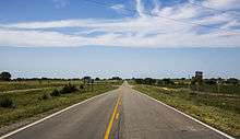
K-31 is a 134-mile (216 km) long state highway in the U.S. state of Kansas. Signed as a north–south highway, K-31 runs diagonally southeast–northwest, connecting small towns in east-central Kansas.
Route description
K-31 begins at a diamond interchange with U.S. Highway 69 (US-69) near Fulton in Bourbon County and heads west on a two-lane road to Mapleton. The highway turns north for six miles (9.7 km), then turns west again at a junction with K-52. Seven miles (11 km) west of this point, K-31 enters the town of Kincaid, where it begins an 18-mile (29 km) concurrency with US-59, and also overlaps US-169 south of Garnett. In Garnett, K-31 leaves US-59 to the west and heads towards Harris where it turns north, again. It turns west at the Franklin County line and overlaps the border until it enters Coffey County, where it continues west toward Waverly. Leaving the town, K-31 heads north again toward Interstate 35 (I-35), and Melvern. It shares a short wrong-way concurrency with I-35 before arriving in Melvern, where it once again turns west. The highway begins a nine-mile (14 km) concurrency with US-75, where it heads toward, and passes through Lyndon. North of the city, K-31 again turns west toward Osage City. It begins a seven-mile (11 km) concurrency with US-56 north of the town and travels north to Burlingame, where it leaves US-56 and heads west toward Harveyville. After passing through Harveyville, K-31 terminates at K-99 in rural Wabaunsee County.
History
The majority K-31 has followed the same route since its creation. Minor adjustments were made when I-35 was built, and K-31 was rerouted through Melvern.
Major intersections
| County | Location | mi[1] | km | Destinations | Notes |
|---|---|---|---|---|---|
| Bourbon | Fulton | 0.0 | 0.0 | Interchange; southern terminus; continues east as Wagon Road | |
| | 7 | 11 | Southern end of K-7 concurrency | ||
| | 8 | 13 | Northern end of K-7 concurrency | ||
| Mapleton | 11 | 18 | |||
| Linn | | 18 | 29 | ||
| | 29 | 47 | |||
| Anderson | Kincaid | 35 | 56 | Southern end of US-59 concurrency | |
| | 47 | 76 | Southern end of US-169 concurrency | ||
| Garnett | 51 | 82 | Northern end of US-169 concurrency | ||
| 53 | 85 | Northern end of US-59 concurrency | |||
| Osage | | 83 | 134 | Southern end of I-35/US-50 concurrency; I-35 exit 162 | |
| | 85 | 137 | Northern end of I-35/US-50 concurrency; I-35 exit 160 | ||
| | 92 | 148 | Interchange; southern end of US-75 concurrency | ||
| | 94 | 151 | |||
| Lyndon | 99 | 159 | |||
| | 101 | 163 | Northern end of US-75 concurrency | ||
| Osage City | 109 | 175 | |||
| | 110 | 180 | Southern end of US-56 concurrency | ||
| | 117 | 188 | Northern end of US-56 concurrency | ||
| | 123 | 198 | Bridge over I-335 / Kansas Turnpike; no access to turnpike | ||
| Wabaunsee | Harveyville | 126 | 203 | ||
| | 134 | 216 | Northern terminus | ||
1.000 mi = 1.609 km; 1.000 km = 0.621 mi
| |||||
References
- ↑ Kansas Department of Transportation (2014). "2014 Condition Survey Report". Topeka: Kansas Department of Transportation. Retrieved August 1, 2015.