McFarland, Kansas
| McFarland, Kansas | |
|---|---|
| City | |
 Location within Wabaunsee County and Kansas | |
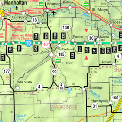 KDOT map of Wabaunsee County (legend) | |
| Coordinates: 39°3′12″N 96°14′20″W / 39.05333°N 96.23889°WCoordinates: 39°3′12″N 96°14′20″W / 39.05333°N 96.23889°W | |
| Country | United States |
| State | Kansas |
| County | Wabaunsee |
| Area[1] | |
| • Total | 0.19 sq mi (0.49 km2) |
| • Land | 0.18 sq mi (0.47 km2) |
| • Water | 0.01 sq mi (0.03 km2) |
| Elevation | 1,017 ft (310 m) |
| Population (2010)[2] | |
| • Total | 256 |
| • Estimate (2012[3]) | 254 |
| • Density | 1,300/sq mi (520/km2) |
| Time zone | Central (CST) (UTC-6) |
| • Summer (DST) | CDT (UTC-5) |
| ZIP code | 66501 [4] |
| Area code | 785 |
| FIPS code | 20-43775 [5] |
| GNIS feature ID | 0476608 [6] |
McFarland is a city in Wabaunsee County, Kansas, United States.[7] As of the 2010 census, the city population was 256.[8]
History

McFarland was established in June 1887 by S.H. Fairfield.[9] It was named after J. N. McFarland, a Topeka, Kansas judge and member of the town company.[10][11]
In 1887, the Chicago, Kansas and Nebraska Railway built a main line from Topeka through McFarland to Herington.[12] The Chicago, Kansas and Nebraska Railway was foreclosed in 1891 and taken over by Chicago, Rock Island and Pacific Railway, which shut down in 1980 and reorganized as Oklahoma, Kansas and Texas Railroad, merged in 1988 with Missouri Pacific Railroad, merged in 1997 with Union Pacific Railroad. Most locals still refer to this railroad as the "Rock Island".
Circa 1910, over 30 passenger trains per day passed through McFarland.[13]
Geography
McFarland is located at 39°3′12″N 96°14′20″W / 39.05333°N 96.23889°W (39.053241, -96.238934).[14] According to the United States Census Bureau, the city has a total area of 0.19 square miles (0.49 km2), of which, 0.18 square miles (0.47 km2) is land and 0.01 square miles (0.03 km2) is water.[1]
Climate
The climate in this area is characterized by hot, humid summers and generally mild to cool winters. According to the Köppen Climate Classification system, McFarland has a humid subtropical climate, abbreviated "Cfa" on climate maps.[15]
Demographics
| Historical population | |||
|---|---|---|---|
| Census | Pop. | %± | |
| 1910 | 388 | — | |
| 1920 | 579 | 49.2% | |
| 1930 | 399 | −31.1% | |
| 1940 | 336 | −15.8% | |
| 1950 | 279 | −17.0% | |
| 1960 | 256 | −8.2% | |
| 1970 | 209 | −18.4% | |
| 1980 | 242 | 15.8% | |
| 1990 | 224 | −7.4% | |
| 2000 | 271 | 21.0% | |
| 2010 | 256 | −5.5% | |
| Est. 2015 | 256 | [16] | 0.0% |
| U.S. Decennial Census | |||
McFarland is part of the Topeka, Kansas Metropolitan Statistical Area.
2010 census
As of the census[2] of 2010, there were 256 people, 110 households, and 68 families residing in the city. The population density was 1,422.2 inhabitants per square mile (549.1/km2). There were 123 housing units at an average density of 683.3 per square mile (263.8/km2). The racial makeup of the city was 95.7% White, 0.4% Native American, 0.8% from other races, and 3.1% from two or more races. Hispanic or Latino of any race were 4.7% of the population.
There were 110 households of which 30.0% had children under the age of 18 living with them, 48.2% were married couples living together, 9.1% had a female householder with no husband present, 4.5% had a male householder with no wife present, and 38.2% were non-families. 31.8% of all households were made up of individuals and 12.7% had someone living alone who was 65 years of age or older. The average household size was 2.33 and the average family size was 3.00.
The median age in the city was 40.5 years. 21.9% of residents were under the age of 18; 8.6% were between the ages of 18 and 24; 24.3% were from 25 to 44; 30.5% were from 45 to 64; and 14.8% were 65 years of age or older. The gender makeup of the city was 54.3% male and 45.7% female.
2000 census
As of the census[5] of 2000, there were 271 people, 105 households, and 72 families residing in the city. The population density was 1,525.6 people per square mile (581.3/km²). There were 115 housing units at an average density of 647.4 per square mile (246.7/km²). The racial makeup of the city was 98.15% White, 0.37% African American, and 1.48% from two or more races. Hispanic or Latino of any race were 1.11% of the population.
There were 105 households out of which 35.2% had children under the age of 18 living with them, 54.3% were married couples living together, 7.6% had a female householder with no husband present, and 30.5% were non-families. 22.9% of all households were made up of individuals and 6.7% had someone living alone who was 65 years of age or older. The average household size was 2.58 and the average family size was 3.05.
In the city the population was spread out with 31.0% under the age of 18, 5.9% from 18 to 24, 30.3% from 25 to 44, 20.7% from 45 to 64, and 12.2% who were 65 years of age or older. The median age was 36 years. For every 100 females there were 105.3 males. For every 100 females age 18 and over, there were 98.9 males.
The median income for a household in the city was $32,250, and the median income for a family was $45,250. Males had a median income of $31,250 versus $23,173 for females. The per capita income for the city was $15,419. About 7.1% of families and 11.1% of the population were below the poverty line, including 9.9% of those under the age of eighteen and 11.5% of those sixty five or over.
References
- 1 2 "US Gazetteer files 2010". United States Census Bureau. Archived from the original on January 24, 2012. Retrieved 2012-07-06.
- 1 2 "American FactFinder". United States Census Bureau. Retrieved 2012-07-06.
- ↑ "Population Estimates". United States Census Bureau. Archived from the original on June 17, 2013. Retrieved 2013-05-29.
- ↑ United States Postal Service (2012). "USPS - Look Up a ZIP Code". Retrieved 2012-02-15.
- 1 2 "American FactFinder". United States Census Bureau. Archived from the original on September 11, 2013. Retrieved 2008-01-31.
- ↑ "US Board on Geographic Names". United States Geological Survey. 2007-10-25. Retrieved 2008-01-31.
- ↑ "Geographic Names Information System". United States Geological Survey. Retrieved 2008-01-31.
- ↑ "2010 City Population and Housing Occupancy Status". U.S. Census Bureau. Archived from the original on July 21, 2011. Retrieved December 2, 2011.
- ↑ "History of McFarland". City of McFarland, Kansas website. 2009. Retrieved 2011-12-08.
- ↑ Rydjord, John (1972). Kansas Place-Names. Norman: University of Oklahoma Press. p. 337. ISBN 0-8061-0994-7.
- ↑ Business Directory and History of Wabaunsee County. Kansas Directory Company. 1907. p. 83.
- ↑ Rock Island Rail History
- ↑ Blackmar, Frank Wilson (1912). Kansas: A Cyclopedia of State History, Volume 2. Standard Publishing Company. p. 203.
- ↑ "US Gazetteer files: 2010, 2000, and 1990". United States Census Bureau. 2011-02-12. Retrieved 2011-04-23.
- ↑ Climate Summary for McFarland, Kansas
- ↑ "Annual Estimates of the Resident Population for Incorporated Places: April 1, 2010 to July 1, 2015". Retrieved July 2, 2016.
External links
| Wikimedia Commons has media related to McFarland, Kansas. |
- City
- Schools
- USD 329, local school district
- Historical
- Maps
- McFarland City Map, KDOT
Municipalities and communities of Wabaunsee County, Kansas, United States | ||
|---|---|---|
| Cities |  | |
| Unincorporated communities | ||
| Footnotes | ‡This populated place also has portions in an adjacent county or counties | |